Maps of Bělčice

Zahrob - c9083-1-002 - Kaiserpflichtexemplar der Landkarten des stabilen Katasters
1 : 2880
Zahrob - c9083-1-001 - Kaiserpflichtexemplar der Landkarten des stabilen Katasters
1 : 2880
Leletitz - c3856-1-001 - Kaiserpflichtexemplar der Landkarten des stabilen Katasters
1 : 2880
Leletitz - c3856-1-002 - Kaiserpflichtexemplar der Landkarten des stabilen Katasters
1 : 2880
Leletitz - c3856-1-003 - Kaiserpflichtexemplar der Landkarten des stabilen Katasters
1 : 2880
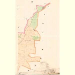
Bieltschitz (Bělčic) - c0189-1-002 - Kaiserpflichtexemplar der Landkarten des stabilen Katasters
1 : 2880
Bieltschitz (Bělčic) - c0189-1-004 - Kaiserpflichtexemplar der Landkarten des stabilen Katasters
1 : 2880
Bieltschitz (Bělčic) - c0189-1-006 - Kaiserpflichtexemplar der Landkarten des stabilen Katasters
1 : 2880
Bieltschitz (Bělčic) - c0189-1-003 - Kaiserpflichtexemplar der Landkarten des stabilen Katasters
1 : 2880
Bieltschitz (Bělčic) - c0189-1-001 - Kaiserpflichtexemplar der Landkarten des stabilen Katasters
1 : 2880
Bieltschitz (Bělčic) - c0189-1-005 - Kaiserpflichtexemplar der Landkarten des stabilen Katasters
1 : 2880
Augezdetz (Augezdec) - c8215-1-001 - Kaiserpflichtexemplar der Landkarten des stabilen Katasters
1 : 2880
Augezdetz (Augezdec) - c8215-1-004 - Kaiserpflichtexemplar der Landkarten des stabilen Katasters
1 : 2880
Augezdetz (Augezdec) - c8215-1-002 - Kaiserpflichtexemplar der Landkarten des stabilen Katasters
1 : 2880
Augezdetz (Augezdec) - c8215-1-003 - Kaiserpflichtexemplar der Landkarten des stabilen Katasters
1 : 2880
Tissow - c7914-1-001 - Kaiserpflichtexemplar der Landkarten des stabilen Katasters
1 : 2880
Tissow - c7914-1-002 - Kaiserpflichtexemplar der Landkarten des stabilen Katasters
1 : 2880

Gradkartenblatt
1 : 25000 Březnice-oblast (Příbram, Česko) Siglitz, Franz
Mapa okresu Blatenského
1 : 80000 Blatná-oblast (Strakonice, Česko) Rollinger, Jos. Neudörfl, Josef Věnceslav J.V. Neudörfl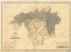
Plan der Herrschaft Rožmital im Prachiner Kreise

Přehlední [sic] mapa velkostatek Rožmital
1 : 50000 Rožmitál pod Třemšínem-oblast (Česko)
Podrobné mapy zemí Koruny české v měřítku 1:75.000 a mapa vzdáleností všech míst při silnici ležících - Blovice - Nepomuk - Blatná. Průvodce statisticko-historický po všech místech na těchto mapách uvedených a rejstřík věcný názvů hor, potoků, řek, rybníků atd. Sešit 42. List 32,
1 : 75000
Pilsen und Blowitz
1 : 75000 Blovice (Česko : oblast) Suchánek, F. K. u. k. militär-geographisches Institut
Pilsen und Blowitz
1 : 75000 Blovice (Česko : oblast) Suchánek, F. K. u. k. Militärgeographisches Institut
Pilsen und Blowitz
1 : 75000 Blovice (Česko : oblast) K. u. k. Militärgeographisches Institut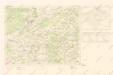
Mapy plánování ČSR

Příbram
1 : 75000 Příbram (Česko : oblast) Vojenský zeměpisný ústav
Příbram
1 : 75000 Příbram-oblast (Česko) Vojenský zeměpisný ústav