Maps of Vlkov pod Oškobrhem

Wolfsberg - c8704-1-001 - Kaiserpflichtexemplar der Landkarten des stabilen Katasters
1 : 2880
Wolfsberg - c8704-1-002 - Kaiserpflichtexemplar der Landkarten des stabilen Katasters
1 : 2880
Odrzepes - c5378-1-001 - Kaiserpflichtexemplar der Landkarten des stabilen Katasters
1 : 2880
Odrzepes - c5378-1-002 - Kaiserpflichtexemplar der Landkarten des stabilen Katasters
1 : 2880
Odrzepes - c5378-1-003 - Kaiserpflichtexemplar der Landkarten des stabilen Katasters
1 : 2880
Odrzepes - c5378-1-005 - Kaiserpflichtexemplar der Landkarten des stabilen Katasters
1 : 2880
Odrzepes - c5378-1-006 - Kaiserpflichtexemplar der Landkarten des stabilen Katasters
1 : 2880
Odrzepes - c5378-1-004 - Kaiserpflichtexemplar der Landkarten des stabilen Katasters
1 : 2880
Wrbitz (Wrbice) - c8825-1-001 - Kaiserpflichtexemplar der Landkarten des stabilen Katasters
1 : 2880
Wrbitz (Wrbice) - c8825-1-004 - Kaiserpflichtexemplar der Landkarten des stabilen Katasters
1 : 2880
Wrbitz (Wrbice) - c8825-1-002 - Kaiserpflichtexemplar der Landkarten des stabilen Katasters
1 : 2880
Wrbitz (Wrbice) - c8825-1-003 - Kaiserpflichtexemplar der Landkarten des stabilen Katasters
1 : 2880
Senitz (Senic) - c6844-1-004 - Kaiserpflichtexemplar der Landkarten des stabilen Katasters
1 : 2880
Senitz (Senic) - c6844-1-002 - Kaiserpflichtexemplar der Landkarten des stabilen Katasters
1 : 2880
Senitz (Senic) - c6844-1-001 - Kaiserpflichtexemplar der Landkarten des stabilen Katasters
1 : 2880
Senitz (Senic) - c6844-1-003 - Kaiserpflichtexemplar der Landkarten des stabilen Katasters
1 : 2880
Odrzepes, Bidschower K[reis]
1 : 2880 Nový Bydžov (Česko : oblast)
Održepes, Bidsch[ower] K[reis]
1 : 2880 Nový Bydžov (Česko : oblast)
III. vojenské mapování 3954/2
1 : 25000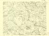
III. vojenské mapování 3954/2
1 : 25000
Gradkartenblatt
1 : 25000 Poděbrady-oblast (Česko) Ansion, Victor

Podrobné mapy zemí Koruny české v měřítku 1:75.000 a mapa vzdáleností všech míst při silnici ležících
1 : 75000 Chlumec nad Cidlinou-oblast (Česko) Bělohlav, Josef Kučera, Karel F. Topič
Podrobné mapy zemí Koruny české v měřítku 1:75.000 a mapa vzdáleností všech míst při silnici ležících - Kolín - Chlumec N. C - Týnec N. Lab.. Průvodce statisticko-historický po všech místech na těchto mapách uvedených a rejstřík věcný názvů hor, potoků, řek, rybníků atd. Sešit 20. List 81,
1 : 75000
III. vojenské mapování 3954
1 : 75000
Neu-Kolin
1 : 75000 Kolín (Česko : oblast) Ansion K. u. k. Militärgeographisches Institut
Neu-Kolin
1 : 75000 Kolín (Česko : oblast) K. u. k. Militärgeographisches Institut
Kolín (Kolin)
1 : 75000 Kolín (Česko : oblast) Zeměpisný ústav ministerstva vnitra
Karte des Gemeindegrenzen


