Maps of Vrátno

Skramausch - c6953-1-001 - Kaiserpflichtexemplar der Landkarten des stabilen Katasters
1 : 2880
Skramausch - c6953-1-006 - Kaiserpflichtexemplar der Landkarten des stabilen Katasters
1 : 2880
Skramausch - c6953-1-005 - Kaiserpflichtexemplar der Landkarten des stabilen Katasters
1 : 2880
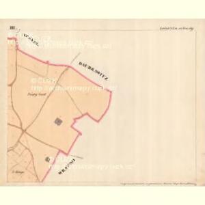
Skramausch - c6953-1-003 - Kaiserpflichtexemplar der Landkarten des stabilen Katasters
1 : 2880
Skramausch - c6953-1-004 - Kaiserpflichtexemplar der Landkarten des stabilen Katasters
1 : 2880
Skramausch - c6953-1-002 - Kaiserpflichtexemplar der Landkarten des stabilen Katasters
1 : 2880
Wratnow - c8808-1-005 - Kaiserpflichtexemplar der Landkarten des stabilen Katasters
1 : 2880
Wratnow - c8808-1-003 - Kaiserpflichtexemplar der Landkarten des stabilen Katasters
1 : 2880
Wratnow - c8808-1-002 - Kaiserpflichtexemplar der Landkarten des stabilen Katasters
1 : 2880
Wratnow - c8808-1-004 - Kaiserpflichtexemplar der Landkarten des stabilen Katasters
1 : 2880
Wratnow - c8808-1-001 - Kaiserpflichtexemplar der Landkarten des stabilen Katasters
1 : 2880
Lobes (Lobze) - c4183-1-002 - Kaiserpflichtexemplar der Landkarten des stabilen Katasters
1 : 2880
Lobes (Lobze) - c4183-1-001 - Kaiserpflichtexemplar der Landkarten des stabilen Katasters
1 : 2880
Lobes (Lobze) - c4183-1-003 - Kaiserpflichtexemplar der Landkarten des stabilen Katasters
1 : 2880
Mapa politického okresu Mladoboleslavského

Gradkartenblatt
1 : 25000 Mšeno-oblast (Česko) Albrecht, Julius
[Kartenblatt]
1 : 25000 Bělá pod Bezdězem (Česko : oblast) Reichsamt für Landesaufnahme
III. vojenské mapování 3853/2
1 : 25000
III. vojenské mapování 3853/2
1 : 25000
III. vojenské mapování 3853/2
1 : 25000

Zur Erinnerung an den 15. 16. u. 17. Mai 1860
Kokořín-oblast (Česko) Wagner, Jan Eduard
Mapa okresu Mělnického
1 : 58000 Mělník-oblast (Česko) Opa, František Karel František Kar. Opa
Karte des Melniker Bezirkes im Prager Kreise
1 : 72000 Mělník-oblast (Česko) Wagner, Jan Eduard in Commission bei Karl André
Karte des Melniker Bezirkes im Prager Kreise
1 : 72000 Mělník-oblast (Česko) Wagner, Jan Eduard in Commission bei Karl André
Karte des Melniker Bezirkes im Prager Kreise
1 : 72000 Mělník-oblast (Česko) Wagner, Jan Eduard in Commission bei Karl André
Straßen-Karte des auton. Bezirkes Dauba
1 : 50000 Dubá (Česko : oblast)
Mapa politického a školního okresu Mělnického
1 : 80000 Mělník-oblast (Česko) Vojna, Jan Hlaváček, Gustav Okresní školní výbor
Melnik
1 : 75000 Benátky nad Jizerou (Česko : oblast) Fitz, J. K. u. k. Militärgeographisches Institut
Melnik
1 : 75000 Benátky nad Jizerou (Česko : oblast) Fitz, J. K. u. k. Militärgeographisches Institut