Maps of Jablonec nad Nisou

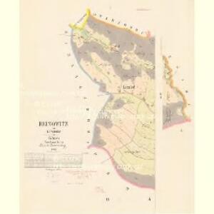
Reinowitz - c6669-1-001 - Kaiserpflichtexemplar der Landkarten des stabilen Katasters
1 : 2880
Reinowitz - c6669-1-003 - Kaiserpflichtexemplar der Landkarten des stabilen Katasters
1 : 2880
Reinowitz - c6669-1-002 - Kaiserpflichtexemplar der Landkarten des stabilen Katasters
1 : 2880
Proschwitz - c6115-1-001 - Kaiserpflichtexemplar der Landkarten des stabilen Katasters
1 : 2880
Proschwitz - c6115-1-004 - Kaiserpflichtexemplar der Landkarten des stabilen Katasters
1 : 2880
Proschwitz - c6115-1-002 - Kaiserpflichtexemplar der Landkarten des stabilen Katasters
1 : 2880
Proschwitz - c6115-1-003 - Kaiserpflichtexemplar der Landkarten des stabilen Katasters
1 : 2880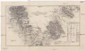
Plan der Gegend von Jeschkenberg über Raschen, Jaberlich, Kohlstadt bis Luxdorff und deren in selber sich befindlichen Verschantzungen
1 : 60000 Javorník (Proseč pod Ještědem, Česko)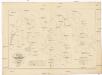
Karte des Forst-Reviers Grünwald
1 : 5800 Mšeno nad Nisou (Jablonec nad Nisou, Česko)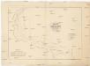
Karte des Forst-Reviers Grünwald
1 : 6000 Mšeno nad Nisou (Jablonec nad Nisou, Česko)
Jablonec nad Nisou

Gränzendorf - c2335-2-003 - Kaiserpflichtexemplar der Landkarten des stabilen Katasters
1 : 2880
Gränzendorf - c2335-2-002 - Kaiserpflichtexemplar der Landkarten des stabilen Katasters
1 : 2880
Gränzendorf - c2335-2-001 - Kaiserpflichtexemplar der Landkarten des stabilen Katasters
1 : 2880
Grünwald - c4889-1-001 - Kaiserpflichtexemplar der Landkarten des stabilen Katasters
1 : 2880
Grünwald - c4889-1-005 - Kaiserpflichtexemplar der Landkarten des stabilen Katasters
1 : 2880
Grünwald - c4889-1-004 - Kaiserpflichtexemplar der Landkarten des stabilen Katasters
1 : 2880
Grünwald - c4889-1-002 - Kaiserpflichtexemplar der Landkarten des stabilen Katasters
1 : 2880
Grünwald - c4889-1-003 - Kaiserpflichtexemplar der Landkarten des stabilen Katasters
1 : 2880
Kunersdorf - c3716-1-001 - Kaiserpflichtexemplar der Landkarten des stabilen Katasters
1 : 2880
Kunersdorf - c3716-1-002 - Kaiserpflichtexemplar der Landkarten des stabilen Katasters
1 : 2880
Gablonz a/N.


Der politische Bezirk Gablonz

Mapa politického a školního okresu turnovského

Mapa politického a školního okresu turnovského
1 : 100000 Turnov-oblast (Česko) Učitelská jednota okresu turnovského
Jablonec n. N. a okolí
1 : 75000 Jablonec nad Nisou (Česko : oblast) Vojenský zeměpisný ústav
Mapka Jizerských hor
1 : 150000 Jizerské hory (Česko a Polsko : oblast) Ed. Grégr