Maps of Ražice

Raažitz (Ražice) - c6470-1-002 - Kaiserpflichtexemplar der Landkarten des stabilen Katasters
1 : 2880
Raažitz (Ražice) - c6470-1-003 - Kaiserpflichtexemplar der Landkarten des stabilen Katasters
1 : 2880
Raažitz (Ražice) - c6470-1-001 - Kaiserpflichtexemplar der Landkarten des stabilen Katasters
1 : 2880
Herzman (Heřmana) - c1842-1-004 - Kaiserpflichtexemplar der Landkarten des stabilen Katasters
1 : 2880
Herzman (Heřmana) - c1842-1-001 - Kaiserpflichtexemplar der Landkarten des stabilen Katasters
1 : 2880
Herzman (Heřmana) - c1842-1-003 - Kaiserpflichtexemplar der Landkarten des stabilen Katasters
1 : 2880
Herzman (Heřmana) - c1842-1-002 - Kaiserpflichtexemplar der Landkarten des stabilen Katasters
1 : 2880
Stietitz (Stietice) - c7782-1-002 - Kaiserpflichtexemplar der Landkarten des stabilen Katasters
1 : 2880
Stietitz (Stietice) - c7782-1-004 - Kaiserpflichtexemplar der Landkarten des stabilen Katasters
1 : 2880
Stietitz (Stietice) - c7782-1-003 - Kaiserpflichtexemplar der Landkarten des stabilen Katasters
1 : 2880
Stietitz (Stietice) - c7782-1-001 - Kaiserpflichtexemplar der Landkarten des stabilen Katasters
1 : 2880
Lhotta - c3923-1-001 - Kaiserpflichtexemplar der Landkarten des stabilen Katasters
1 : 2880
Lhotta - c3923-1-002 - Kaiserpflichtexemplar der Landkarten des stabilen Katasters
1 : 2880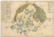
Mapa lesů a rybníků na statku Kestřany 1

Putim - c6291-1-003 - Kaiserpflichtexemplar der Landkarten des stabilen Katasters
1 : 2880
Putim - c6291-1-004 - Kaiserpflichtexemplar der Landkarten des stabilen Katasters
1 : 2880
Putim - c6291-1-001 - Kaiserpflichtexemplar der Landkarten des stabilen Katasters
1 : 2880
Putim - c6291-1-002 - Kaiserpflichtexemplar der Landkarten des stabilen Katasters
1 : 2880
Putim - c6291-1-006 - Kaiserpflichtexemplar der Landkarten des stabilen Katasters
1 : 2880
Putim - c6291-1-005 - Kaiserpflichtexemplar der Landkarten des stabilen Katasters
1 : 2880
Záměrná mapa revíru Mladějovice a Kváskovice
1 : 5833
Mapa hranic lesů velkostatku v katastru obcí Mladějovice a Sedliště
1 : 2880
Mladiegowitz (Mladěgowitz) - c4737-1-003 - Kaiserpflichtexemplar der Landkarten des stabilen Katasters
1 : 2880
Mladiegowitz (Mladěgowitz) - c4737-1-005 - Kaiserpflichtexemplar der Landkarten des stabilen Katasters
1 : 2880
Mladiegowitz (Mladěgowitz) - c4737-1-001 - Kaiserpflichtexemplar der Landkarten des stabilen Katasters
1 : 2880
Mladiegowitz (Mladěgowitz) - c4737-1-002 - Kaiserpflichtexemplar der Landkarten des stabilen Katasters
1 : 2880
Mladiegowitz (Mladěgowitz) - c4737-1-004 - Kaiserpflichtexemplar der Landkarten des stabilen Katasters
1 : 2880
Hospodářská mapa revíru Mladějovice
1 : 5833


