Maps of Přepeře

Przeperz - c6198-1-003 - Kaiserpflichtexemplar der Landkarten des stabilen Katasters
1 : 2880
Przeperz - c6198-1-001 - Kaiserpflichtexemplar der Landkarten des stabilen Katasters
1 : 2880
Przeperz - c6198-1-002 - Kaiserpflichtexemplar der Landkarten des stabilen Katasters
1 : 2880
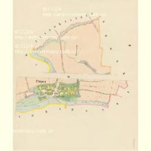
Mapa vsí Rychmburk a Lažany
1 : 4000
Wohrasenitz (Wohraženice) - c5390-1-003 - Kaiserpflichtexemplar der Landkarten des stabilen Katasters
1 : 2880
Wohrasenitz (Wohraženice) - c5390-1-001 - Kaiserpflichtexemplar der Landkarten des stabilen Katasters
1 : 2880
Wohrasenitz (Wohraženice) - c5390-1-004 - Kaiserpflichtexemplar der Landkarten des stabilen Katasters
1 : 2880
Wohrasenitz (Wohraženice) - c5390-1-002 - Kaiserpflichtexemplar der Landkarten des stabilen Katasters
1 : 2880
Stwerin (Stweřin) - c1044-1-002 - Kaiserpflichtexemplar der Landkarten des stabilen Katasters
1 : 2880
Stwerin (Stweřin) - c1044-1-003 - Kaiserpflichtexemplar der Landkarten des stabilen Katasters
1 : 2880
Stwerin (Stweřin) - c1044-1-001 - Kaiserpflichtexemplar der Landkarten des stabilen Katasters
1 : 2880
Stwerin (Stweřin) - c1044-1-004 - Kaiserpflichtexemplar der Landkarten des stabilen Katasters
1 : 2880
Przischowitz (Přissowic) - c6254-1-001 - Kaiserpflichtexemplar der Landkarten des stabilen Katasters
1 : 2880
Przischowitz (Přissowic) - c6254-1-003 - Kaiserpflichtexemplar der Landkarten des stabilen Katasters
1 : 2880
Przischowitz (Přissowic) - c6254-1-004 - Kaiserpflichtexemplar der Landkarten des stabilen Katasters
1 : 2880
Przischowitz (Přissowic) - c6254-1-002 - Kaiserpflichtexemplar der Landkarten des stabilen Katasters
1 : 2880
Modřitz (Modřic) - c4801-1-001 - Kaiserpflichtexemplar der Landkarten des stabilen Katasters
1 : 2880
Modřitz (Modřic) - c4801-1-004 - Kaiserpflichtexemplar der Landkarten des stabilen Katasters
1 : 2880
Modřitz (Modřic) - c4801-1-003 - Kaiserpflichtexemplar der Landkarten des stabilen Katasters
1 : 2880
Modřitz (Modřic) - c4801-1-002 - Kaiserpflichtexemplar der Landkarten des stabilen Katasters
1 : 2880
Stabilní katastr - Procovní otisk Turnov

Lažan (Lažana) - c3830-1-001 - Kaiserpflichtexemplar der Landkarten des stabilen Katasters
1 : 2880
Lažan (Lažana) - c3830-1-002 - Kaiserpflichtexemplar der Landkarten des stabilen Katasters
1 : 2880

III. vojenské mapování 3754/4
1 : 25000

Mapa politického a školního okresu turnovského

Mapa politického a školního okresu turnovského
1 : 100000 Turnov-oblast (Česko) Učitelská jednota okresu turnovského
Turnov a okolí
1 : 75000 Turnov (Česko : oblast) Vojenský zeměpisný ústav