Maps of Maršovice

Marschowitz - c4497-1-002 - Kaiserpflichtexemplar der Landkarten des stabilen Katasters
1 : 2880
Marschowitz - c4497-1-001 - Kaiserpflichtexemplar der Landkarten des stabilen Katasters
1 : 2880
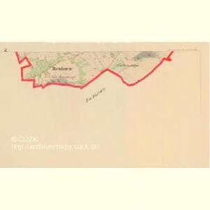
Dalleschitz - c1051-1-006 - Kaiserpflichtexemplar der Landkarten des stabilen Katasters
1 : 2880
Dalleschitz - c1051-1-001 - Kaiserpflichtexemplar der Landkarten des stabilen Katasters
1 : 2880
Dalleschitz - c1051-1-004 - Kaiserpflichtexemplar der Landkarten des stabilen Katasters
1 : 2880
Dalleschitz - c1051-1-005 - Kaiserpflichtexemplar der Landkarten des stabilen Katasters
1 : 2880
Dalleschitz - c1051-1-007 - Kaiserpflichtexemplar der Landkarten des stabilen Katasters
1 : 2880
Dalleschitz - c1051-1-003 - Kaiserpflichtexemplar der Landkarten des stabilen Katasters
1 : 2880
Dalleschitz - c1051-1-002 - Kaiserpflichtexemplar der Landkarten des stabilen Katasters
1 : 2880
Marschowitz - c2938-2-002 - Kaiserpflichtexemplar der Landkarten des stabilen Katasters
1 : 2880
Marschowitz - c2938-2-003 - Kaiserpflichtexemplar der Landkarten des stabilen Katasters
1 : 2880
Marschowitz - c2938-2-001 - Kaiserpflichtexemplar der Landkarten des stabilen Katasters
1 : 2880
Marschowitz - c2938-2-004 - Kaiserpflichtexemplar der Landkarten des stabilen Katasters
1 : 2880
Kukan - c3270-1-001 - Kaiserpflichtexemplar der Landkarten des stabilen Katasters
1 : 2880
Kukan - c3270-1-002 - Kaiserpflichtexemplar der Landkarten des stabilen Katasters
1 : 2880
Karte des Forst-Reviers Schumburg
1 : 6000
Karte des Forst-Reviers Schumburg
1 : 6000
Mapa politického okresu Turnovského

III. vojenské mapování 3754/2
1 : 25000
[Kartenblatt]
1 : 25000 Jablonec nad Nisou (Česko : oblast) Reichsamt für Landesaufnahme


Der politische Bezirk Gablonz

Podrobné mapy zemí Koruny české v měřítku 1:75.000 a mapa vzdáleností všech míst při silnici ležících - Jablonec - Roketnice - Žel. Brod. Průvodce statisticko-historický po všech místech na těchto mapách uvedených a rejstřík věcný názvů hor, potoků, řek, rybníků atd. Sešit 11. List 78,
1 : 75000
Podrobné mapy zemí Koruny české v měřítku 1:75.000 a mapa vzdáleností všech míst při silnici ležících
1 : 75000 Harrachov (Semily, Česko : oblast) Bělohlav, Josef F. Topič
Politický a školní okres Semilský
1 : 100000 Semily (Česko : okres : 1960-) Fučík, Josef Jan Jos.J. Fučík
Mapa politického a školního okresu turnovského

Mapa politického a školního okresu turnovského
1 : 100000 Turnov-oblast (Česko) Učitelská jednota okresu turnovského