Maps of Zbraslavice

Klein Skallitz (Mala Skallice) - c4376-1-001 - Kaiserpflichtexemplar der Landkarten des stabilen Katasters
1 : 2880
Klein Skallitz (Mala Skallice) - c4376-1-002 - Kaiserpflichtexemplar der Landkarten des stabilen Katasters
1 : 2880
Gross Skallitz (Welka Skalice) - c8405-1-001 - Kaiserpflichtexemplar der Landkarten des stabilen Katasters
1 : 2880
Gross Skallitz (Welka Skalice) - c8405-1-002 - Kaiserpflichtexemplar der Landkarten des stabilen Katasters
1 : 2880
Zbraslawitz (Zbraslawice) - c9191-1-006 - Kaiserpflichtexemplar der Landkarten des stabilen Katasters
1 : 2880
Zbraslawitz (Zbraslawice) - c9191-1-005 - Kaiserpflichtexemplar der Landkarten des stabilen Katasters
1 : 2880
Zbraslawitz (Zbraslawice) - c9191-1-002 - Kaiserpflichtexemplar der Landkarten des stabilen Katasters
1 : 2880
Zbraslawitz (Zbraslawice) - c9191-1-003 - Kaiserpflichtexemplar der Landkarten des stabilen Katasters
1 : 2880
Zbraslawitz (Zbraslawice) - c9191-1-004 - Kaiserpflichtexemplar der Landkarten des stabilen Katasters
1 : 2880
Zbraslawitz (Zbraslawice) - c9191-1-001 - Kaiserpflichtexemplar der Landkarten des stabilen Katasters
1 : 2880
Gradkartenblatt
1 : 25000 Čechy (Česko) Czechák, Carl
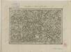
III. vojenské mapování 4054/4
1 : 25000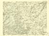
III. vojenské mapování 4054/4
1 : 25000

Podrobné mapy zemí Koruny české v měřítku 1:75.000 a mapa vzdáleností všech míst při silnici ležících - Kutná Hora - Čáslav - Golčův Jeníkov. Průvodce statisticko-historický po všech místech na těchto mapách uvedených a rejstřík věcný názvů hor, potoků, řek, rybníků atd. Sešit 21. List 82,
1 : 75000
Kutná Hora
1 : 75000 Kutná Hora (Česko : oblast) Vojenský zeměpisný ústav
Kuttenberg und Kohljanowitz
1 : 75000 Kutná Hora (Česko : oblast) Kotrtsch K. u. k. militär-geographisches Institut
Kuttenberg und Kohljanowitz
1 : 75000 Kutná Hora (Česko : oblast) Kotrtsch K. u. k. Militärgeographisches Institut
Kuttenberg und Kohljanowitz
1 : 75000 Kutná Hora (Česko : oblast) K. u. k. Militärgeographisches Institut
Mapy plánování ČSR

III. vojenské mapování 4054
1 : 75000
Karte des Gemeindegrenzen

Podrobná mapa Království českého
1 : 100000 Ledeč nad Sázavou (Česko : oblast) Srp, Jan Jaroslav Bursík
[Vilímkovy místopisné mapy zemí Koruny české]
1 : 100000 Ledeč nad Sázavou (Česko : oblast) Srp, Jan Jos. R. Vilímek
Politický okres Ledeč nad Sázavou
1 : 100000 Ledeč nad Sázavou-oblast (Česko) Kratochvíl, M. Josef Richard Vilímek
Politický okres Vlašim
1 : 100000 Vlašim-oblast (Česko) Kratochvíl, M. Josef Richard Vilímek
Politický okres Kutná Hora
1 : 100000 Kutná Hora (Česko : okres : 1960-) Kratochvíl, M. Josef Richard Vilímek
[Beneschau und Umgebung]
1 : 144000 Benešov-oblast (Česko) Kořistka, Karel František Edvard
Kuttenberg und Kohljanowitz.
from Spezialkarte der osterreichisch-ungarischen Monarchie.