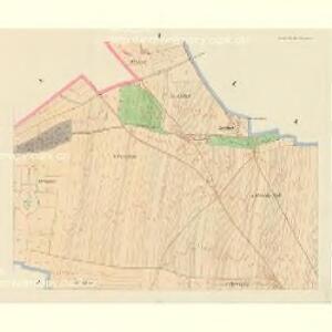
Maps of Libochovice

Libochowitz (Libochowic) - c4036-1-004 - Kaiserpflichtexemplar der Landkarten des stabilen Katasters
1 : 2880
Libochowitz (Libochowic) - c4036-1-002 - Kaiserpflichtexemplar der Landkarten des stabilen Katasters
1 : 2880
Libochowitz (Libochowic) - c4036-1-001 - Kaiserpflichtexemplar der Landkarten des stabilen Katasters
1 : 2880
Libochowitz (Libochowic) - c4036-1-003 - Kaiserpflichtexemplar der Landkarten des stabilen Katasters
1 : 2880
Libochowitz (Libochowic) - c4036-1-005 - Kaiserpflichtexemplar der Landkarten des stabilen Katasters
1 : 2880
Duban - c1581-1-002 - Kaiserpflichtexemplar der Landkarten des stabilen Katasters
1 : 2880
Duban - c1581-1-001 - Kaiserpflichtexemplar der Landkarten des stabilen Katasters
1 : 2880
Plán pozemků dvorů Podsedice a Neuland
1 : 4494
Slatina - c7006-1-001 - Kaiserpflichtexemplar der Landkarten des stabilen Katasters
1 : 2880
Slatina - c7006-1-002 - Kaiserpflichtexemplar der Landkarten des stabilen Katasters
1 : 2880
Slatina - c7006-1-004 - Kaiserpflichtexemplar der Landkarten des stabilen Katasters
1 : 2880
Slatina - c7006-1-003 - Kaiserpflichtexemplar der Landkarten des stabilen Katasters
1 : 2880
Popels - c6012-1-003 - Kaiserpflichtexemplar der Landkarten des stabilen Katasters
1 : 2880
Popels - c6012-1-002 - Kaiserpflichtexemplar der Landkarten des stabilen Katasters
1 : 2880
Popels - c6012-1-001 - Kaiserpflichtexemplar der Landkarten des stabilen Katasters
1 : 2880
Radowesitz (Radowesic) - c6401-1-005 - Kaiserpflichtexemplar der Landkarten des stabilen Katasters
1 : 2880
Radowesitz (Radowesic) - c6401-1-006 - Kaiserpflichtexemplar der Landkarten des stabilen Katasters
1 : 2880
Radowesitz (Radowesic) - c6401-1-002 - Kaiserpflichtexemplar der Landkarten des stabilen Katasters
1 : 2880
Radowesitz (Radowesic) - c6401-1-009 - Kaiserpflichtexemplar der Landkarten des stabilen Katasters
1 : 2880
Radowesitz (Radowesic) - c6401-1-010 - Kaiserpflichtexemplar der Landkarten des stabilen Katasters
1 : 2880
Radowesitz (Radowesic) - c6401-1-008 - Kaiserpflichtexemplar der Landkarten des stabilen Katasters
1 : 2880
Radowesitz (Radowesic) - c6401-1-004 - Kaiserpflichtexemplar der Landkarten des stabilen Katasters
1 : 2880
Radowesitz (Radowesic) - c6401-1-001 - Kaiserpflichtexemplar der Landkarten des stabilen Katasters
1 : 2880
Radowesitz (Radowesic) - c6401-1-007 - Kaiserpflichtexemplar der Landkarten des stabilen Katasters
1 : 2880
Regulační plán pro část obce Klapé
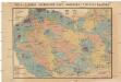
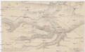
Čeňka Zahálky geologické mapy Podřipska
1 : 25000 Podřipsko (Česko) Zahálka, Čeněk
III. vojenské mapování 3852/1
1 : 25000
[Kartenblatt]
1 : 25000 Libochovice (Česko : oblast) Reichsamt für Landesaufnahme
Gradkartenblatt
1 : 25000 Louny-oblast (Česko) Bellschan, Anton