Maps of Příbram

Lasetz (Lazec) - c3814-1-002 - Kaiserpflichtexemplar der Landkarten des stabilen Katasters
1 : 2880
Lasetz (Lazec) - c3814-1-001 - Kaiserpflichtexemplar der Landkarten des stabilen Katasters
1 : 2880
Worlow - c5513-1-003 - Kaiserpflichtexemplar der Landkarten des stabilen Katasters
1 : 2880
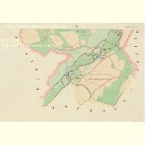
Worlow - c5513-1-001 - Kaiserpflichtexemplar der Landkarten des stabilen Katasters
1 : 2880
Worlow - c5513-1-002 - Kaiserpflichtexemplar der Landkarten des stabilen Katasters
1 : 2880
Kozitschin (Kozyczjn) - c3446-1-001 - Kaiserpflichtexemplar der Landkarten des stabilen Katasters
1 : 2880
Kozitschin (Kozyczjn) - c3446-1-002 - Kaiserpflichtexemplar der Landkarten des stabilen Katasters
1 : 2880
Plan [sic] král[ovského] horního města Příbrami
1 : 5000 Příbram (Česko : oblast) Vašta, Jan Knihkupectví Karla Simona
Přzibram (Přjbram) - c6226-1-003 - Kaiserpflichtexemplar der Landkarten des stabilen Katasters
1 : 2880
Přzibram (Přjbram) - c6226-1-005 - Kaiserpflichtexemplar der Landkarten des stabilen Katasters
1 : 2880
Přzibram (Přjbram) - c6226-1-002 - Kaiserpflichtexemplar der Landkarten des stabilen Katasters
1 : 2880
Přzibram (Přjbram) - c6226-1-006 - Kaiserpflichtexemplar der Landkarten des stabilen Katasters
1 : 2880
Přzibram (Přjbram) - c6226-1-007 - Kaiserpflichtexemplar der Landkarten des stabilen Katasters
1 : 2880
Přzibram (Přjbram) - c6226-1-008 - Kaiserpflichtexemplar der Landkarten des stabilen Katasters
1 : 2880
Přzibram (Přjbram) - c6226-1-004 - Kaiserpflichtexemplar der Landkarten des stabilen Katasters
1 : 2880
Přzibram (Přjbram) - c6226-1-001 - Kaiserpflichtexemplar der Landkarten des stabilen Katasters
1 : 2880
Zdaborz (Zdaboř) - c9205-1-001 - Kaiserpflichtexemplar der Landkarten des stabilen Katasters
1 : 2880
Hochofen (Wysoka-Pec) - c8952-1-001 - Kaiserpflichtexemplar der Landkarten des stabilen Katasters
1 : 2880
Obecnitz
Obecnice (Česko) Wagner, Jan Eduard Renard Verlag des böhmischen Forstvereins
Gradkartenblatt
1 : 25000 Příbram-oblast (Česko) Riebel, Ferdinand von

Přehlední [sic] mapa velkostatků Tochovice, Břežnice Rožmitál
1 : 50000 Březnice (Příbram, Česko) Schrantz, Fr.
Karte des Příbramer Bezirkes im Prager Kreise
1 : 70000 Příbram-oblast (Česko) Wagner, Jan Eduard Karl André
Karte des Příbramer Bezirkes im Prager Kreise
1 : 70000 Příbram-oblast (Česko) Wagner, Jan Eduard Karl André

Přehlední [sic] mapa velkostatek Rožmital
1 : 50000 Rožmitál pod Třemšínem-oblast (Česko)
Podrobné mapy zemí Koruny české v měřítku 1:75.000 a mapa vzdáleností všech míst při silnici ležících - Příbram - Dobříš. Průvodce statisticko-historický po všech místech na těchto mapách uvedených a rejstřík věcný názvů hor, potoků, řek, rybníků atd./ Sešit 10. List 43,
1 : 75000
Soubor map okresů Pražského kraje

Mapa okresu Příbramského v Pražském kraji

Karte des Horowitzer Bezirkes im Prager Kreise
1 : 7300 Hořovice-oblast (Česko) Wagner, Jan Eduard Karl André