Maps of Jinočany

Ginotschan (Ginoczan) - c2918-1-002 - Kaiserpflichtexemplar der Landkarten des stabilen Katasters
1 : 2880
Ginotschan (Ginoczan) - c2918-1-001 - Kaiserpflichtexemplar der Landkarten des stabilen Katasters
1 : 2880
Chrastian (Chrasstiany) - c2646-1-001 - Kaiserpflichtexemplar der Landkarten des stabilen Katasters
1 : 2880
Chrastian (Chrasstiany) - c2646-1-003 - Kaiserpflichtexemplar der Landkarten des stabilen Katasters
1 : 2880
Chrastian (Chrasstiany) - c2646-1-002 - Kaiserpflichtexemplar der Landkarten des stabilen Katasters
1 : 2880
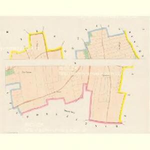
Trzebonitz (Třebonic) - c8044-1-003 - Kaiserpflichtexemplar der Landkarten des stabilen Katasters
1 : 2880
Trzebonitz (Třebonic) - c8044-1-002 - Kaiserpflichtexemplar der Landkarten des stabilen Katasters
1 : 2880
Trzebonitz (Třebonic) - c8044-1-001 - Kaiserpflichtexemplar der Landkarten des stabilen Katasters
1 : 2880
Výškopisný plán hlavního města Prahy s okolím

Dobrzitsch (Dobřič) - c1212-1-003 - Kaiserpflichtexemplar der Landkarten des stabilen Katasters
1 : 2880
Dobrzitsch (Dobřič) - c1212-1-001 - Kaiserpflichtexemplar der Landkarten des stabilen Katasters
1 : 2880
Dobrzitsch (Dobřič) - c1212-1-002 - Kaiserpflichtexemplar der Landkarten des stabilen Katasters
1 : 2880
Duschnik (Duschnjka) - c1615-1-001 - Kaiserpflichtexemplar der Landkarten des stabilen Katasters
1 : 2880
Duschnik (Duschnjka) - c1615-1-002 - Kaiserpflichtexemplar der Landkarten des stabilen Katasters
1 : 2880
Duschnik (Duschnjka) - c1615-1-003 - Kaiserpflichtexemplar der Landkarten des stabilen Katasters
1 : 2880
Zbuzan - c9196-1-001 - Kaiserpflichtexemplar der Landkarten des stabilen Katasters
1 : 2880
Zbuzan - c9196-1-003 - Kaiserpflichtexemplar der Landkarten des stabilen Katasters
1 : 2880
Zbuzan - c9196-1-002 - Kaiserpflichtexemplar der Landkarten des stabilen Katasters
1 : 2880
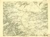
Umgebung von Prag
Mapa okolí Svárovského a Nučického mezi Prahou a Berounem
III. vojenské mapování 3952/4
1 : 25000
Gradkartenblatt
1 : 25000 Unhošť-oblast (Česko) Albrecht, Julius
III. vojenské mapování 3952/4
1 : 25000
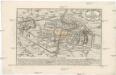
Karte des Smichower Bezirkes im Prager Kreise
1 : 70000 Praha-oblast (Česko) Wagner, Jan Eduard Karl André
Belagerung der königlicher Haupt-Stadt Prag...

Mapa okresu smíchovského v Pražském kraji = Karte des Smichower Bezirkes im Prager Kreise : podle nejnovějších a nejbezpečnějších pramenů sestavena a vydána k založení obecních knihoven ve veškerých okresích kraje Pražského

Belagerung der Königl. Haupt-Stadt Prag
1 : 57000 Berounka (Česko) Werner, Bedřich Bernard Strahowsky, B.
Soubor map okresů Pražského kraje
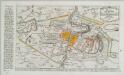
Plan der Battaille welche d. 6. Maj zwischen der kayserlich-königlich-ungarischen und königlich preussischen Armée bey Prag geliefert worden, 1757
Praha (Česko)