Maps of Jankov

Jankau - c2744-1-001 - Kaiserpflichtexemplar der Landkarten des stabilen Katasters
1 : 2880
Oppattau (Oppattow) - c5482-1-004 - Kaiserpflichtexemplar der Landkarten des stabilen Katasters
1 : 2880
Oppattau (Oppattow) - c5482-1-001 - Kaiserpflichtexemplar der Landkarten des stabilen Katasters
1 : 2880
Oppattau (Oppattow) - c5482-1-002 - Kaiserpflichtexemplar der Landkarten des stabilen Katasters
1 : 2880
Oppattau (Oppattow) - c5482-1-003 - Kaiserpflichtexemplar der Landkarten des stabilen Katasters
1 : 2880
Militschau - c4666-1-001 - Kaiserpflichtexemplar der Landkarten des stabilen Katasters
1 : 2880
Militschau - c4666-1-004 - Kaiserpflichtexemplar der Landkarten des stabilen Katasters
1 : 2880
Militschau - c4666-1-002 - Kaiserpflichtexemplar der Landkarten des stabilen Katasters
1 : 2880
Militschau - c4666-1-003 - Kaiserpflichtexemplar der Landkarten des stabilen Katasters
1 : 2880
Gradkartenblatt
1 : 25000 Jihlava-oblast (Česko) Bulla, Eduard

[Gradkartenblatt]
1 : 25000 Jihlava-oblast (Česko) Vojenský zeměpisný ústav
Podrobné mapy zemí Koruny české v měřítku 1:75.000 a mapa vzdáleností všech míst při silnici ležících
1 : 75000 Humpolec (Pelhřimov, Česko : oblast) Bělohlav, Josef F. Topič

Geologická mapa okresu Humpoleckého
1 : 30000 Humpolec-oblast (Pelhřimov, Česko) Kobliha, Gustav
Podrobné mapy zemí Koruny české v měřítku 1:75.000 a mapa vzdáleností všech míst při silnici ležících - Pelhřimov - Humpolec. Průvodce statisticko-historický po všech místech na těchto mapách uvedených a rejstřík věcný názvů hor, potoků, řek, rybníků atd. Sešit 45. List 84,
1 : 75000
Pelhřimov - Humpolec

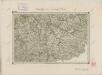
Provincia Czaslaviensis
1 : 217000 Mollova mapová sbírka Erber, Bernardinus Winkler, Johann Christoph Kurzböck, Josef von
III. vojenské mapování 4255
1 : 75000
Zone 8, Kol. XIII, Iglau, uit: Geologische Karte der im Reichsrathe vertretenen Königreiche und Länder der Österreich-Ungarischen Monarchie : auf Grundlage der Specialkarte i.M. 1:75.000 des k.u.k. Militär-geographischen Institutes / neu bearb. und als Kartenwerk von 341 Blattnummern in zwanglosen Lfg. hrsg. durch die k.k. Geologische Reichsanstalt in Wien
1 : 75000 titelvariant: Geologische Spezialkarte der im Reichsrate vertretenen Königreiche und Länder der Österreichisch-Ungarischen Monarchie; Geologische Specialkarte der im Reichsrathe vertretenen Königreiche und Länder der Österreichisch-Ungarischen Monarchie; Annotatie: Titel bovenaan kaartblad: Geologische Spezialkarte der im Reichsrate vertretenen Königreiche und Länder der Österreichisch-Ungarischen Monarchie en Geologische Specialkarte der im Reichsrathe vertretenen Königreiche und Länder der Österreichisch-Ungarischen Monarchie; Annotatie geografische gegevens: Coördinaten gebaseerd op nulmeridiaan van Ferro (Hierro) Kaiserlich-Königliche Geologische Reichsanstalt, Wenen Wien : K.K. Geologische Reichsanstalt
Jglau
1 : 75000 Jihlava (Česko : oblast) Höller, K. K. u. k. militär-geographisches Institut
Jglau
1 : 75000 Jihlava (Česko : oblast) K. u. k. Militärgeographisches Institut
Geologische Spezialkarte der im Reichsrate vertretenen Königreiche und Länder der Österreichisch-Ungarischen Monarchie
1 : 75000 Jihlava (Česko : oblast) Hinterlechner, Karl Adrian, F. Freiherrn von K. k. geologischen Reichsanstalt
Podrobná místopisná mapa Království Českého
Special - Karte des Koenigreiches Boehmen
II. vojenské mapování 27
1 : 144000
Kamenitz a./d. Linde (Bohmen).
from Spezialkarte der osterreichisch-ungarischen Monarchie.
Iglau.
from Spezialkarte der osterreichisch-ungarischen Monarchie.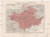
Generální mapa okresního hejtmanství Něm. Brodského
1 : 220000 Havlíčkův Brod-oblast (Česko) Wagner, Jan Eduard F. Kytka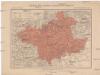
Generální mapa okresního hejtmanství Něm. Brodského
1 : 220000 Havlíčkův Brod-oblast (Česko) Wagner, Jan Eduard F. Kytka