Maps of Chodský Újezd

Ober Godrisch - c2056-1-003 - Kaiserpflichtexemplar der Landkarten des stabilen Katasters
1 : 2880
Ober Godrisch - c2056-1-001 - Kaiserpflichtexemplar der Landkarten des stabilen Katasters
1 : 2880
Ober Godrisch - c2056-1-002 - Kaiserpflichtexemplar der Landkarten des stabilen Katasters
1 : 2880
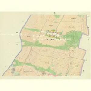
Situations-Plan der Versuchswiese für den Wiesenbaucurs in Plan 1896
1 : 1000 Planá (Tachov, Česko : oblast)
Glasau - c4977-1-002 - Kaiserpflichtexemplar der Landkarten des stabilen Katasters
1 : 2880
Glasau - c4977-1-001 - Kaiserpflichtexemplar der Landkarten des stabilen Katasters
1 : 2880
Katastrální mapa obce Neblažov
1 : 2880
Katastrální mapa obce Neblažov
1 : 2880
Heiligenkreuz - c2558-3-007 - Kaiserpflichtexemplar der Landkarten des stabilen Katasters
1 : 2880
Heiligenkreuz - c2558-3-002 - Kaiserpflichtexemplar der Landkarten des stabilen Katasters
1 : 2880
Heiligenkreuz - c2558-3-003 - Kaiserpflichtexemplar der Landkarten des stabilen Katasters
1 : 2880
Heiligenkreuz - c2558-3-004 - Kaiserpflichtexemplar der Landkarten des stabilen Katasters
1 : 2880
Heiligenkreuz - c2558-3-005 - Kaiserpflichtexemplar der Landkarten des stabilen Katasters
1 : 2880
Heiligenkreuz - c2558-3-008 - Kaiserpflichtexemplar der Landkarten des stabilen Katasters
1 : 2880
Heiligenkreuz - c2558-3-001 - Kaiserpflichtexemplar der Landkarten des stabilen Katasters
1 : 2880
Heiligenkreuz - c2558-3-006 - Kaiserpflichtexemplar der Landkarten des stabilen Katasters
1 : 2880
Unter Godrisch - c1300-1-003 - Kaiserpflichtexemplar der Landkarten des stabilen Katasters
1 : 2880
Unter Godrisch - c1300-1-001 - Kaiserpflichtexemplar der Landkarten des stabilen Katasters
1 : 2880
Unter Godrisch - c1300-1-005 - Kaiserpflichtexemplar der Landkarten des stabilen Katasters
1 : 2880
Unter Godrisch - c1300-1-002 - Kaiserpflichtexemplar der Landkarten des stabilen Katasters
1 : 2880
Unter Godrisch - c1300-1-004 - Kaiserpflichtexemplar der Landkarten des stabilen Katasters
1 : 2880
Khoau - c3767-1-002 - Kaiserpflichtexemplar der Landkarten des stabilen Katasters
1 : 2880
Khoau - c3767-1-001 - Kaiserpflichtexemplar der Landkarten des stabilen Katasters
1 : 2880
[Kartenblatt]
1 : 25000 Planá (Tachov, Česko : oblast) Reichsamt für Landesaufnahme
Gradkartenblatt
1 : 25000 Tachov-oblast (Česko) Bulla, Eduard
Hayder Vicariat
Bor-oblast (Tachov, Česko)
Marienbad und Tachau
1 : 75000 Mariánské Lázně (Česko : oblast) Höller, K. K. u. k. Militärgeographisches Institut
Marienbad und Tachau
1 : 75000 Mariánské Lázně (Česko : oblast) K. u. k. Militärgeographisches Institut
Přehledová mapa velkostatku Tachov
1 : 17280