Maps of Mirotice

Borzitz (Borzice) - c0416-1-001 - Kaiserpflichtexemplar der Landkarten des stabilen Katasters
1 : 2880
Borzitz (Borzice) - c0416-1-002 - Kaiserpflichtexemplar der Landkarten des stabilen Katasters
1 : 2880
Radobitz (Radobice) - c6368-1-003 - Kaiserpflichtexemplar der Landkarten des stabilen Katasters
1 : 2880
Radobitz (Radobice) - c6368-1-002 - Kaiserpflichtexemplar der Landkarten des stabilen Katasters
1 : 2880
Radobitz (Radobice) - c6368-1-001 - Kaiserpflichtexemplar der Landkarten des stabilen Katasters
1 : 2880
Jarotitz - c2779-1-002 - Kaiserpflichtexemplar der Landkarten des stabilen Katasters
1 : 2880
Jarotitz - c2779-1-001 - Kaiserpflichtexemplar der Landkarten des stabilen Katasters
1 : 2880
Muschetitz (Mužetic) - c4910-1-004 - Kaiserpflichtexemplar der Landkarten des stabilen Katasters
1 : 2880
Muschetitz (Mužetic) - c4910-1-002 - Kaiserpflichtexemplar der Landkarten des stabilen Katasters
1 : 2880
Muschetitz (Mužetic) - c4910-1-001 - Kaiserpflichtexemplar der Landkarten des stabilen Katasters
1 : 2880
Muschetitz (Mužetic) - c4910-1-003 - Kaiserpflichtexemplar der Landkarten des stabilen Katasters
1 : 2880
Maltschitz (Malčic) - c4386-1-002 - Kaiserpflichtexemplar der Landkarten des stabilen Katasters
1 : 2880
Maltschitz (Malčic) - c4386-1-003 - Kaiserpflichtexemplar der Landkarten des stabilen Katasters
1 : 2880
Maltschitz (Malčic) - c4386-1-001 - Kaiserpflichtexemplar der Landkarten des stabilen Katasters
1 : 2880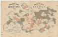
Uibersichts-Karte der Herrschaft Drhovle
1 : 30700 Drhovle (Česko) Kraus Verlag des böhmischen Forstvereins
III. vojenské mapování 4252/1
1 : 25000

Gradkartenblatt
1 : 25000 Blatná-oblast (Strakonice, Česko) Albrecht, Julius
III. vojenské mapování 4252/1
1 : 25000
Přehledná mapa velkostatku Orlíka, Čimelic, Varvažova, Tochovic a přivtělených statků Bukovan, Zalužan, a Zbenic podle majetkového stavu z r. 1905/06 1
1 : 25000
Náčrty majetkové držby statků v okolí Orlíka a Zvíkova od Karla IV. do r. 1850 znázorňující historický vývoj panství orlického a okolních statků, vyhotovené M. Jakubičkou r. 1917 podle Sedláčkových historických mapek, list 5 1

Pisek und Blatna
1 : 75000 Blatná (Strakonice, Česko : oblast) Petrakovič K. u. k. militär-geographisches Institut
Pisek und Blatna
1 : 75000 Blatná (Strakonice, Česko : oblast) K. u. k. Militärgeographisches Institut
Plan der hochfürstlich Schwarzenbergischen Herrschaften Worlik und Klingenberg
1 : 41400 Bukovany (Příbram, Česko) Hertschl, Franz
Přehledná mapa panství Orlíka a přivtělených statků 1

Koenigreich Boehmen...

Übersichtskarte der Herrschaft Worlik
1 : 43200 Orlík nad Vltavou-oblast (Česko) Runčík, V.
Písek
1 : 75000 Blatná (Strakonice, Česko : oblast) Vojenský zeměpisný ústav
Přehledná mapa velkostatku Orlíka, Čimelic a Varvažova s vyznačením hranic jednotlivých katastrálních obcí a pozemkové držby velkostatku s označením jednotlivých parcel 1


