Maps of Saint-Denis

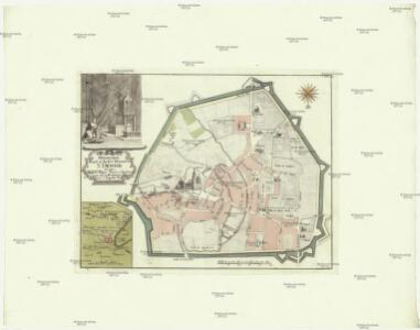
Topographia regii ac inclyti monasterii S. Dionysii in quo mausolea regum Franciae a Dagoberto I. usque ad nostra tempora visuntur
1 : 5000 Saint-Denis (Francie) Weigel, Christoph C. Weigelius
La Topographie de Paris ou Plan détaillé de la Ville de Paris 3

La Topographie de Paris ou Plan détaillé de la Ville de Paris 1

La Topographie de Paris ou Plan détaillé de la Ville de Paris 2
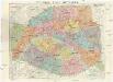
Karte der Befestigung von Paris

Plan‘‘sraženija pod’’ Parižem‘‘, 18 marta 1814 g.
Frankreich Paris Befreiungskriege <1813-1815>
Flle. 3. St. Denis, uit: Carte topographique des environs de Versailles dite "Carte des chasses du Roi"
1 : 28800 titelvariant: Carte des chasses du Roi; Annotatie: Herdruk van originele koperplaten; Oorspr. uitg.: 1764-1807; Voor aanwezige bladen zie overzichtsblad; Annotatie geografische gegevens: Opname: 1764-1773 [Paris : IGN]
Noveau plan complet et historique de Paris, avec ses fortifications

French Ports & Harbours, and Plan of Paris.
Fullarton, A. & Co.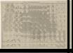

Plan de Paris
1 : 16000 Vuillemin, A. A. (Alexandre A.), b. 1812 Hachette & Cie.
Plan touristique de Paris: chemin de fer métropolitain et principales lignes dautobus et de tramways, permettant la visite de la ville, de ses monuments, de ses musées et de ses promenades / fond de plan dressé et dessiné par G. Peltier
Syndicat dInitiative de Paris et du Département de la Seine ; Peltier, G.

[Recto], uit: Nouveau Paris monumental : itinéraire pratique de l'étranger à Paris / gravé par L. Poulmaire
1 : 15000 Poulmaire, L. Paris : Garnier
Paris illustré et ses fortifications / dressé par Maillard
1 : 10000 titelvariant: Plan de Paris; Annotatie: Omslagtitel: Plan de Paris; Met straatnamenregister Maillard, ... Paris : Logerot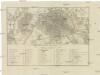
PLAN VON PARIS mit seinen nächsten Umgebungen
1 : 51000 Paříž (Francie)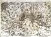
A plan of Paris [et]c
1 Karte : Kupferdruck ; 46 x 69 cm Rocque John Rocque in y.e Strand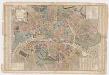
Plan de la ville et faubourg de Paris : avec tous ses accroissemens et la nouvelle eceinte des barrieres de cette capitale
1 : 6666 Mondhare et Jean Mondhare et Jean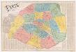
Paris 1867
1 : 12800 Dumas-Vorzet, Ed. (Eduard) Librairie du Petit Journal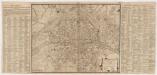
Plan de la ville, cité, université, et faubourgs de Paris avec ses environs : augmenter de plusieurs bastiments et remarques que l'on y a fait de puis peu tres exactement dessinés sur les lieux par *...*****
1 : 7200 Loon, H. V. (Herman van) chez le Sr. Jaillot Geographe du Roy, pres les Grands Augustins aux duex Globes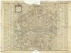
Nouveau plan de Paris
1 : 8400 Paříž (Francie) F. Chereau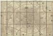
Nouveau plan complet de Paris avec ses fortifications
1 : 18000 Paříž (Francie) Henriot, J. N. A. Bes et F. Dubreuil
Carte topographique des environs & du plan de Paris
1 : 25200 Paříž (Francie) Delagrive, Jean von Homaen[n]ischen Erben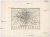
Plan von Paris 1835
Paříž (Francie) Meyer, Joseph Bibliographisches Institut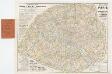
[Kaart], uit: Nouveau plan de Paris avec toutes les lignes du Métropolitain et du Nord-Sud / P. Bineteau del.
1 : 15000 titelvariant: Nouveau plan de Paris contenant toutes les lignes du Métropolitain et du Nord-Sud; Annotatie: Omslagtitel: Nouveau plan de Paris contenant toutes les lignes du Métropolitain et du Nord-Sud Bineteau, P. Paris : Taride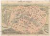
Nouveau Paris monumental
Paříž (Francie) Dufour, F. Garnier Freres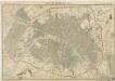
Plan de Paris en 1855
Nouveau plan de Paris
1 : 9000 Paříž (Francie) Dufrenoy
Nouveau plan de Paris en relief
1 : 10900 Paříž (Francie) Bauerkeller & Co. Bauerkeller