Maps of Metropolitan France

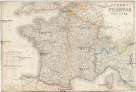
Guerra della Francia colla Prussia
1 : 1900000 Francie Stabilimento Rouchi
General Kriegs-Schauplatz oder neueste Karte von ganz Frankreich
1 : 2100000 Anglie Müller, Franz Artaria Compagnie
General Kriegs-Schauplatz oder neueste Karte von ganz Frankreich
1 : 2150000 Anglie Müller, Franz bey Artaria
La France
1 Karte : Kupferdruck ; 51 x 64 cm Jaillot; Cordier chez le Sr. Jaillot
France Provinces en 1789
Vidal de La Blache, Paul
Frankreich

France - Belgium and Switzerland.
1 : 3380000 Sharpe, J.
Carte itinéraire de la France
Francie Lorain, A. chez Dopter
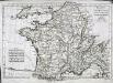
Carte de France
1 Karte : Kupferdruck ; 45 x 62 cm Clouet; Mondhare; Jean chez Mondhare et Jean rue St. Jean de Beauvais n.o 4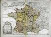
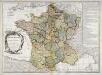
Le royaume de France
1 Karte : Kupferdruck ; 44 x 63 cm Jaillot; Cordier; Sanson; Basset; Basset chez Basset rüe St. Jacques au coin de celle des Mathurins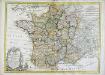
Carte de France
1 Karte : Kupferdruck ; 45 x 62 cm Clouet; Mondhare chez le Sr. Mondhare ruë St. Jacques a la ville de Caen
Le royaume de France dans toute son etandüe
1 Karte : Kupferdruck ; 48 x 64 cm Fer; Danet G. Danet sur le pont N. Dame a la sphere royale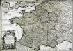
Le royaume de France
1 Karte : Kupferdruck ; 44 x 63 cm Jaillot; Cordier; Sanson chez H. Iaillot joignant les grands Augustins aux 2. globes

Atlas für Industrie- und Handelsgeographie: Für commercielle und technische Lehranstalten, für Kaufleute und Industrielle
Mappa Galliæ antiquæ
1 Karte : Kupferdruck ; 21 x 31 cm Bonne; Perrier; André s.n.
France en 1789.
1 : 3000000 Levasseur, E.
Königreich Frankreich
1 : 4000000 Francie
Königreich Frankreich
Francie
Karte von Frankreich
1 : 2056000 Francie Mollo, Tranquillo T. Mollo
Karte von Frankreich
1 : 2056000 Francie Müller, Franz T. Mollo
Karte von Frankreich
1 : 2060000 Francie Mollo, Tranquillo T. Mollo und Comp.
Karte von Frankreich
1 : 2060000 Francie Mollo, Tranquillo T. Mollo und Comp.
Karte von Frankreich
1 : 2060000 Francie Mollo, Tranquillo T. Mollo und Comp.
Nova totius Galliae descriptio
1 : 3000000 Francie De Jode, Gerhard Gérard de Jode
France.
1 : 3900000 Lavoisne, M.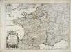
Le royaume de France
1 Karte : Kupferdruck ; 44 x 63 cm Jaillot; Cordier; Sanson; Basset; Basset chez Basset rüe St. Jacques au coin de celle des Mathurins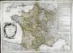
Le royaume de France
1 Karte : Kupferdruck ; 45 x 64 cm Janvier; Santini; Choffard chez Francois Santini rue S.te Justine pres la ditte eglise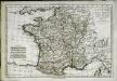
La France par gouvernements
1 Karte : Kupferdruck ; 21 x 31 cm Bonne; Perrier s.n.