Maps of okres Jindřichův Hradec
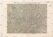
General-Karte zu den Corps-Manövern bei Waidhofen a[n] [der Thaya] 1891
1 : 300000 Waidhofen an der Thaya (Rakousko)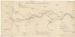
Übersicht der Canaltracen der Strecke Wien-Budweis
1 : 300000 Vídeň (Rakousko) Staff, A. Rosenberg, K.
Vermehrte und Verbesserte Landkarten des Königreichs Ungarn :
1 : 500000 Mollova mapová sbírka Stier, Martin Böner, Johann-Alexander Endter, Martin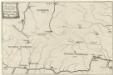
Locus Conjuctionis Danubij cum Moldava
Mollova mapová sbírka Vogemont, Lothar

III. vojenské mapování 4354/4
1 : 25000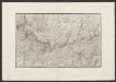
Militair Karte von Süd-Deutschland in 20 Sectionen
1 : 400000 12. Section Coulon, Alois von A. von Coulon
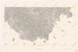
Jihovýchodní Čechy
1 : 220000 Jihočeský kraj (Česko) Wagner, Jan Eduard F. Kytka
Znaim 132, uit: Special-Karte von Mittel-Europa / nach amtlichen Quellen bearbeitet von W. Liebenow
1 : 300000 titelvariant: W. Liebenow's Mittel-Europa; Annotatie: Titel boven de bladen: W. Liebenow's Mittel-Europa Johannes Wilhelm Liebenow 1822-1897 Frankfurt a. M. : Ludwig Ravenstein
Ob Mannharts Berg
1 : 640000 Mollova mapová sbírka Insprugger, Sebastianus Märtin, Johann Heinrich Voigt, Maria Theresia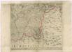
Müllerova mapa Čech
1 : 132000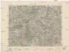
Jihlava
1 : 75000 Jihlava (Česko : oblast) Vojenský zeměpisný ústav
Jihlava
1 : 75000 Jihlava-oblast (Česko) Vojenský zeměpisný ústav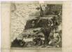
Müllerova mapa Čech XXIV
1 : 132000
Melk -Linz, Pöchlarn - Gamming Göpfritz - Budweis - Klain Reifling mit Umgebund
Linec (Rakousko) K. k. Österreichische Staatsbahnen
Generální mapa Protektorátu Čechy a Morava

Das in dem Ertzhertzogtumb Vnter Osterreich
1 : 246000 Dolní Rakousko (Rakousko) Vischer, Georg Matthaeus Hoffmann, Jakob
Spezial-Karte des Budweiser Kreis...

Monumenta Cartographica Bohemiae II.: Müllerova mapa

Special-Karte des Budweiser Kreis - resp. politischen Verwaltungs Bezirkes in Böhmen
1 : 230000 České Budějovice-oblast (Česko) Schmidt, Eduard Wend. Morauer
Special-Karte des Budweiser Kreis - resp. politischen Verwaltungs Bezirkes in Böhmen
1 : 230000 České Budějovice-oblast (Česko) Schmidt, Eduard Wend. Morauer
Special-Karte des Budweiser Kreis, resp. politischen Verwaltungs Bezirkes in Böhmen
České Budějovice-oblast (Česko) Schmidt, Eduard Steyrer, Fr. C. Wend. Morauer
Nová Mapa království Českého
1 : 200000 Čechy jižní (Česko) Kotyška, Václav Hanf, Norbert Bursík & Kohout
Mapa ku IV. dílu Hradů, zámků a tvrzí českých
1 : 278000 Jindřichův Hradec (Česko : oblast) Král z Dobré Vody, Vojtěch Šimáček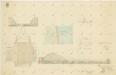
Plán bašty Adolfka na hrázi Rožmberského rybníka 1
Mapa království Českého 9.
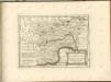

Charte vom Budweiser Kreise des Königreiches Böheim
1 : 250000 České Budějovice-oblast (Česko) Kreibich, František Jakub Jindřich Kettner, Carl C. W. Enders
Charte vom Budweiser Kreise des Königreiches Böheim
1 : 250000 České Budějovice-oblast (Česko) Kreibich, František Jakub Jindřich Kettner, Carl C. W. Enders
![General-Karte zu den Corps-Manövern bei Waidhofen a[n] [der Thaya] 1891](https://images-2.georeferencer.com/images/iiif/310099088430/full/,300/0/native.jpg)

