Maps of Děčín

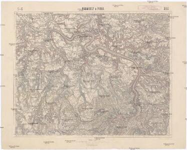
Podmokly a Pirna
1 : 75000 Děčín (Česko : oblast) Vojenský zeměpisný ústav
III. vojenské mapování 3652
1 : 75000
Podmokly
1 : 75000 Německo Vojenský zeměpisný ústav
Podmokly
1 : 75000 Čechy (Česko) Vojenský zeměpisný ústav
Wanderkarte Sächsische Schweiz

Die Sächsische Schweiz
1 : 153000 Saské Švýcarsko (Německo) Medau, Karel Vilém C.W. Medau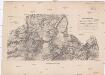
Darstellung der Gegend zwischen Hohnstein in Sachsen und Peterswalde in Böhmen
1 : 45500 Petrovice-oblast (Ústí nad Labem, Česko) Aster, H. Renner, F. Adler & Dietze
[Kartenblatt]
1 : 25000 Děčín-oblast (Česko) Reichsamt für Landesaufnahme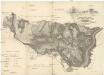
Situations-Karte der zusammenhängenden Waldungen von der Excellenz gräflich Thun'schen Domaine Tetschen in Böhmen
1 : 35000 Děčín-oblast (Česko) Funke, Wilhelm Sandtner, Jan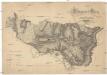
Situations-Karte der zusammenhängenden Waldungen von der Excellenz gräflich Thun'schen Domaine Tetschen in Böhmen
1 : 35000 Děčín-oblast (Česko) Funke, Wilhelm Sandtner, Jan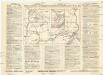
Reichenberger Messe u[nd] Sondermesse für wirtschaftliche Betriebsführung 15.-21. Aug[ust] 1925
Děčín (Česko : oblast) Weber-Ostwalden
III. vojenské mapování 3652/4
1 : 25000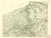
III. vojenské mapování 3652/4
1 : 25000
III. vojenské mapování 3652/4
1 : 25000
III. vojenské mapování 3652/4
1 : 25000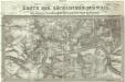
Karte der Sächsischen Schweiz
Saské Švýcarsko (Německo)
[Kartenblatt]
1 : 25000 Libouchec (Česko) Reichsamt für Landesaufnahme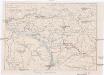
Okolí Hřenska
1 : 65000 Hřensko (Česko : oblast) Ed. Grégr
Meßtischblatt 5150 : Rosenthal, 1942
1 : 250000 Rosenthal. - Aufn. 1933/34, bericht. 1938, letzte Nachtr. 1937, hrsg. 1937. - 1:25000. - Leipzig, 1942. - 1 Kt.
Meßtischblatt 103 : Rosenthal, 1920
1 : 250000 Rosenthal. - Aufgen. 1898, rev. 1901, hrsg. 1911, kurrentgest. 1920. - 1:25000. - Leipzig, 1920. - 1 Kt.
Meßtischblatt 103 : Rosenthal, 1919
1 : 250000 Rosenthal. - Aufgen. 1898, rev. 1901, hrsg. 1911, einz. Nachtr. 1919. - 1:25000. - Leipzig, 1919. - 1 Kt.
Meßtischblatt 103 : Rosenthal, 1916
1 : 250000 Rosenthal. - Aufgen. 1898, rev. 1901, hrsg. 1911, einz. Nachtr. 1916. - 1:25000. - Leipzig, 1916. - 1 Kt.
Meßtischblatt 103 : Rosenthal, 1911
1 : 250000 Rosenthal. - Aufgen. 1898, rev. 1901, hrsg. 1911. - 1:25000. - Leipzig, 1911. - 1 Kt.
III. vojenské mapování 3652/3
1 : 25000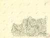
III. vojenské mapování 3652/3
1 : 25000
III. vojenské mapování 3652/3
1 : 25000
Maxdorf - c4535-1-008 - Kaiserpflichtexemplar der Landkarten des stabilen Katasters
1 : 2880
Maxdorf - c4535-1-001 - Kaiserpflichtexemplar der Landkarten des stabilen Katasters
1 : 2880
Maxdorf - c4535-1-004 - Kaiserpflichtexemplar der Landkarten des stabilen Katasters
1 : 2880
Maxdorf - c4535-1-007 - Kaiserpflichtexemplar der Landkarten des stabilen Katasters
1 : 2880
Maxdorf - c4535-1-002 - Kaiserpflichtexemplar der Landkarten des stabilen Katasters
1 : 2880
Maxdorf - c4535-1-011 - Kaiserpflichtexemplar der Landkarten des stabilen Katasters
1 : 2880
Maxdorf - c4535-1-006 - Kaiserpflichtexemplar der Landkarten des stabilen Katasters
1 : 2880
Maxdorf - c4535-1-010 - Kaiserpflichtexemplar der Landkarten des stabilen Katasters
1 : 2880
Maxdorf - c4535-1-005 - Kaiserpflichtexemplar der Landkarten des stabilen Katasters
1 : 2880
Maxdorf - c4535-1-003 - Kaiserpflichtexemplar der Landkarten des stabilen Katasters
1 : 2880