Maps of okres Pardubice
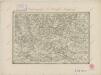
Landesdurchforschung von Böhmen
1 : 200000 Chrudim-oblast (Česko) Kořistka, Karel František Edvard
Indikační skica mapy stabilního katastru pro obec Hoděšovice I.-V.
1 : 2880
Landesdurchforschung von Böhmen
1 : 200000 Čechy severovýchodní (Česko) Kořistka, Karel František Edvard
Mapa platická s patry výše po 25 metrech
Čechy severovýchodní (Česko) Kořistka, Karel František Edvard
[Výzkum Čech]
Čechy východní (Česko) Kořistka, Karel František Edvard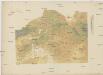
[Landesdurchforschung von Böhmen
Litoměřice-oblast (Česko) Kořistka, Karel František Edvard
[Proskoumání [sic] Čech
Trutnov-oblast (Česko) Kořistka, Karel František Edvard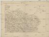
Landesdurchforschung von Böhmen
Čechy severovýchodní (Česko) Kořistka, Karel František Edvard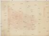
[Landesdurchforschung von Böhmen
Trutnov-oblast (Česko) Kořistka, Karel František Edvard
Landesdurchforschung von Böhmen
1 : 200000 Čechy (Česko) Kořistka, Karel František Edvard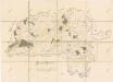
Mapa panství Pardubice
1 : 36000
[Königgrätz und Umgebung]
1 : 144000 Hradec Králové-oblast (Česko) Kořistka, Karel František Edvard
Regni Bohemiae circulus Chrudimensis
1 : 192700 Chrudim-oblast (Česko) Müller, Johann Christoph ab Homannianis Heredibus
Regni Bohemiae circulus Chrudimensis
1 : 190000 Chrudim-oblast (Česko) Müller, Johann Christoph ab Homannianis Heredibus
Regni Bohemiae circulus Chrudimensis
1 : 192700 Chrudim-oblast (Česko) Müller, Johann Christoph ab Homannianis Heredibus
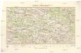
144. Lewin, uit: Topographische Uebersichtskarte des Deutschen Reiches / herausgegeben v. d. Kartogr. Abt. d. Königl. Preuß. Landesaufnahme
1 : 200000 titelvariant: Topogr. Übersichtskarte des Deutschen Reiches; Annotatie: Titel boven bladen ook: Topogr. Übersichtskarte des Deutschen Reiches; Annotatie geografische gegevens: Op elk blad twee maatstokken: 10 Kilometer = 5,5 cm; 1 geogr. Meile = 3,6 cm; Legenda onder op elk blad Königlich Preußische Landesaufnahme. Kartographische Abtheilung [S.l : Königlich Preußische Landesaufnahme, Kartographische Abtheilung]
Charte ehemaliger Burgen & Vesten im Bidžower & Koeniggrätzer Kreise Böhmens
1 : 530000 Hradec Králové-oblast (Česko)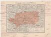
Generální mapa okresního hejtmanství Pardubického
1 : 220000 Pardubice-oblast (Česko) Wagner, Jan Eduard F. Kytka
Generální mapa okresního hejtmanství Rychnovského
1 : 220000 Rychnov nad Kněžnou-oblast (Česko) Wagner, Jan Eduard F. Kytka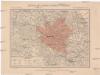
Generální mapa okresního hejtmanství Rychnovského
1 : 220000 Rychnov nad Kněžnou-oblast (Česko) Wagner, Jan Eduard F. Kytka
Generální mapa okresního hejtmanství Rychnovského
1 : 220000 Rychnov nad Kněžnou-oblast (Česko) Wagner, Jan Eduard F. Kytka
Camp imperial royal comandé par le prince Picolomini et celui des Prussiennes comandé par le comte Swerin
Hradec Králové-oblast (Česko) Trattner, Johann Thomas Jean Thomas Trattner
Pardubický okres
1 : 100000 Pardubice-oblast (Česko) Myška, Josef Mapový ateliér Ed. Fastra
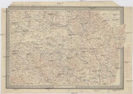
Reichenau und Tinischt a.d. Adler.
from Spezialkarte der osterreichisch-ungarischen Monarchie.
Konigcratz, Elbeteinitz und Pardubitz.
from Spezialkarte der osterreichisch-ungarischen Monarchie.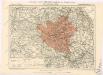
Generální mapa okresních hejtmanství
II. vojenské mapování 15
1 : 144000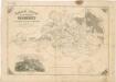
Generální mapa panství Pardubice
1 : 95000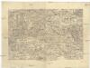
[Hradec Králové a okolí]
1 : 144000 Hradec Králové-oblast (Česko)