Maps of Rakovník
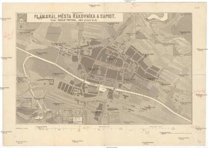
Plán král. města Rakovníka a samot
1 : 4100 Rakovník (Česko) Treybal, Václav Ponheimer, Kilian F. Příhoda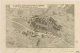
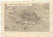
Plán král. města Rakovníka a Samot

Rakonitz (Rakownjk) - c6427-1-004 - Kaiserpflichtexemplar der Landkarten des stabilen Katasters
1 : 2880
Rakonitz (Rakownjk) - c6427-1-005 - Kaiserpflichtexemplar der Landkarten des stabilen Katasters
1 : 2880
Rakonitz (Rakownjk) - c6427-1-003 - Kaiserpflichtexemplar der Landkarten des stabilen Katasters
1 : 2880
Rakonitz (Rakownjk) - c6427-1-009 - Kaiserpflichtexemplar der Landkarten des stabilen Katasters
1 : 2880
Rakonitz (Rakownjk) - c6427-1-010 - Kaiserpflichtexemplar der Landkarten des stabilen Katasters
1 : 2880
Rakonitz (Rakownjk) - c6427-1-002 - Kaiserpflichtexemplar der Landkarten des stabilen Katasters
1 : 2880
Rakonitz (Rakownjk) - c6427-1-007 - Kaiserpflichtexemplar der Landkarten des stabilen Katasters
1 : 2880
Rakonitz (Rakownjk) - c6427-1-008 - Kaiserpflichtexemplar der Landkarten des stabilen Katasters
1 : 2880
Rakonitz (Rakownjk) - c6427-1-006 - Kaiserpflichtexemplar der Landkarten des stabilen Katasters
1 : 2880
Rakonitz (Rakownjk) - c6427-1-001 - Kaiserpflichtexemplar der Landkarten des stabilen Katasters
1 : 2880
Umgebung von Rakonitz
Rakovník-oblast (Česko) Biller, Bernhardt Marco Berra
Regni Bohemiae Circulus Rakonicensis
1 : 160000 Rakovník-oblast (Česko) Müller, Johann Christoph ab Homannianis Heredibus
Regni Bohemiae circulus Rakonicensis
1 : 165000 Rakovník-oblast (Česko) Müller, Johann Christoph ab Homannianis Heredibus
Regni Bohemiae circulus Rakonicensis
1 : 165000 Rakovník-oblast (Česko) Müller, Johann Christoph ab Homannianis Heredibus
Regni Bohemiae Circulus Rakonicensis
1 : 160000 Rakovník-oblast (Česko) Müller, Johann Christoph ab Homannianis Heredibus
[Kartenblatt]
1 : 25000 Rakovník (Česko : oblast) Reichsamt für Landesaufnahme
Gradkartenblatt
1 : 25000 Rakovník-oblast (Česko) Bulla, Eduard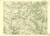
III. vojenské mapování 3951/4
1 : 25000

Karte des Rakonitzer Bezirkes im Prager Kreise
1 : 70000 Rakovník-oblast (Česko) Wagner, Jan Eduard Karl André
Karte des Rakonitzer Bezirkes im Prager Kreise
1 : 70000 Rakovník-oblast (Česko) Wagner, Jan Eduard Karl André
Situations-Plan der Fürst zu Fürstenberg'schen Herrschaft Pürglitz, Kruschowitz, dann des Gutes Nischburg, Wschetatt und Wolleschna etc
1 : 84000 Křivoklát-oblast (Česko) Bohutinský, Friedrich Fürstenberg, Karl Egon
Rakovník
1 : 75000 Podbořany (Česko : oblast) Vojenský zeměpisný ústav
Mapy plánování ČSR

III. vojenské mapování 3951
1 : 75000
Rakovník
1 : 75000 Rakovník-oblast (Česko) Vojenský zeměpisný ústav
Podersam und Rakonitz
1 : 75000 Podbořany (Česko : oblast) K. u. k. Militärgeographisches Institut
Podersam und Rakonitz
1 : 75000 Podbořany (Česko : oblast) Hertel, A. K. u. k. militär-geographisches Institut
Podersam und Rakonitz
1 : 75000 Podbořany (Česko : oblast) Hertel, A. K. u. k. Militärgeographisches Institut