Maps of Europe
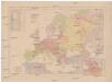
Evropa
Evropa z c. k. školního kněhoskladu
L'Europe sous l'empire de Charlesmagne ou tableau historique de cette partie du monde à la fin du h
1 : 12400000 1 Karte : Kupferdruck ; 37 x 51 cm Brué, Adrien Hubert chez l'auteur ... et chez les principaux m.ds de cartes géographiques
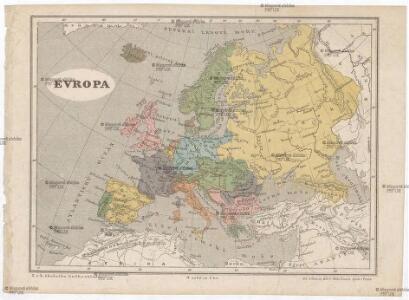
Europa
1 : 44000000 Evropa Biller, Franz
Neueste Karte von Europa
1 : 18000000 Evropa Radefeld Bibliographisches Institut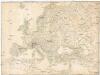
[Europa]
Evropa Klöden, Carl Friedrich
Charte von Europa
1 : 12000000 Evropa Verlag des Industrie-Comptoirs
Übersicht der Europaeischen Seeküsten
1 : 8000000 Evropa Bowles, Carington F.A. Schraembl
EUROPA
1 : 12400000 Evropa Hase, Johann Matthias edita curis Homannianorum Heredum
Europa
1 : 11750000 Evropa Hase, Johann Matthias edita curis Homannianorum Heredum
Europa secundum legitimas Projectionis Stereographicae regulas et juxta recentisimas observationes aeque ac relationes
1 : 12000000 Evropa Hase, Johann Matthias Homann, Johann Baptist Homannianorum Heredum
Europa
1 : 11750000 Evropa Hase, Johann Matthias edita curis Homannianorum Heredum
EUROPA
1 : 12400000 Evropa Hase, Johann Matthias edita curis Homannianorum Heredum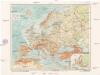
Evropa
1 : 17500000 Evropa Machát, František V. Neubert a synové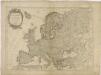
L'Europa divisée en ses principaux Etats suivant les nouvelles observations astronomiques

Europa
1 : 15900 Evropa Biller, Dominik T. Mollo
Ewropa
1 : 20600000 Evropa Merklas, Václav V. Merklas
Ewropa
1 : 20600000 Evropa Merklas, Václav V. Merklas
Ewropa
1 : 20600000 Evropa Merklas, Václav V. Merklas
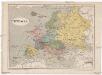
Europa
1 : 7500000 Evropa Herrich, Alwin Carl Flemming u. C.T. Wiskott
Europa
1 : 10000000 Evropa Weiland, Karl Ferdinand Kiepert, Heinrich im Verlage des geograph. Instituts
[Evropa]
Evropa Klöden, Karl Friedrich von Simon Schropp et Co.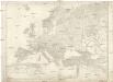
[Evropa]
Evropa Klöden, Karl Friedrich von Simon Schropp et Co.

Accuratissima Europæ tabula
1 Karte : Kupferdruck ; 49 x 58 cm Allard ex officina I. Cóvens et C. Mortier
Nova et accurate divisa in regna et regiones præcipuas Europæ descriptio
1 Karte : Kupferdruck ; 43 x 53 cm Wit ex officina I. Cóvens et C. Mortier
Europa excultissima
1 Karte : Kupferdruck ; 48 x 57 cm Schenk Pieter Schenk
Accuratissima Europæ tabula
1 Karte : Kupferdruck ; 48 x 57 cm Allard Carel Allard
Europe and the Mediterranean
1 : 6000000 Evropa National Geographic Society
Visecí mapa Evropy
Evropa Kocen, Blaž Kovář, Matěj Radoslav Ed. Helzel