Maps of Chiltern

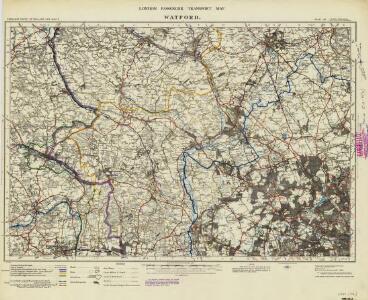
London passenger transport map
Ordnance Survey
England and Wales [OS of]
Ordnance Survey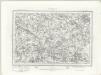
Beaconsfield (Outline) - OS One-Inch Revised New Series
1 : 63360 Topographic maps Ordnance Survey Ordnance Survey
Beaconsfield (Hills) - OS One-Inch Revised New Series
1 : 63360 Topographic maps Ordnance Survey Ordnance Survey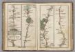
London to Tring.
1 : 63360 Cary, John
Chipping Barnet
1 : 31680 The most obvious features of this plan are major roads coloured yellow, with their cumulative lengths noted at intervals of one mile. North is not orientated towards the top. As a result,Watford appears to the left of St Albans, and the boundary between Middlesex and Hertfordshire (a dashed black-ink line)runs from the top left of the map down through Elstree to Hadley. The paper carries a watermark from the James Whatman Turkey Mill. Hyett, William
Hemel Hempstead
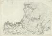
1 : 31680 This drawing describes a section of the Grand Junction Canal. The prehistoric Icknield Way appears at the top left of the plan. Hill-shading techniques and the attention given to communications routes conform to the military and cartographic standards employed by the Survey. Some name corrections are visible in faded ink in the centre of the map around Bovingdon. Harefield Common is also revised. Hyett, William
Carte topographique de le comté de Middlesex, 1
1 Blatt : 53 x 69 cm John Rocque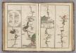
Watford to Rickmans Worth to Amersham, Watford to St. Albans.
1 : 63360 Cary, John
Uxbridge, Windsor
1 : 31680 This plan of the Chiltern Hills runs from Beaconsfield and Harefield at the top to Windsor Park, Egham and Staines at the bottom. A section of the Grand Junction Canal, running from Harefield down to West Drayton, is shown in aquamarine. The paper carries the watermark "E ,amp; P", standing for Edmeads and Pine. Boyce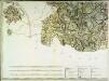
A topographical map of Hartford-Shire, 7
1 Blatt : 53 x 72 cm A. Dury
A topographical map, of the county, of Berks, Blatt VII und XIII
2 Blätter : 99 x 52 cm John Rocque
TL10 - OS 1:25,000 Provisional Series Map
1 : 25000 Topographic maps Ordnance Survey Ordnance Survey
TQ19 - OS 1:25,000 Provisional Series Map
1 : 25000 Topographic maps Ordnance Survey Ordnance Survey
TQ18 - OS 1:25,000 Provisional Series Map
1 : 25000 Topographic maps Ordnance Survey Ordnance Survey
TQ09 - OS 1:25,000 Provisional Series Map
1 : 25000 Topographic maps Ordnance Survey Ordnance Survey
TQ08 - OS 1:25,000 Provisional Series Map
1 : 25000 Topographic maps Ordnance Survey Ordnance Survey
SU99 - OS 1:25,000 Provisional Series Map
1 : 25000 Topographic maps Ordnance Survey Ordnance Survey
SU98 - OS 1:25,000 Provisional Series Map
1 : 25000 Topographic maps Ordnance Survey Ordnance Survey
TL00 - OS 1:25,000 Provisional Series Map
1 : 25000 Topographic maps Ordnance Survey Ordnance Survey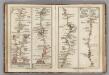
London to Highgate & Hampstead to Hendon, London to St. Albans.
1 : 63360 Cary, John
SP90 - OS 1:25,000 Provisional Series Map
1 : 25000 Topographic maps Ordnance Survey Ordnance Survey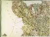
A topographical map of Hartford-Shire, 4
1 Blatt : 54 x 72 cm A. Dury
SU89 - OS 1:25,000 Provisional Series Map
1 : 25000 Topographic maps Ordnance Survey Ordnance Survey
SU88 - OS 1:25,000 Provisional Series Map
1 : 25000 Topographic maps Ordnance Survey Ordnance Survey
SP80 - OS 1:25,000 Provisional Series Map
1 : 25000 Topographic maps Ordnance Survey Ordnance Survey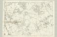
Buckinghamshire XLIX - OS Six-Inch Map
1 : 10560 Topographic maps Ordnance Survey Ordnance Survey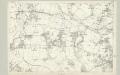
Buckinghamshire LIV - OS Six-Inch Map
1 : 10560 Topographic maps Ordnance Survey Ordnance Survey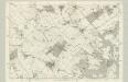
Buckinghamshire XXXIX - OS Six-Inch Map
1 : 10560 Topographic maps Ordnance Survey Ordnance Survey