Maps of Escambia County

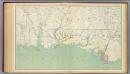
Maps of the Eastern, Middle and Southern States; Fort Pickens
Sketch of Pensacola Naval Yard and Fort Pickens. By W.A. Williams, Civil Engineer. L. Prang & Co.
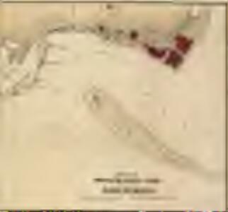
The Key of the South [United States], showing Fort Pickens and vicinity
The Key of the South, showing Fort Pickens & Vicinity, Position of Forts, Batteries, Fleet and soundings of every part of Pensacola Bay. Drawn by M.K. Couzins, C.E. Produced by M.K. Couzens and published by W. Schaus, The Key of the South, showing Fort Pickens and the Vicinity depicts the fortifications and fleet positions in Pensacola Bay, Florida in 1861. Fort Pickens was one a handful of forts within the Confederacy that the Union kept control of and it was fiercely defended throughout the war. It was also where troops went after Fort Barrancas was evacuated in January 1861. Some have argued that the small fire-fight that occurred on this occasion marked the start of the war as opposed to the firing on Fort Sumter four months later. The Bay itself had been home to Navy bases, building yards and federal forts since the War of 1812 and was a key strategic region for naval defences.
Strategic War Points of the United States no.5: Pensacola Bay and its fortifications
Strategic War points of the United States: Pensacola Bay and its fortifications J. Wyld
Lloyd's Military Campaign Charts: Pensacola Bay
Lloyd's Military Campaign Charts, showing the principal places of interest, compiled from official data by Gen. E.L. Viele and C. Haskins. Published under the auspices of the American Geographical and Statistical Society. Pensacola Bay.
Fort Barrancas
1 : 24000
Fort Barrancas
1 : 24000
Fort Barrancas
1 : 24000
Fort Barrancas
1 : 24000
Fort Barrancas
1 : 24000
Fort Barrancas
1 : 25000
Strategic War Points of the United States no.5: Pensacola Bay and its fortifications
Strategic War Points of the United States no.5: Pensacola Bay and its fortifications. J. Wyld
Prang's Naval Expedition Maps: Fort Pickens, and Pensacola Harbor
Prang's Naval Expedition Maps: Fort Pickens, and Pensacola Harbor L. Prang & Co.
Fort Barrancas
1 : 62500
Fort Barrancas
1 : 62500
Fort Barrancas
1 : 62500
Fort Barrancas
1 : 62500
Gulf Breeze
1 : 24000
Gulf Breeze
1 : 24000
Gulf Breeze
1 : 24000
Gulf Breeze
1 : 25000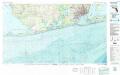
Pensacola
1 : 100000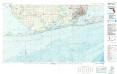
Pensacola
1 : 100000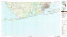
Pensacola
1 : 100000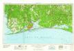
Pensacola
1 : 250000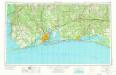
Pensacola
1 : 250000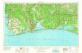
Pensacola
1 : 250000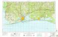
Pensacola
1 : 250000
Baies, Florides, Golfe du Mexique.
1 : 65000 Poussin, Guillaume Tell, 1794-1876
Map of New Orleans and Adjacent Country.
1 : 625000 Melish, John