Maps of Swale
Sittingbourne, Kent
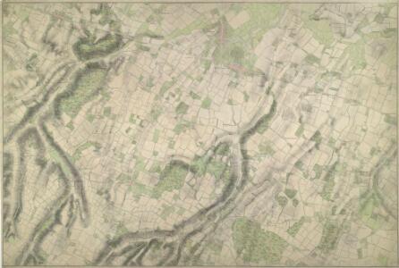
1 : 10560 This plan, showing the area around Sittingbourne in Kent, is drawn on rectangular sheet lines and enclosed by a black border. Fields are coloured brown where cultivated, and green or blank if untilled. Stonework buildings or structures are drawn in red ink at major settlements like Milton and Sittingbourne, at the centre top of the plan. Infilled or blocked areas of black or sepia ink depict structures or buildings made from impermanent materials such as wood. Corrections have been made on this plan and it is likely that the red-ink numerical annotations of altitude are measured rather than estimated or sketched.
Kent XXXIII - OS Six-Inch Map
1 : 10560 Topographic maps Ordnance Survey Ordnance Survey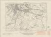
Kent XXXIII.NW - OS Six-Inch Map
1 : 10560 Topographic maps Ordnance Survey Ordnance Survey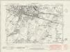
Kent XXXIII.NW - OS Six-Inch Map
1 : 10560 Topographic maps Ordnance Survey Ordnance Survey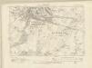
Kent XXXIII.NW - OS Six-Inch Map
1 : 10560 Topographic maps Ordnance Survey Ordnance Survey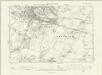
Kent XXXIII.NW - OS Six-Inch Map
1 : 10560 Topographic maps Ordnance Survey Ordnance Survey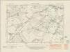
Kent XXXII.NE - OS Six-Inch Map
1 : 10560 Topographic maps Ordnance Survey Ordnance Survey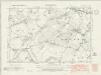
Kent XXXII.NE - OS Six-Inch Map
1 : 10560 Topographic maps Ordnance Survey Ordnance Survey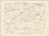
Kent XXXII.NE - OS Six-Inch Map
1 : 10560 Topographic maps Ordnance Survey Ordnance Survey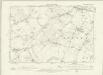
Kent XXXII.NE - OS Six-Inch Map
1 : 10560 Topographic maps Ordnance Survey Ordnance Survey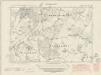
Kent XXXIII.SW - OS Six-Inch Map
1 : 10560 Topographic maps Ordnance Survey Ordnance Survey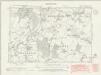
Kent XXXIII.SW - OS Six-Inch Map
1 : 10560 Topographic maps Ordnance Survey Ordnance Survey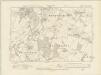
Kent XXXIII.SW - OS Six-Inch Map
1 : 10560 Topographic maps Ordnance Survey Ordnance Survey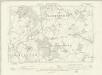
Kent XXXIII.SW - OS Six-Inch Map
1 : 10560 Topographic maps Ordnance Survey Ordnance Survey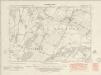
Kent XXXII.SE - OS Six-Inch Map
1 : 10560 Topographic maps Ordnance Survey Ordnance Survey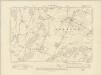
Kent XXXII.SE - OS Six-Inch Map
1 : 10560 Topographic maps Ordnance Survey Ordnance Survey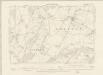
Kent XXXII.SE - OS Six-Inch Map
1 : 10560 Topographic maps Ordnance Survey Ordnance Survey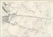
Kent XXXIII.2 (includes: Bapchild; Sittingbourne and Milton; Tonge) - 25 Inch Map
1 : 2500 Topographic maps Ordnance Survey Ordnance Survey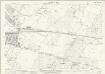
Kent XXXIII.2 (includes: Bapchild; Sittingbourne and Milton; Tonge) - 25 Inch Map
1 : 2500 Topographic maps Ordnance Survey Ordnance Survey
Kent XXXIII.2 (includes: Bapchild; Sittingbourne and Milton; Tonge) - 25 Inch Map
1 : 2500 Topographic maps Ordnance Survey Ordnance Survey
Kent XXXIII.6 (includes: Bapchild; Rodmersham; Tonge) - 25 Inch Map
1 : 2500 Topographic maps Ordnance Survey Ordnance Survey
Kent XXXIII.6 (includes: Bapchild; Rodmersham; Tonge) - 25 Inch Map
1 : 2500 Topographic maps Ordnance Survey Ordnance Survey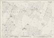
Kent XXXIII.10 (includes: Lynsted; Rodmersham; Tonge) - 25 Inch Map
1 : 2500 Topographic maps Ordnance Survey Ordnance Survey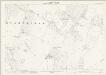
Kent XXXIII.10 (includes: Lynsted; Rodmersham; Tonge) - 25 Inch Map
1 : 2500 Topographic maps Ordnance Survey Ordnance Survey
Kent XXXIII.10 (includes: Lynsted; Rodmersham; Tonge) - 25 Inch Map
1 : 2500 Topographic maps Ordnance Survey Ordnance Survey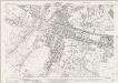
Kent XXXIII.1 (includes: Sittingbourne and Milton) - 25 Inch Map
1 : 2500 Topographic maps Ordnance Survey Ordnance Survey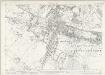
Kent XXXIII.1 (includes: Sittingbourne and Milton) - 25 Inch Map
1 : 2500 Topographic maps Ordnance Survey Ordnance Survey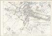
Kent XXXIII.1 (includes: Sittingbourne and Milton) - 25 Inch Map
1 : 2500 Topographic maps Ordnance Survey Ordnance Survey
Kent XXXIII.5 (includes: Sittingbourne and Milton; Tunstall) - 25 Inch Map
1 : 2500 Topographic maps Ordnance Survey Ordnance Survey