Maps of Lincolnshire

Tattershall(002OSD000000013U00243000)
1 : 31680 This drawing covers part of the Lincolnshire coast. It shows sand dunes and silt and the navigable portion off the coast known as the Boston Deeps on the right of the sheet. Canals and dykes are a manmade feature of the East Fen and are highlighted in blue towards the left of the plan. These date from the 17th century, when James I appointed Dutch engineer Cornelius Vermuyden to direct the drainage of the fens wetlands. Many local people opposed the scheme as the plan involved commonland on which they grazed cattle. As a result of Vermuyden's work, the Fens changed radically in appearance, from an area of flooded marshes to one of extensively farmed agricultural land. Budgen, Charles
TF55 - OS 1:25,000 Provisional Series Map
1 : 25000 Topographic maps Ordnance Survey Ordnance Survey
TF45 - OS 1:25,000 Provisional Series Map
1 : 25000 Topographic maps Ordnance Survey Ordnance Survey
TF44 & Parts of TF54 - OS 1:25,000 Provisional Series Map
1 : 25000 Topographic maps Ordnance Survey Ordnance Survey
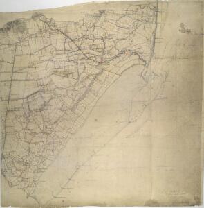
A Coloured Plan of a New Cut from Wainfleet in Lincolnshire to the Sea
This is a map showing the proposed new haven’ or channel from Wainfleet in Lincolnshire, to the sea. It is orientated with east to the top, although the cardinal points have not been inserted. It is thought to date from around 1570. It shows the channels and distances to the sea from Wainfleet. A legend at the foot of the map records the lengths of the waterway for which the Lord Dalby’ (Sir William Brereton) and various parishes and districts were responsible. On the death of Sir William Brereton in 1569 his son became a ward and his manor of Dalby reverted to the Crown. It is likely that Lord Burghley, who owned a version of this map from which this map is copied, became interested in Wainfleet Haven at this point. Burghley, as Commissioner of Sewers in 1564 and 1570, had a particular interest in Wainfleet Haven and is recorded as having written to the Commissioner of Sewers on February 1568/9 about the diking of two streams forming part of the Haven. Burghley was himself on the board of Commissioners of Sewers for Holland in 1554; for Lincolnshire, Northamptonshire, and the Isle of Ely in 1555, and for Lincolnshire in 1564 and 1570.
TF56 - OS 1:25,000 Provisional Series Map
1 : 25000 Topographic maps Ordnance Survey Ordnance Survey
TF46 - OS 1:25,000 Provisional Series Map
1 : 25000 Topographic maps Ordnance Survey Ordnance Survey
Lincolnshire LXXXIV.SE - OS Six-Inch Map
1 : 10560 Topographic maps Ordnance Survey Ordnance Survey
Lincolnshire LXXXIV.SE - OS Six-Inch Map
1 : 10560 Topographic maps Ordnance Survey Ordnance Survey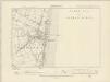
Lincolnshire LXXXIV.SE - OS Six-Inch Map
1 : 10560 Topographic maps Ordnance Survey Ordnance Survey
Lincolnshire LXXXIV.SE - OS Six-Inch Map
1 : 10560 Topographic maps Ordnance Survey Ordnance Survey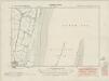
Lincolnshire XCII.NE - OS Six-Inch Map
1 : 10560 Topographic maps Ordnance Survey Ordnance Survey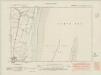
Lincolnshire XCII.NE - OS Six-Inch Map
1 : 10560 Topographic maps Ordnance Survey Ordnance Survey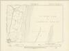
Lincolnshire XCII.NE - OS Six-Inch Map
1 : 10560 Topographic maps Ordnance Survey Ordnance Survey
Lincolnshire XCII.NE - OS Six-Inch Map
1 : 10560 Topographic maps Ordnance Survey Ordnance Survey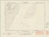
Lincolnshire XCII.SE - OS Six-Inch Map
1 : 10560 Topographic maps Ordnance Survey Ordnance Survey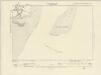
Lincolnshire XCII.SE - OS Six-Inch Map
1 : 10560 Topographic maps Ordnance Survey Ordnance Survey
Lincolnshire XCII.SE - OS Six-Inch Map
1 : 10560 Topographic maps Ordnance Survey Ordnance Survey
Lincolnshire LXXXIV.SW - OS Six-Inch Map
1 : 10560 Topographic maps Ordnance Survey Ordnance Survey
Lincolnshire LXXXIV.SW - OS Six-Inch Map
1 : 10560 Topographic maps Ordnance Survey Ordnance Survey
Lincolnshire LXXXIV.SW - OS Six-Inch Map
1 : 10560 Topographic maps Ordnance Survey Ordnance Survey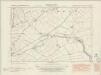
Lincolnshire XCII.NW - OS Six-Inch Map
1 : 10560 Topographic maps Ordnance Survey Ordnance Survey
Lincolnshire XCII.NW - OS Six-Inch Map
1 : 10560 Topographic maps Ordnance Survey Ordnance Survey
Lincolnshire XCII.NW - OS Six-Inch Map
1 : 10560 Topographic maps Ordnance Survey Ordnance Survey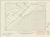
Lincolnshire XCII.SW - OS Six-Inch Map
1 : 10560 Topographic maps Ordnance Survey Ordnance Survey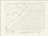
Lincolnshire XCII.SW - OS Six-Inch Map
1 : 10560 Topographic maps Ordnance Survey Ordnance Survey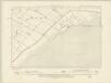
Lincolnshire XCII.SW - OS Six-Inch Map
1 : 10560 Topographic maps Ordnance Survey Ordnance Survey
Lincolnshire XCII.SW - OS Six-Inch Map
1 : 10560 Topographic maps Ordnance Survey Ordnance Survey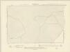
Lincolnshire CII.NW & CII.NE - OS Six-Inch Map
1 : 10560 Topographic maps Ordnance Survey Ordnance Survey