Maps of Newton Purcell with Shelswell
Winslow
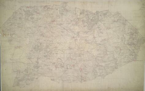
1 : 31680 Enclosed farmland characterises the landscape of this part of Buckinghamshire. To the right of the manuscript, a section of the Grand Junction Canal is depicted running from Leighton Buzzard to Fenny Strafford along the River Fosse Valley. Two Roman roads are depicted on the plan: the Watling Street from London to Wroxeter in Wales via St. Albans and Leicester, at top right, and the Akeman Street Way, at lower left. Boyce
Buckingham (Hills) - OS One-Inch Revised New Series
1 : 63360 Topographic maps Ordnance Survey Ordnance Survey
Buckingham (Outline) - OS One-Inch Revised New Series
1 : 63360 Topographic maps Ordnance Survey Ordnance Survey
SP82 - OS 1:25,000 Provisional Series Map
1 : 25000 Topographic maps Ordnance Survey Ordnance Survey
SP72 - OS 1:25,000 Provisional Series Map
1 : 25000 Topographic maps Ordnance Survey Ordnance Survey
SP62 - OS 1:25,000 Provisional Series Map
1 : 25000 Topographic maps Ordnance Survey Ordnance Survey
Hertfordshire XXIV (inset XVI) - OS Six-Inch Map
1 : 10560 Topographic maps Ordnance Survey Ordnance Survey
Buckinghamshire XV - OS Six-Inch Map
1 : 10560 Topographic maps Ordnance Survey Ordnance Survey
Buckinghamshire XX - OS Six-Inch Map
1 : 10560 Topographic maps Ordnance Survey Ordnance Survey
Buckinghamshire XXIV - OS Six-Inch Map
1 : 10560 Topographic maps Ordnance Survey Ordnance Survey
Buckinghamshire XIV - OS Six-Inch Map
1 : 10560 Topographic maps Ordnance Survey Ordnance Survey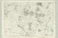
Buckinghamshire XIX - OS Six-Inch Map
1 : 10560 Topographic maps Ordnance Survey Ordnance Survey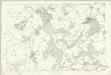
Buckinghamshire XXIII - OS Six-Inch Map
1 : 10560 Topographic maps Ordnance Survey Ordnance Survey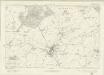
Buckinghamshire XIII - OS Six-Inch Map
1 : 10560 Topographic maps Ordnance Survey Ordnance Survey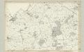
Buckinghamshire XIII - OS Six-Inch Map
1 : 10560 Topographic maps Ordnance Survey Ordnance Survey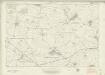
Buckinghamshire XVIII - OS Six-Inch Map
1 : 10560 Topographic maps Ordnance Survey Ordnance Survey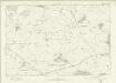
Buckinghamshire XVIII - OS Six-Inch Map
1 : 10560 Topographic maps Ordnance Survey Ordnance Survey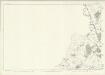
Oxfordshire XVIII - OS Six-Inch Map
1 : 10560 Topographic maps Ordnance Survey Ordnance Survey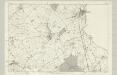
Buckinghamshire XXII - OS Six-Inch Map
1 : 10560 Topographic maps Ordnance Survey Ordnance Survey
Buckinghamshire XXVII - OS Six-Inch Map
1 : 10560 Topographic maps Ordnance Survey Ordnance Survey
Buckinghamshire XXVII - OS Six-Inch Map
1 : 10560 Topographic maps Ordnance Survey Ordnance Survey
SP83 - OS 1:25,000 Provisional Series Map
1 : 25000 Topographic maps Ordnance Survey Ordnance Survey
Buckinghamshire XXIX - OS Six-Inch Map
1 : 10560 Topographic maps Ordnance Survey Ordnance Survey
SP73 - OS 1:25,000 Provisional Series Map
1 : 25000 Topographic maps Ordnance Survey Ordnance Survey
SP63 - OS 1:25,000 Provisional Series Map
1 : 25000 Topographic maps Ordnance Survey Ordnance Survey
SP61 - OS 1:25,000 Provisional Series Map
1 : 25000 Topographic maps Ordnance Survey Ordnance Survey
SP71 - OS 1:25,000 Provisional Series Map
1 : 25000 Topographic maps Ordnance Survey Ordnance Survey
SP81 - OS 1:25,000 Provisional Series Map
1 : 25000 Topographic maps Ordnance Survey Ordnance Survey
Bedfordshire XXIV.NW - OS Six-Inch Map
1 : 10560 Topographic maps Ordnance Survey Ordnance Survey
Bedfordshire XXIV.NW - OS Six-Inch Map
1 : 10560 Topographic maps Ordnance Survey Ordnance Survey