Maps of Launceston
Launceston, Cornwall
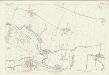
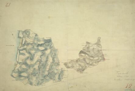
This drawing of the area around Launceston in Cornwall displays several of the,characteristic techniques,of draughtsman, Robert Dawson (1771-1860).,He used dense colour washes and short, hatched lines pointing in the direction of slopes ('hachures') to,represent relief,,combining them,with numerical estimates of relative altitude.,Magnetic north is decoratively indicated just off the coast at Tintagell Castle, the legendary birthplace of King Arthur, to the central left of the picture.,Launceston Castle is,shown at the most easterly point of the smaller inland landmass.,Slate quarries are marked at Delaboule, in the centre of the left landmass, and Tresmarrow, in the centre of the right.,Pencil lines are clearly visible, recording the,angles between fixed points used for triangulation.,The paper carries an Edmeads,,amp; Pine watermark. Dawson, Robert
Cornwall XVI.NE - OS Six-Inch Map
1 : 10560 Topographic maps Ordnance Survey Ordnance Survey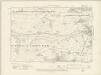
Cornwall XVI.NE - OS Six-Inch Map
1 : 10560 Topographic maps Ordnance Survey Ordnance Survey
Cornwall XVI.NE - OS Six-Inch Map
1 : 10560 Topographic maps Ordnance Survey Ordnance Survey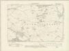
Cornwall XVI.SE - OS Six-Inch Map
1 : 10560 Topographic maps Ordnance Survey Ordnance Survey
Cornwall XVI.SE - OS Six-Inch Map
1 : 10560 Topographic maps Ordnance Survey Ordnance Survey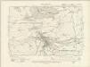
Devonshire LXXXVI.SW - OS Six-Inch Map
1 : 10560 Topographic maps Ordnance Survey Ordnance Survey
Devonshire LXXXVI.SW - OS Six-Inch Map
1 : 10560 Topographic maps Ordnance Survey Ordnance Survey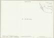
Devon LXXXVI.9 (includes: Launceston; St Stephens By Launceston Rural; Werrington) - 25 Inch Map
1 : 2500 Topographic maps Ordnance Survey Ordnance Survey
Devon LXXXVI.9 (includes: Launceston; St Stephens By Launceston Rural; Werrington) - 25 Inch Map
1 : 2500 Topographic maps Ordnance Survey Ordnance Survey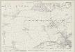
Cornwall XVI.4 (includes: Launceston; St Stephens By Launceston Rural; St Thomas The Apostle Rural) - 25 Inch Map
1 : 2500 Topographic maps Ordnance Survey Ordnance Survey
Cornwall XVI.4 (includes: Launceston; St Stephens By Launceston Rural; St Thomas The Apostle Rural) - 25 Inch Map
1 : 2500 Topographic maps Ordnance Survey Ordnance Survey
Cornwall XVI.8 (includes: Launceston; South Petherwin; St Stephens By Launceston Rural; St Thomas The Apostle Rural) - 25 Inch Map
1 : 2500 Topographic maps Ordnance Survey Ordnance Survey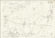
Cornwall XVI.8 (includes: Launceston; South Petherwin; St Stephens By Launceston Rural; St Thomas The Apostle Rural) - 25 Inch Map
1 : 2500 Topographic maps Ordnance Survey Ordnance Survey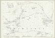
Cornwall XVI.12 (includes: Launceston; South Petherwin) - 25 Inch Map
1 : 2500 Topographic maps Ordnance Survey Ordnance Survey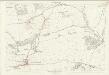
Cornwall XVI.12 (includes: Launceston; South Petherwin) - 25 Inch Map
1 : 2500 Topographic maps Ordnance Survey Ordnance Survey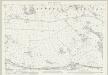
Cornwall XVI.3 (includes: Egloskerry; St Stephens By Launceston Rural; St Thomas The Apostle Rural) - 25 Inch Map
1 : 2500 Topographic maps Ordnance Survey Ordnance Survey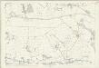
Cornwall XVI.3 (includes: Egloskerry; St Stephens By Launceston Rural; St Thomas The Apostle Rural) - 25 Inch Map
1 : 2500 Topographic maps Ordnance Survey Ordnance Survey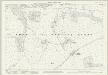
Cornwall XVI.7 (includes: South Petherwin; St Stephens By Launceston Rural; St Thomas The Apostle Rural) - 25 Inch Map
1 : 2500 Topographic maps Ordnance Survey Ordnance Survey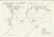
Cornwall XVI.7 (includes: South Petherwin; St Stephens By Launceston Rural; St Thomas The Apostle Rural) - 25 Inch Map
1 : 2500 Topographic maps Ordnance Survey Ordnance Survey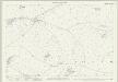
Cornwall XVI.11 (includes: South Petherwin; St Thomas The Apostle Rural) - 25 Inch Map
1 : 2500 Topographic maps Ordnance Survey Ordnance Survey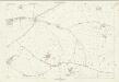
Cornwall XVI.11 (includes: South Petherwin; St Thomas The Apostle Rural) - 25 Inch Map
1 : 2500 Topographic maps Ordnance Survey Ordnance Survey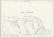
Cornwall XII.16 (includes: St Stephens By Launceston Rural; Werrington) - 25 Inch Map
1 : 2500 Topographic maps Ordnance Survey Ordnance Survey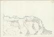
Cornwall XII.16 (includes: St Stephens By Launceston Rural; Werrington) - 25 Inch Map
1 : 2500 Topographic maps Ordnance Survey Ordnance Survey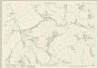
Cornwall XII.15 (includes: Egloskerry; North Petherwin; St Stephens By Launceston Rural; Werrington) - 25 Inch Map
1 : 2500 Topographic maps Ordnance Survey Ordnance Survey
Cornwall XII.15 (includes: Egloskerry; North Petherwin; St Stephens By Launceston Rural; Werrington) - 25 Inch Map
1 : 2500 Topographic maps Ordnance Survey Ordnance Survey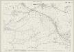
Cornwall XVI.2 (includes: Egloskerry; St Stephens By Launceston Rural; St Thomas The Apostle Rural) - 25 Inch Map
1 : 2500 Topographic maps Ordnance Survey Ordnance Survey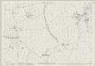
Cornwall XVI.6 (includes: Egloskerry; St Thomas The Apostle Rural; Trewen) - 25 Inch Map
1 : 2500 Topographic maps Ordnance Survey Ordnance Survey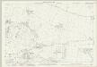
Cornwall XVI.10 (includes: Lewannick; South Petherwin; St Thomas The Apostle Rural; Trewen) - 25 Inch Map
1 : 2500 Topographic maps Ordnance Survey Ordnance Survey