Maps of Kingston upon Hull

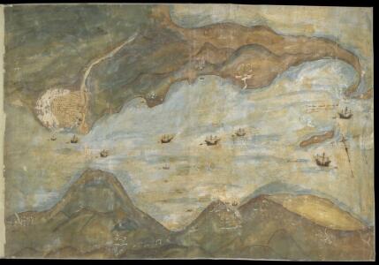
Humber from Hull and Barton to Sea
This is a map showing the River Humber, River Hull and the town of hull. It dates from between 1541-1547. The map is drawn in a loose pictorial style but despite this the defences of Hull are shown in accurate detail. These fortifications were built under the instruction of Henry VIII to protect the eastern side of the town. Plans for the building work were made in 1541 after the king visited in October of that year and dictated that the eastern side of the town, defended only by the River Hull, must be strengthened. At this time Henry VIII feared an invasion from the combined forces of France and Spain. In 1538 Francis I of France, and Charles V Holy Roman Emperor and King of Spain signed a peace treaty. This union gave rise to the possibility that France and Spain may combine forces to invade England. France was England’s historical enemy and Henry VIII’s divorce of Catherine of Aragon, Charles V’s aunt, had offended the militantly catholic King of Spain. The town of Hull, located on the east coast of the country, near the Anglo-Scottish border occupies a position of strategic importance as it provided a base for war against Scotland or Catholic Europe As can be seen here the fortifications at Hull consisted of two large trefoil headed blockhouses’ or bulwarks’ at opposite ends of the harbour, with a castle’ between them. Connecting these fortresses was a crenellated wall almost half a mile long running parallel to the river. This would provide defences which could protect against overland attack from the east, or naval invasion from the Humber. The draughtsman has accurately recorded the unusual trefoil shapes of the bulwarks, the segmental forms of the castle and the angled bend and crenellations of the connecting wall. In December 1543 costs were given as 21,056 5s. 6d in total. This chart could date from as early as October 1541, when the King visited Hull in October 1541 and expressed concern that the east side of the town was vulnerable to an attack.
Nordsee
1 : 150000 Grimsby (Anglie) Reichs-Marine-Amt
Patrington (Hills) - OS One-Inch Revised New Series
1 : 63360 Topographic maps Ordnance Survey Ordnance Survey
Patrington (Outline) - OS One-Inch Revised New Series
1 : 63360 Topographic maps Ordnance Survey Ordnance Survey
Great Grimsby (Outline) - OS One-Inch Revised New Series
1 : 63360 Topographic maps Ordnance Survey Ordnance Survey
Great Grimsby (Hills) - OS One-Inch Revised New Series
1 : 63360 Topographic maps Ordnance Survey Ordnance Survey
Grimsby
1 : 31680 This drawing covers part of north-east Lincolnshire, showing Grimsby and its harbour on the Humber estuary at top right. An important seaport since the Middle Ages, Grimsby declined in importance as its harbour became blocked by silt from the Humber. The harbour was improved and expanded in the 18th and 19th centuries. Grimsby is now the main fishing port of Great Britain. Metcalf, Edward B.
Hornsea (Hills) - OS One-Inch Revised New Series
1 : 63360 Topographic maps Ordnance Survey Ordnance Survey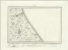
Hornsea (Outline) - OS One-Inch Revised New Series
1 : 63360 Topographic maps Ordnance Survey Ordnance Survey
Brigg
1 : 31680 The minimal shading and interlining on this plan conveys the flatness of the land around Brigg. Its complex drainage system is highlighted in blue. Near Market Rasen, "TG" indicates a tollgate. Budgen, Charles
TA32 & Parts of TA33 & TA42 - OS 1:25,000 Provisional Series Map
1 : 25000 Topographic maps Ordnance Survey Ordnance Survey
TA31 & Parts of TA41 - OS 1:25,000 Provisional Series Map
1 : 25000 Topographic maps Ordnance Survey Ordnance Survey
TA23 & Parts of TA33 - OS 1:25,000 Provisional Series Map
1 : 25000 Topographic maps Ordnance Survey Ordnance Survey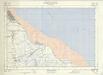
TA30 & Parts of TA40 - OS 1:25,000 Provisional Series Map
1 : 25000 Topographic maps Ordnance Survey Ordnance Survey
TA22 - OS 1:25,000 Provisional Series Map
1 : 25000 Topographic maps Ordnance Survey Ordnance Survey
TA21 - OS 1:25,000 Provisional Series Map
1 : 25000 Topographic maps Ordnance Survey Ordnance Survey
TA13 - OS 1:25,000 Provisional Series Map
1 : 25000 Topographic maps Ordnance Survey Ordnance Survey
TA20 - OS 1:25,000 Provisional Series Map
1 : 25000 Topographic maps Ordnance Survey Ordnance Survey
TA12 - OS 1:25,000 Provisional Series Map
1 : 25000 Topographic maps Ordnance Survey Ordnance Survey
TA11 - OS 1:25,000 Provisional Series Map
1 : 25000 Topographic maps Ordnance Survey Ordnance Survey
TA10 - OS 1:25,000 Provisional Series Map
1 : 25000 Topographic maps Ordnance Survey Ordnance Survey
TF19 - OS 1:25,000 Provisional Series Map
1 : 25000 Topographic maps Ordnance Survey Ordnance Survey
Yorkshire 213 - OS Six-Inch Map
1 : 10560 Topographic maps Ordnance Survey Ordnance Survey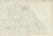
Yorkshire 228 - OS Six-Inch Map
1 : 10560 Topographic maps Ordnance Survey Ordnance Survey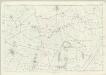
Yorkshire 242 - OS Six-Inch Map
1 : 10560 Topographic maps Ordnance Survey Ordnance Survey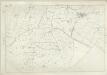
Yorkshire 256 - OS Six-Inch Map
1 : 10560 Topographic maps Ordnance Survey Ordnance Survey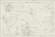
Yorkshire 212 - OS Six-Inch Map
1 : 10560 Topographic maps Ordnance Survey Ordnance Survey
Yorkshire 268 - OS Six-Inch Map
1 : 10560 Topographic maps Ordnance Survey Ordnance Survey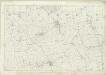
Yorkshire 227 - OS Six-Inch Map
1 : 10560 Topographic maps Ordnance Survey Ordnance Survey