Maps of Stratton Hall

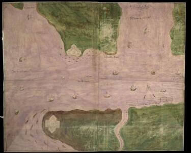
Orwell Haven
This is a map of Orwell Haven, Essex. It is thought to date from1543. It shows proposed fortifications at the mouth of Harwich harbour which were not built. The forts are shown in plan form and have seem to be measured plans, recording details such as the splayed external opening of embrasures and the curved internal space for a man to stand. In this they contrast with the loose pictorial style of the rest of the map. The forts comprise a central fort with a curtain wall with bastions at each corner. The fort at Lagner Point has angular bastions in the Italian style perhaps revealing the influence of the Italian military engineers employed by Henry VIII in the 1540’s. The advantage of angle bastions is that they provide fire power outwards and flanking power along the walls so that no blind spots exist, enabling defenders to cover all the surrounding ground. The concern with the defensive capabilities of Orwell Haven and other coastal area at this date was due to the resumption of hostilities between England and France 1542. The map is the work of Richard Lee, a mason by trade was worked as a surveyor on fortification schemes in England and English territory in France. It is probable that this map was intended for personal explanation by Lee to Henry VIII. Lee, Richard
Essex XXI - OS Six-Inch Map
1 : 10560 Topographic maps Ordnance Survey Ordnance Survey
Suffolk LXXXIX.NE - OS Six-Inch Map
1 : 10560 Topographic maps Ordnance Survey Ordnance Survey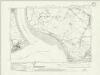
Suffolk LXXXIX.NE - OS Six-Inch Map
1 : 10560 Topographic maps Ordnance Survey Ordnance Survey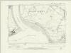
Suffolk LXXXIX.NE - OS Six-Inch Map
1 : 10560 Topographic maps Ordnance Survey Ordnance Survey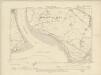
Essex XXI.NE - OS Six-Inch Map
1 : 10560 Topographic maps Ordnance Survey Ordnance Survey
Suffolk LXXXIX.NE - OS Six-Inch Map
1 : 10560 Topographic maps Ordnance Survey Ordnance Survey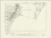
Suffolk LXXXIX.SE - OS Six-Inch Map
1 : 10560 Topographic maps Ordnance Survey Ordnance Survey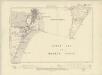
Essex XXI.SE - OS Six-Inch Map
1 : 10560 Topographic maps Ordnance Survey Ordnance Survey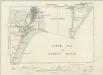
Suffolk LXXXIX.SE - OS Six-Inch Map
1 : 10560 Topographic maps Ordnance Survey Ordnance Survey
Suffolk LXXXIX.SE - OS Six-Inch Map
1 : 10560 Topographic maps Ordnance Survey Ordnance Survey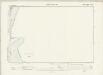
Essex XXX.NE - OS Six-Inch Map
1 : 10560 Topographic maps Ordnance Survey Ordnance Survey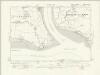
Essex nXXI.SW - OS Six-Inch Map
1 : 10560 Topographic maps Ordnance Survey Ordnance Survey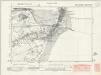
Essex nXXXI.NW - OS Six-Inch Map
1 : 10560 Topographic maps Ordnance Survey Ordnance Survey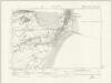
Essex nXXXI.NW - OS Six-Inch Map
1 : 10560 Topographic maps Ordnance Survey Ordnance Survey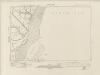
Essex nXXXI.SW - OS Six-Inch Map
1 : 10560 Topographic maps Ordnance Survey Ordnance Survey
Essex (New Series 1913-) n XXI.14 (includes: Felixstowe; Shotley; Trimley St Mary) - 25 Inch Map
1 : 2500 Topographic maps Ordnance Survey Ordnance Survey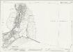
Essex (New Series 1913-) n XXXI.2 (includes: Harwich) - 25 Inch Map
1 : 2500 Topographic maps Ordnance Survey Ordnance Survey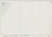
Essex (New Series 1913-) n XXXI.6 - 25 Inch Map
1 : 2500 Topographic maps Ordnance Survey Ordnance Survey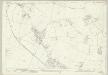
Suffolk LXXXIII.16 (includes: Felixstowe; Trimley St Martin; Trimley St Mary) - 25 Inch Map
1 : 2500 Topographic maps Ordnance Survey Ordnance Survey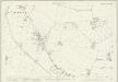
Suffolk LXXXIII.16 (includes: Felixstowe; Trimley St Martin; Trimley St Mary) - 25 Inch Map
1 : 2500 Topographic maps Ordnance Survey Ordnance Survey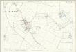
Suffolk LXXXIII.16 (includes: Felixstowe; Trimley St Martin; Trimley St Mary) - 25 Inch Map
1 : 2500 Topographic maps Ordnance Survey Ordnance Survey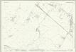
Suffolk LXXXIX.4 (includes: Felixstowe; Trimley St Mary) - 25 Inch Map
1 : 2500 Topographic maps Ordnance Survey Ordnance Survey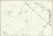
Suffolk LXXXIX.4 (includes: Felixstowe; Trimley St Mary) - 25 Inch Map
1 : 2500 Topographic maps Ordnance Survey Ordnance Survey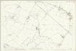
Suffolk LXXXIX.4 (includes: Felixstowe; Trimley St Mary) - 25 Inch Map
1 : 2500 Topographic maps Ordnance Survey Ordnance Survey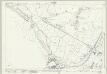
Suffolk LXXXIX.8 (includes: Felixstowe; Trimley St Mary) - 25 Inch Map
1 : 2500 Topographic maps Ordnance Survey Ordnance Survey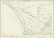
Suffolk LXXXIX.8 (includes: Felixstowe; Trimley St Mary) - 25 Inch Map
1 : 2500 Topographic maps Ordnance Survey Ordnance Survey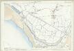
Suffolk LXXXIX.8 (includes: Felixstowe; Trimley St Mary) - 25 Inch Map
1 : 2500 Topographic maps Ordnance Survey Ordnance Survey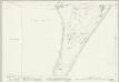
Suffolk LXXXIX.12 (includes: Felixstowe) - 25 Inch Map
1 : 2500 Topographic maps Ordnance Survey Ordnance Survey
Suffolk LXXXIX.12 (includes: Felixstowe) - 25 Inch Map
1 : 2500 Topographic maps Ordnance Survey Ordnance Survey