Maps of Coastal Plain

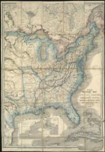
Wyld's military map of the United States, the northern states, and the southern Confederate states, with the forts, harbours, arsenals, and military positions

Vereinigten Staaten v. N. America.
1 : 5140000 Weiland, C. F. (Carl Ferdinand), d. 1847
Vereinigten Staaten von Nord America
Neuester Schul-Atlas Walch, Johann im Verlag bei Joh. Walch
Amplissimae regionis Mississipi seu Provinciae Ludovicianae â R. P. Ludovico Hennepin francisc miss. in America septentrionali anno 1687 detectae, nunc Gallorum coloniis et actionum negotiis toto orbe celeberrimae, nova tabula
1 : 6350000 Mississippi, řeka-oblast Homann, Johann Baptist a Io. Bapt. Homanno
4. Population 1830-1860.
1 : 8450000 Gannett, Henry, 1846-1914; United States. Census Office
3. Population 1790-1820.
1 : 8450000 Gannett, Henry, 1846-1914; United States. Census Office
Foreign population 1870.
1 : 7200000 Walker, Francis Amasa, 1840-1897
US Population 1850.
1 : 7100000 Walker, Francis Amasa, 1840-1897
Illiteracy 1870.
1 : 7100000 Walker, Francis Amasa, 1840-1897
Enteric, cerebro-spinal, typhus deaths.
1 : 7200000 Walker, Francis Amasa, 1840-1897
Foreign parentage 1870.
1 : 7100000 Walker, Francis Amasa, 1840-1897
Colored population proportion 1870.
1 : 7100000 Walker, Francis Amasa, 1840-1897
White male illiteracy.
1 : 7100000 Walker, Francis Amasa, 1840-1897
Predominating sex US.
1 : 7200000 Walker, Francis Amasa, 1840-1897
US Population 1860.
1 : 7100000 Walker, Francis Amasa, 1840-1897
US Population 1790-1820.
1 : 14300000 Walker, Francis Amasa, 1840-1897
Public indebtedness US.
1 : 7200000 Walker, Francis Amasa, 1840-1897
Consumption deaths US.
1 : 7200000 Walker, Francis Amasa, 1840-1897
Intestinal diseases deaths US.
1 : 7200000 Walker, Francis Amasa, 1840-1897
Malarial deaths US.
1 : 7200000 Walker, Francis Amasa, 1840-1897
Taxation per capita US.
1 : 7200000 Walker, Francis Amasa, 1840-1897
Wealth distribution US.
1 : 7200000 Walker, Francis Amasa, 1840-1897
Foreign population proportion 1870.
1 : 7200000 Walker, Francis Amasa, 1840-1897
Irish, German population 1870.
1 : 14300000 Walker, Francis Amasa, 1840-1897
Foreign parentage proportion 1870.
1 : 7100000 Walker, Francis Amasa, 1840-1897
Farms, production, corn, dairy.
1 : 14300000 Walker, Francis Amasa, 1840-1897
Crops US.
1 : 14300000 Walker, Francis Amasa, 1840-1897
Birth rate US.
1 : 7200000 Walker, Francis Amasa, 1840-1897
Colored population density 1870.
1 : 7100000 Walker, Francis Amasa, 1840-1897