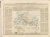
Maps of Mediterranean Sea

Europa Prima Nova Tabula [Karte], in: Geographia universalis vetus et nova complectens Claudii Ptolemaei Alexandrini enarrationis libros VIII, S. 302.
1 Karte aus Atlas Münster, Sebastian [und Ptolemaeus, Claudius]
Europa Prima Nova Tabula [Karte], in: Claud. Ptolemaeus. Geographia lat. cum mappis [...], S. 332.
1 Karte aus Atlas Münster, Sebastian [und Ptolemaeus, Claudius]
Europa im 16. Jahrhundert (1559)
1 : 15000000 Europa
Západní a střední Evropa v době absolutismu až do konce francouzské revoluce

20. Europa im 16. Jahrhundert (1559)
1 : 15000000 Europa
Europe Centrale en 1920
1 : 4200000 titelvariant: Nouvelle carte de l'Europe Centrale; Annotatie: Titel linksboven: Nouvelle carte de l'Europe Centrale Paris : Taride
Incursions of barbarians.
1 : 23500000 Mitchell, Samuel Augustus
A map of the western part of the Roman empire
1 Karte : Kupferdruck ; 39 x 46 cm s.n.
Roman Empire, Palestine.
1 : 15200000 Worcester, Joseph E.
23. Europa im 17. und 18. Jahrhundert (1740)
1 : 15000000 Europa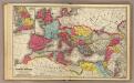
Roman Empire.
1 : 13600000 Mitchell, Samuel Augustus
Landtaflen
1 Atlas [von Johannes Stumpf] Christoffel Froschower, Zürych
Roman Empire, Greece.
1 : 17000000 Mitchell, Samuel Augustus
Europa im 17. und 18. Jahrhundert (1740)
1 : 15000000 Europa
Kriegszusammenhänge II (1672-1699)
1 : 25000000 Europa Englisch-Niederländischer Seekrieg <1672-1674>, Türkenkriege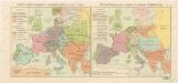
Rozsah panství Habsburků ... za Karla V. (1555) Říše Napoleonova (1810) a Evropa po kongresu Vídeňském (1815)

Eisenbahn- Post- und Dampfschiffahrts-Karte von Europa
1 : 8000000 Evropa Denk, L. Lith. Anst. v. L. Mohn's Witwe
L'Europe au Temps des Croisades.
Andriveau-Goujon, J.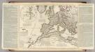
Theatrum historicum ad annum Christi quadringentesimu. Pars occidentalis.
1 : 8500000 L'Isle, Guillaume de, 1675-1726

Europa 1668
Europa Kunz, Andreas ; Moeschl, Joachim Robert
Composite: Imperii Romani.
1 : 9850000 Vivien de St Martin, L.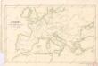
Evropa v době humdsko - germánské od 4. do 6. stol.

Carte approximative de la marche simultanée des Alains, des Suèves et des Vandales, en l’an 406 et suivants
Europa Alanen Vandalen Sweben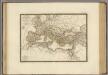
Empire Romain sous Constantin.
1 : 11300000 Brue, Adrien Hubert, 1786-1832
Europa 1699
Europa Kunz, Andreas ; Moeschl, Joachim Robert
Europa 31.12.1806
Europa Kunz, Andreas ; Moeschl, Joachim Robert
![Europa Prima Nova Tabula [Karte], in: Geographia universalis vetus et nova complectens Claudii Ptolemaei Alexandrini enarrationis libros VIII, S. 302.](https://images-2.georeferencer.com/images/iiif/139751438605/full/,300/0/native.jpg)

