Maps of Zurich

Atlas novus Reipublicae Helveticae
1 Atlas ([40] Bl., 97 S.) bey Orell, Gessner und Compagnie, Zürich
[Geologische Karte des Kantons Zürich]
1 : 250000 1 Karte
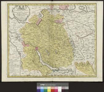
Canton Zürich sive illustris Helvetiorum respublica Tigurina cum subditis suis et confinibus
1 : 275000 1 Karte [Gabriel Walser?]
[Karte des Kantons Zürich]
1 : 250000 1 Karte
[Karte des Kantons Zürich]
1 : 250000 1 Karte
<<Der>> Canton Zürich
1 : 230000 1 Karte H. Keller del. ; J.J. Scheurmann sc.
Bodenverbesserungen im Kanton Zürich
1 : 280000 1 Karte zusammengestellt von J. Girsberger
Canton Zürich sive illustris Helvetiorum respublica Tigurina cum subditis suis et confinibus
1 : 275000 1 Karte [Gabriel Walser?]
Karte des Zürichgebiets nach Murdochs Entwerfungsart
Aktualisierte Ausgabe der ersten Auflage von 1803. Mit Distriktseinteilung (5 Distrikte) und Erklärung der Zeichen. Orell Füssli und Cie., in Zürich
Canton Zürich sive illustris Helvetiorum respublica Tigurina cum subditis suis et confinibus
1 : 135000 1 Karte recenter delineata à Gabriele Walsero
Canton Zürich
1 : 240000 1 Karte gezeichnet und herausgegeben von Hch. Keller
Zürich Gebiet
1 : 250000 1 Karte J.H. Streulinus inv. ; J.G. Seiller sculpsit
Karte des Kantons Zürich
1 : 250000 1 Karte
<<Das>> Zürichgebiet nach Murdochs Entwerfungsart
1 : 300000 1 Karte
<<Das>> Zürichgebiet nach Murdochs Entwerfungsart
1 : 300000 1 Karte
Carte des Cantons Zürich
1 : 275000 1 Karte gezeichnet und gestochen von J.H. Bachofen ; hrsg. und im Verlag von J.H. Locher
<<Der>> Canton Zürich
1 : 230000 1 Karte H. Keller del. ; J. J. Scheurmann sc.
<<Der>> Kanton Zürich
1 : 200000 1 Karte [gez. v. Beust]
<<Der>> Canton Zürich
1 : 230000 1 Karte
Karte des Zürichgebiets nach Murdochs Entwerfungsart
Mit Distriktseinteilung (15 Distrikte) und Erklärung der Zeichen. Orell Füssli und Cie., in Zürich Stich: Senn
Canton Zürich
1 : 230000 1 Karte gezeichnet und herausgegeben von Hch. Keller ; gest. v. J. Scheurmann
Tabula topographica parochiarum synodo Tigurinae obstrictarum opera
1 : 190000 1 Karte Joh. Heinr. Freytag
<<Der>> Kanton Zürich
1 : 200000 1 Karte [gez. v. Beust]
<<Der>> Canton Zürich
1 : 230000 1 Karte H. Keller del. ; J.J. Scheurmann sc.
Atlas der alten Eidgenossenschaft in 20 Karten: Kanton Zürich
Originaltitel: Canton Zürich sive Illustris Helvetiorum Respublica Tigurina cum Subditis suis et Confinibus. Mit Erklärung der Zeichen sowie Nebenkarte der Landvogtei Sax. Zeichnung: Walser, Gabriel (1695-1776), reformierter Pfarrer, von Teufen AR Herausgeber: Homännische Erben
Karte des Kantons Zürich
1 : 250000 1 Karte
Karte des Kantons Zürich
1 : 250000 1 Karte
Karte des Kantons Zürich
1 : 200000 1 Karte gez. v. Beust
Canton de Zurich
1 : 291000 1 Karte dressé par Th. Duvotenay ; gravé par C. Dyonnet ; Bénard sc.