Maps of Europe

Septima Asie Tabula [Karte], in: Claudii Ptolemei viri Alexandrini mathematice discipline philosophi doctissimi geographie opus [...], S. 211.
1 Karte aus Atlas Waldseemüller, Martin [und Ptolemaeus, Claudius] Übelin, Georg
Die Kaspi-Volga-Weißmeer/Ostseeroute im 17. Jahrhundert
Russland Handelsstraße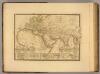
Monde connu des anciens.
1 : 25000000 Picquet, C.
Terra Veteribus Nota.
1 : 47000000 Finley, Anthony
Monde Connu des Anciens.
Levasseur, E.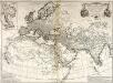
Orbis veteribus notus
1 Karte : Kupferdruck ; 49 x 66 cm Anville; Santini apud Franciscum Santini
Tabula Asiae VII. [Karte], in: Geographia universalis vetus et nova complectens Claudii Ptolemaei Alexandrini enarrationis libros VIII, S. 284.
1 Karte aus Atlas Münster, Sebastian [und Ptolemaeus, Claudius]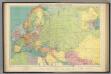
Europe's overland, sea communications.
1 : 20000000 Philip, George
Europae / [Arnoldo di Arnoldi]
1 : 15000000 Annotatie: De linkerhelft van de kaart ontbreekt; Lit.: Florilegium cartographicum ... - Leipzig : Pfaeler, 1990, p. 117-130 Arnoldi, Arnoldo di [Siena : Matteo Florimi]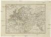
Geographie des Mittel Alters
1 : 36360000 Afrika severní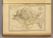
Geographie du Moyen Age.
1 : 35000000 Malte-Brun, Conrad, 1775-1826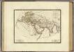
Monde connu des anciens.
1 : 25000000 Brue, Adrien Hubert, 1786-1832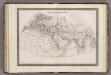
Monde Connu des Anciens.
1 : 34000000 Monin, C.V.
Museumskart 33: Atlasillustrasjon
Frederick De Wit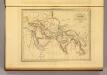
Asie Ancienne.
1 : 34000000 Malte-Brun, Conrad, 1775-1826
Ptolemeisch general Tafel
1 : 65000000 1 Karte : Holzschnitt ; 31 x 36 cm Ptolemaeus, Claudius [Sebastian Münster]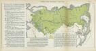
Nr. 13. Russlands neueste Entwicklung. - Japan 1895
Russland Expansion, Zentralasien
[Verbreitung und Vertheilung der Europäischen Vögel]
Zweiter Band, enthaltend in vier Abtheilungen die Vertheilung der Organismen: 5. Pflanzen-Geographie, 6. Thier-Geographie, 7. Anthropographie, 8. Ethnographie Humboldt, Alexander von Verlag von Justus Perthes
Europa zur Uebersicht der Flussgebiete und Höhenzüge
Hand-Atlas über alle Theile der Erde nach dem neuesten Zustande und über das Weltgebäude Stieler, Adolf bei Justus Perthes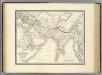
l'Asie ancienne.
1 : 16000000 Labat, L.
Museumskart 158: Atlasillustrasjon

Mongolenreiche
1 : 48000000 Asien, Europa, Mongolen
Karte über die geographische Verbreitung des Kameels
Evropa Ziegler, Jakob Melchior Ritter, Carl Top. Anstalt v. J. Wurster u. Comp.
Starý svět až po časy Daria
Asie západní kamenopisní [sic] ústav Jos. Jelínka

Homannův atlas světa
1 : 1100000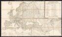
Karte von Europa in IV Blättern
1 : 6000000 Bär, J.C. ; Stülpnagel, Friedrich von Justus Perthes
Russland, Italien, Balkan u. Orient, uit: Zu den grossen Offensive im Westen ; Russland, Italien, Balkan und Orient / bearb. und hrsg. von Walter Paasche
titelvariant: Russland, Italien, Balkan und Orient Walter Paasche Stuttgart : Paasche & Luz
Orbis terrarum verteribus notus usque ad annum 500 a. Chr.
Alte Welt
![Septima Asie Tabula [Karte], in: Claudii Ptolemei viri Alexandrini mathematice discipline philosophi doctissimi geographie opus [...], S. 211.](https://images-2.georeferencer.com/images/iiif/090105372686/full/,300/0/native.jpg)

