Maps of Dinaric Alps

Pannoniae, Et Illyrici Veteris Tabula. [Karte], in: Theatrum orbis terrarum, S. 484.
1 Karte aus Atlas Ortelius, Abraham Vrients, Jan Baptista
Pannoniae, Et Illyrici Veteris Tabula. [Karte], in: Theatrum orbis terrarum, S. 383.
1 Karte aus Atlas Ortelius, Abraham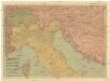
Pohraničí rakousko-uhersko-italské
1 : 1250000 Itálie Machát, František V. Neubert
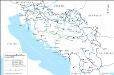
Jugoslávie
Das jugoslawische Eisenbahnnetz im Jahre 1918
1 : 2500000 Jugoslawien Eisenbahnnetz Kežić, Danijel ; John, Holger W.
Politische Aufteilung des Königreichs Jugoslawien auf Banschaften 1929
Jugoslawien Verwaltungsgliederung Džambo, Jozo
Eisenbahnnetz und Aufteilung der Adriaküste in Zonen (nach Vasković)
1 : 2500000 Jugoslawien Eisenbahnnetz Kežić, Danijel ; John, Holger W.
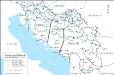
Jugoslavia
1 : 2000000 Bartholomew. Firme [Edinburgh] : Edinburgh Geographical Institute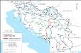
Eisenbahnnetz und Adria-Bahn-Projekte 1922
1 : 2500000 Jugoslawien Eisenbahnnetz Kežić, Danijel ; John, Holger W.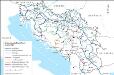
Das jugoslawische Eisenbahnnetz im Jahre 1969
1 : 2500000 Jugoslawien Eisenbahnnetz Kežić, Danijel ; John, Holger W.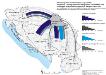
Vojvodina - Immigration und Emigration von Serben und sonstigen ethnischen Gruppen im Vergleich bis 1981
Wojwodina Migration, ethnische Gruppe Hofinger, Veronika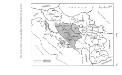
Politische Aufteilung des Königreichs SHS auf Gebiete (oblasti) 1922
Kraljevina Srba, Hrvata i Slovenaca Verwaltungsgliederung Džambo, Jozo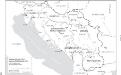
Jugoslawien nach dem Zweiten Weltkrieg (bis 1991) mit Republiken und Autonomen Provinzen
1 : 2500000 Jugoslawien Clewing, Konrad ; John, Holger W.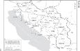
Die administrative Einteilung des Königreiches Jugoslawien nach Banschaften/banovine (ab 1929)
1 : 2500000 Jugoslawien Verwaltungsgliederung Clewing, Konrad ; John, Holger W.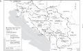
Staatenbildung im ehemaligen Jugoslawien, 1991 - 2008
1 : 2500000 Jugoslawien Auflösung, Staatenbildung Clewing, Konrad ; John, Holger W.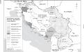
Besetzung und territoriale Aufteilung Jugoslawiens im Zweiten Weltkrieg
1 : 2500000 Jugoslawien Besetzung, Weltkrieg <1939-1945> Clewing, Konrad ; John, Holger W.
[XVIII], uit: Geognostische Karte des Oesterreichischen Kaiserstaates mit einem grossen Theile Deutschland's u. Italien / hauptsachlich nach ... Haidinger's geognostischer Karte dieses Staates bearb. von Josef Scheda
1 : 3000000 titelvariant: General-Karte von Europa in 25 Blättern; Annotatie: Bijlage bij: General-Karte von Europa in 25 Blättern. - 1:2.592.000. - 1845-1847 Scheda, Joseph Wien : K.K. Militär. Geografisch. Institut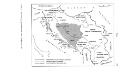
Zerstückelung Jugoslawiens nach der Okkupation 1941
Jugoslawien Balkanfeldzug <1941>, Besetzung Džambo, Jozo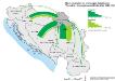
Binnenmigration im ehemaligen Jugoslawien: Vojvodina - Immigration und Emigration 1953-1961
Wojwodina Binnenwanderung Hofinger, Veronika
Handkarte des Jugoslawischen Reiches
1 : 1500000 Evropa jihovýchodní Ed. Hölzel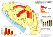
Vojvodina: Immigration und Emigration 31.03.1953 - 31.03.1981
Wojwodina Migration Hofinger, Veronika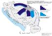
Vojvodina: Immigration und Emigration von Serben bis 1961
Wojwodina Migration, Serben Hofinger, Veronika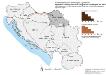
Vojvodina: Immigration und Emigration von Ungarn bis 1971
Wojwodina Migration, Magyaren Hofinger, Veronika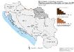
Vojvodina: Immigration und Emigration von Ungarn bis 1981
Wojwodina Migration, Magyaren Hofinger, Veronika
Vojvodina: Immigration und Emigration von Montenegrinern bis 1971
Wojwodina Migration, Montenegriner Hofinger, Veronika
Vojvodina: Immigration und Emigration von Ungarn bis 1961
Wojwodina Migration, Magyaren Hofinger, Veronika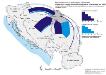
Vojvodina: Immigration und Emigration von Serben bis 1981
Wojwodina Migration, Serben Hofinger, Veronika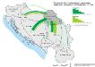
Binnenmigration im ehemaligen Jugoslawien: Vojvodina - Immigration und Emigration 1971-1981
Wojwodina Binnenwanderung Hofinger, Veronika
![Pannoniae, Et Illyrici Veteris Tabula. [Karte], in: Theatrum orbis terrarum, S. 484.](https://images-2.georeferencer.com/images/iiif/823444180540/full/,300/0/native.jpg)

