Maps of Gipuzkoa
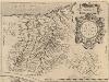
Guipus Coae Regionis Typus. [Karte], in: Theatrum orbis terrarum, S. 107.
1 Karte aus Atlas Ortelius, Abraham Vrients, Jan Baptista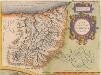
Guipus Coae Regionis Typus. [Karte], in: Theatrum orbis terrarum, S. 60.
1 Karte aus Atlas Ortelius, Abraham
Guipuzcoa
1 : 200000 Coello, Francisco [Verlag nicht ermittelbar]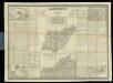
Guipúzcoa
1 : 200000 1 Mapa, b/n. Dins: Atlas de España y sus posesiones de ultramar Coello, Francisco ; Madoz, Pascual [Imprenta del Atlas de España]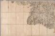
No. 140 [ St. Jean Pied de Port], uit: Carte géométrique de la France dite "Carte de Cassini" ou "de l'Académie"
1 : 86400 titelvariant: Carte de Cassini; Annotatie: Incompleet; Voor aanwezige bladen zie overzichtsblad Cassini de Thury, C.-F. Paris : [s.n.]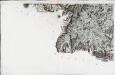
[Saint-Jean-Pied-de-Port]
1 Blatt : 57 x 90 cm Aldring s.n.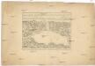
Plan du port du passage en Espagne
1 : 16000 Biskajský záliv (Francie a Španělsko) Fer, Nicolas de de Fer
Plan de lisle de la Conference
1 Vogelschauplan : Kupferdruck ; 41 x 51 cm Beaulieu S. de Pontault de Beaulieu
Plan of the town and port of San Sebastian in the bay of Biscay and province of Guipuscoa.- Plan of the port of passages in the bay ofbiscay and province of Guipuscoa
Tofiño de San Miguel, Vicente
Plano del Puerto de Lequeitio
Palmerola, J. ; Pérez y Pérez, E. ; Becerril, J.
Plan de St. Jean de Luz avec les différents projets d'agrandissem.t du port

Plan de l'isle des Faisans, a present dite de la Conference
1 Plan : Kupferdruck ; 42 x 51 cm Beaulieu S. de Pontault de Beaulieu
Mapa de la provincia de Guipuzcoa / construido segun las noticias de sus naturales por Dn. Tomás Lopez
1 Mapa, b/n. Full 89 de: Atlas geográfico de España. Madrid, 1830 (1a ed. 1804). Editat pels fills de T. López Datació aproximada. López, Tomás en la calle de Atocha
Mapa del m. n. y m. l. provincia de Guipuzcoa
1 Karte : Kupferdruck ; 36 x 36 cm López s.n.
Provinciarum Guipuscoæ, Alavæ et Biscayæ tabula geographica
1 Karte : Kupferdruck ; 41 x 55 cm Güssefeld; López excuderunt Hom. Heredes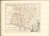

Gvipvscoa
1 Karte : Kupferdruck ; 15 x 22 cm Lambert Andreae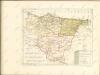

Mapa del m. n. y m. l. señorio de Vizcaya
1 Karte : Kupferdruck ; 36 x 36 cm López; Bowles s.n.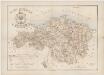
Plano itinerario de la M.N. y M.L. provincia de Vizcaya / formado por Juan Luis de Luzárraga
1 : 100000 Annotatie: Met informatie over vuurtorenlichten Juan Luis de Luzárraga Paris : Maison Andriveau-Goujon, H.Barrère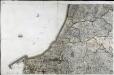
[Bayonne]
1 Blatt : 56 x 90 cm s.n.
Govvernement de Bayonne
1 Karte : Kupferdruck ; 11 x 15 cm Sebastian Cramoisy
Mapa de Navarra
1 : 200000 1 mapa entelat. 0 0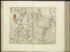
[10][10] Regni Navarrae accurata tabula, uit: Atlas sive Descriptio terrarum orbis
Annotatie: Gedigitaliseerde versie. Amsterdam. Heiloo : Picturae (vervaardiger), 2015. tiff-bestand. Gedigitaliseerd: 07-01-2015; Origineel: Universiteitsbibliotheek Vrije Universiteit (XL.05127.-) ; Netherlands; Titelpagina ontbreekt Wit, Frederik de Amsterdam : Frederick de Wit
Carte des provinces basques et de la Navarre espagnoles, pour suivre les opérations carlistes
1 : 500000 Paris : Auguste Ghio
Navarra [Karte], in: Gerardi Mercatoris et I. Hondii Newer Atlas, oder, Grosses Weltbuch, Bd. 2, S. 177.
1 Karte aus Atlas Mercator, Gerhard und Hondius, Jodocus Jansson, Jan
Biscaia Et Guipuscoa Cantabriae Veteris Pars. [Karte], in: Novus Atlas, das ist, Weltbeschreibung, Bd. 2, S. 219.
1 Karte aus Atlas Blaeu, Joan Blaeu, Willem Janszoon
BISCAIA | ET | GVIPVSCOA | CANTABRIÆ | VETERIS | PARS.
[Amsterdam : Joan Blaeu]
![Guipus Coae Regionis Typus. [Karte], in: Theatrum orbis terrarum, S. 107.](https://images-2.georeferencer.com/images/iiif/492838303962/full/,300/0/native.jpg)

