Maps of Netherlands
Brabantia III. Rheni Et X. Nova Tabula. [Karte], in: Claud. Ptolemaeus. Geographia lat. cum mappis [...], S. 371.
1 Karte aus Atlas Münster, Sebastian [und Ptolemaeus, Claudius]
Totius fluminis Rheni : novissima descriptio / ex. officina N. Visscher
1 : 950000 Annotatie: Origineel is Blad 116 in atlas factice; Annotatie geografische gegevens: 2 schaalstokken op kaart met de schaalaanduidingen: Milliaria Germanica com:, Gemeene Duytsche Mylen, en: Milliaria Gallica communia, en: Uren gaans; Zuidwest boven Nicolaes Jansz. Visscher jr. 1649-1702 [Amsterdam : Nicolaes Visscher]
Totius Fluminis Rheni Novissima Descriptio [Karte, Teil 2], in: Novus atlas absolutissimus, Bd. 2, S. 150.
1 Karte aus Atlas Janssonius Offizin
Patriae Antique Inter Iuly et Caroli Magni Caesarum Romanorum Tempora Descriptio
1 : 1100000 Mollova mapová sbírka Ewich, Hermann Saevry, S.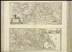
[37][37] Totius fluminis Rheni novissima descriptio, uit: Atlas sive Descriptio terrarum orbis
Annotatie: Gedigitaliseerde versie. Amsterdam. Heiloo : Picturae (vervaardiger), 2015. tiff-bestand. Gedigitaliseerd: 07-01-2015; Origineel: Universiteitsbibliotheek Vrije Universiteit (XL.05127.-) ; Netherlands; Titelpagina ontbreekt Wit, Frederik de Amsterdam : Frederick de Wit
Holand and Belgium.
1 : 1290000 Colton, G.W.
Holland And Belgium.
1 : 2100000 Tanner, Henry S.
Holland And Belgium.
1 : 2050000 Tanner, Henry S.
Holland and Belgium.
1 : 2080000 Tanner, Henry S.
Niederlande und Belgien
Plastischer Schul-Atlas über alle Theile der Erde : in 24 Karten Woldermann, G Verlag von P. Eckerlein
Holland and Belgium.
1 : 2060000 Mitchell, Samuel Augustus
Holland and Belgium.
1 : 2060000 Mitchell, Samuel Augustus
Rheinprovinz, Westphalen, Holland und Belgien
Schul-Atlas in 36 Karten Völter, Daniel Verlag der J.M. Dannheimer'schen Buchhandlung
[Kaart], uit: Kaart der bevaarbare waterloopen van België, Nederland, N.-Frankrijk, W.-Duitschland, en den Rijn van Rotterdam tot Basel = Carte des voies navigables de la Belgique, la Hollande, N. de la France, Allemagne Est, et le Rhin de Rotterdam à Bâle = Wasserstrassen Karte von Belgien, Holland, N. Frankreich, W. Deutschland und der Rhein von Rotterdam bis Basel
1 : 800000 Antwerpen : Seghers
XVII provinciae Belgii sive Germaniae inferioris
1 : 1682000 Belgie Lotter, Tobias Conrad Rogg, Gottfried studio et opera Tobiae Conradi Lotter
XVII provinciae Belgii sive Germaniae inferioris
1 : 1682000 Belgie Lotter, Tobias Conrad Rogg, Gottfried opera Tobiae Conradi Lotter
XVII provinciae Belgii sive Germaniae inferioris
1 : 1682000 Belgie Lotter, Tobias Conrad Rogg, Gottfried T. C. Lotter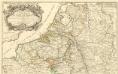
Theatre de la Guerre en Allemagne et dans les Pays Bas.
1 : 1100000 Mollova mapová sbírka Nolin, Jean-Baptiste Nolin, Jean-Baptiste I.
Belgii Universi seu Inferioris Germaniae quam XVII Provinciae Aistriaco, Gallico et Batavo Sceptro parentes constituunt nova Tabula Geographica
1 : 1050000 Mollova mapová sbírka Mayer, Tobias Homann, Johann Baptista - dědici
Kaart van de Nederlanden, Belgie, Luxemburg, Noordelijk Frankrijk en Westelijk Duitschland : ten gebruike van algemeene besturen, touristen, handelsreizigers, kantoren, instituten, enz. / vervaardigd ... onder toezicht en met medew. van J.A. van Voorthuijsen ; door A.A. en A.C. Nunnink
1 : 400000 J.A. van Voorthuijsen 1869 fl.; Albertus Anthonius Nunnink; Adolf Carel Nunnink 1813-1894 Brussel [etc.] : C. Muquardt

Carte du Royaume des Pays-Bas, comprenant les routes de poste et relais depuis Paris jusqu'aux frontières septentrionales de la Hollande, avec un Itinéraire des communications de Strasbourg à Amsterdam et Hambourg
1 : 1280000 [par] Hocquart. Paris : Audin

Homannův atlas světa
1 : 7000000
XVII Provinciae Belgii sive Germaniae Inferioris priscis temporibus circulo Burgundisco S.R.I. annumeratae quarum X hodie maximam partem Hispaniarum, non nullae Galliae regis ditioni subjacent, VII vero sub nomine Foederatarum Provinciarum Libertate gaudent
1 : 1250000 studio et opera Tobiae Conradi Lotter G. Rogg del. Augusta [Vindelicorum], : Tobiae Conradi Lotter
Septendecim provinciae Germaniae Inferior. uti sunt sub potestate regum Franciae et Hispaniae Ordinumque Generalium provinciarum unitarum : una cum episcopatibus Monasteriensi, Coloniensi, Leodiensi, et Cameracensi ...
1 : 1000000 P. Schenk exc. Amst. : P. Schenk exc.
Niederland u. Belgien
1 : 2220000 Belgie Stein, Carl

XVII Provinciae Belgii sive Germaniae Inferioris priscis temporibus Circulo Burgundico S. R. I. annumeratae, quarum X. hodie maximam partem Hispaniarum, non nullae Galliae Regis ditioni subiacent, VII. vero sub nomine Foederatarum Provinciar. libertate gaudent
1 : 1250000 studio et opera Matthaei Seutteri G. Rogg del. Augusta [Vind.] : Matthaeus Seutter
![Brabantia III. Rheni Et X. Nova Tabula. [Karte], in: Claud. Ptolemaeus. Geographia lat. cum mappis [...], S. 371.](https://images-2.georeferencer.com/images/iiif/952131747157/full/,300/0/native.jpg)

