Maps of Metropolitan France
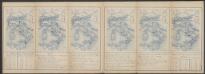
Gallia IIII. Nova Tabula [Karte], in: Claud. Ptolemaeus. Geographia lat. cum mappis [...], S. 341.
1 Karte aus Atlas Münster, Sebastian [und Ptolemaeus, Claudius]
Tercia Europe Tabula [Karte], in: [Clavdii Ptholomei Cosmographi ...], S. 254.
1 Karte aus Atlas Nicolaus Germanus [und Ptolemaeus, Claudius]
Gallia IIII. Nova Tabula [Karte], in: Geographia universalis vetus et nova complectens Claudii Ptolemaei Alexandrini enarrationis libros VIII, S. 311.
1 Karte aus Atlas Münster, Sebastian [und Ptolemaeus, Claudius]
Tabula Europae III. [Karte], in: Geographia universalis vetus et nova complectens Claudii Ptolemaei Alexandrini enarrationis libros VIII, S. 228.
1 Karte aus Atlas Münster, Sebastian [und Ptolemaeus, Claudius]
Tabula Europae III. [Karte], in: Claud. Ptolemaeus. Geographia lat. cum mappis [...], S. 260.
1 Karte aus Atlas Münster, Sebastian [und Ptolemaeus, Claudius]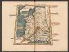
Tercia Europe Tabula [Gallia] [Karte], in: Claudii Ptolemei viri Alexandrini mathematice discipline philosophi doctissimi geographie opus [...], S. 157.
1 Karte aus Atlas Waldseemüller, Martin [und Ptolemaeus, Claudius] Übelin, Georg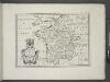
France, and parts adjoining.
from A new sett of maps both of antient and present geography : wherein not only the latitude and longitude of many places are corrected according to the latest observations, but also the most remarkable differences of antient and present geography may be quickly discern'd by a bare inspection or comparing of correspondent maps, which seems to be the most natural and easy method to lead young students (for whose use the work is principally intended) unto a competent knowledge of the geographical science : together with a geographical treatise particularly adapted to the use and design of these maps / by Edward Wells, M.A. and student of Christ-Church, Oxon.
Westeuropa 1839
Westeuropa Kunz, Andreas ; Röss, Wolf ; Johnen, Bettina ; Moeschl, Joachim Robert
Map of France, Spain, and Portugal; Switzerland in cantons [inset]; Island of Corsica [inset].
from Mitchell's new general atlas, containing maps of the various countries of the world, plans of cities, etc., embraced in fifty-three quarto maps., forming a series of eighty four maps and plans, together with valuable statistical tables.
Westeuropa 1789
Westeuropa Kunz, Andreas ; Treiling, Thomas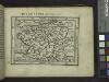
Gallia.
from Abraham Ortelius his epitome of the theater of the worlde / nowe latlye ... renewed and augmented ... by Micheal Coignet, mathematitian of Antwarpe.
Tabula Moderna Gallie [Karte], in: Claudii Ptolemei viri Alexandrini mathematice discipline philosophi doctissimi geographie opus [...], S. 242.
1 Karte aus Atlas Waldseemüller, Martin [und Ptolemaeus, Claudius] Übelin, Georg
Westeuropa 1830
Westeuropa Kunz, Andreas ; Röss, Wolf ; Johnen, Bettina ; Moeschl, Joachim Robert
Westeuropa 1848
Westeuropa Kunz, Andreas ; Röss, Wolf ; Johnen, Bettina ; Moeschl, Joachim Robert
Westeuropa 1867
Westeuropa Kunz, Andreas ; Röss, Wolf ; Johnen, Bettina ; Moeschl, Joachim Robert
Westeuropa 1922
Westeuropa Kunz, Andreas ; Treiling, Thomas
Westeuropa 1812
Westeuropa Kunz, Andreas ; Treiling, Thomas
Westeuropa 1820
Westeuropa Kunz, Andreas ; Röss, Wolf ; Johnen, Bettina ; Moeschl, Joachim Robert
Westeuropa 1797
Westeuropa Kunz, Andreas ; Treiling, Thomas
Westeuropa 1957
Westeuropa Kunz, Andreas ; Treiling, Thomas
Westeuropa 1935
Westeuropa Kunz, Andreas ; Treiling, Thomas
Westeuropa 1937
Westeuropa Kunz, Andreas ; Treiling, Thomas

Westeuropa 1914
Westeuropa Kunz, Andreas ; Röss, Wolf ; Johnen, Bettina ; Moeschl, Joachim Robert
Westeuropa 1871
Westeuropa Kunz, Andreas ; Röss, Wolf ; Johnen, Bettina ; Moeschl, Joachim Robert
Westeuropa 1861
Westeuropa Kunz, Andreas ; Röss, Wolf ; Johnen, Bettina ; Moeschl, Joachim Robert
Westeuropa 1990
Westeuropa Kunz, Andreas ; Treiling, Thomas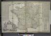
A new and exact map of France divided into all its provinces and acquisitions, ...
from The world described, or, A new and correct sett of maps : shewing the kingdoms and states in all the known parts of the earth, with the principal cities, and most considerable towns in the world ... / ... by Herman Moll, geographer ...
Westeuropa 1949
Westeuropa Kunz, Andreas ; Treiling, Thomas
![Gallia IIII. Nova Tabula [Karte], in: Claud. Ptolemaeus. Geographia lat. cum mappis [...], S. 341.](https://images-2.georeferencer.com/images/iiif/537166319387/full/,300/0/native.jpg)

