Maps of Loire-Atlantique

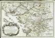
Carte De L'Evesché De Nantes [Nova Nannetensis Episcopatus Tabula] [Karte], in: Atlas nouveau, contenant toutes les parties du monde [...], Bd. 1, S. 124.
1 Karte aus Atlas Sanson, Nicolas Jaillot, Alexis Hubert und Mortier, Pieter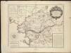
Carte de l'evesché de Nantes
1 : 285000
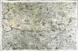
Composite 8: Carte de France.
1 : 86400 Cassini family; Cassini, Cesar-Francois, 1714-1784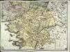
Carte géométrique de la province de Bretagne, 4
1 Blatt : chés l'auteur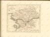
Carte géométrique du comté nantois
1 Karte : Kupferdruck ; 58 x 87 cm Ogée; Le Roy s.n.
Carte de l'evesché de Nantes
1 Karte : Kupferdruck ; 43 x 55 cm Jaillot chez le Sr. Iaillot geographe du roy joignant les grands Augustins aux deux globes
Département de la Loire inférieure
1 Karte : Kupferdruck ; 34 x 40 cm Capitaine s.n.
20) VII.N.E. ''Nantes'', uit: Carte géologique de France
1 : 500000 Annotatie: Voor aanwezige bladen zie bladoverzicht [S.l : s.n.]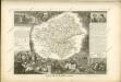

Département de la La Loire inferieure
1 Karte : Kupferdruck ; 48 x 48 cm Houdan au bureau de l'atlas national rue Serpente n.o 15, et au dépôt du dit atlas rue de la Monnoye n.o 5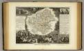
Dept. De La Loire Infre.
1 : 590000 Levasseur, Victor.
Département de la Mayenne et Loire
1 Karte : Kupferdruck ; 33 x 40 cm Capitaine s.n.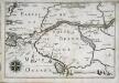
Capitaineries garde costes de Nantes
1 Karte : 22 x 33 cm de Fer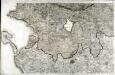
[Nantes]
1 Blatt : 60 x 91 cm s.n.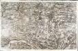
[Paimboeuf - Redon]
1 Blatt : 60 x 91 cm s.n.
[Rennes]
1 Blatt : 60 x 91 cm s.n.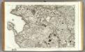
131 Nantes.
1 : 86400 Cassini family; Cassini, Cesar-Francois, 1714-1784
130 Paimboeuf, Redon.
1 : 86400 Cassini family; Cassini, Cesar-Francois, 1714-1784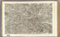
98 Angers.
1 : 86400 Cassini family; Cassini, Cesar-Francois, 1714-1784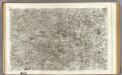
99 Mortagne.
1 : 86400 Cassini family; Cassini, Cesar-Francois, 1714-1784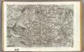
97 Laval.
1 : 86400 Cassini family; Cassini, Cesar-Francois, 1714-1784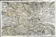
[Angers]
1 Blatt : 60 x 92 cm s.n.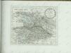

Département de Mayne [et] Loire
1 Karte : Kupferdruck ; 49 x 48 cm Houdan au bureau de l'atlas national de France rue de la Harpe n.o 26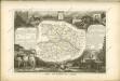
[Mortagne]
1 Blatt : 61 x 92 cm Aldring s.n.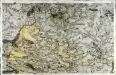
[Laval]
1 Blatt : 60 x 92 cm Chalmandrier s.n.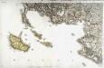
[Belle-Isle]
1 Blatt : 60 x 92 cm s.n.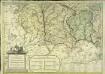
![Carte De L'Evesché De Nantes [Nova Nannetensis Episcopatus Tabula] [Karte], in: Atlas nouveau, contenant toutes les parties du monde [...], Bd. 1, S. 124.](https://images-2.georeferencer.com/images/iiif/114734601294/full/,300/0/native.jpg)

