Maps of Utrecht
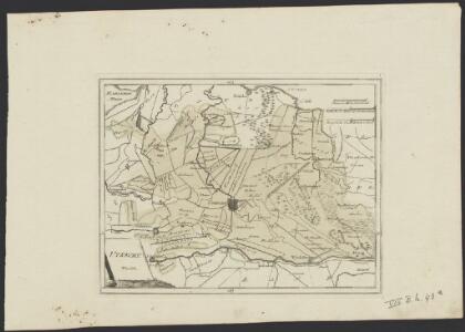
Utrecht.
1 : 250000 [Wien] : [Franz Johann Joseph von Reilly]
VLTRAIECTVM | DOMINIVM.
Excudit Guiljelmus Blaeuw.
VLTRAIECTVM | DOMINIVM.
Excudit Guiljelmus Blaeuw.
Episcop. Ultraiectinus
1 : 115000 auct. Balthazaro Florentio a Berkenrode Evert Sijmonszoon Hamersveldt sculpsit. Amstelodami : apud Henricum Hondium, sub insigno Atlantis., ao. 1628
[Kaart], uit: Utrecht / lithogr. J. Smulders
1 : 80000 titelvariant: Sleeswijk's kaart van Utrecht; Annotatie: Omslagtitel: Sleeswijk's kaart van Utrecht : voor wandelaars, wielrijders en automobilisten : voor school, kantoor en huiskamer; Verso: plaatsnamenregister J. Smulders & Co., 's-Gravenhage Bussum : Sleeswijk
Kaart van de provincie Utrecht
1 : 50000 vervaardigd op last van: de edel groot achtbare heeren staten van dat gewest, en onder toezigt van: J.H. Kips ... zamengest. en geteekend, door A.A. Nunnink ; [lithografie van Johannes Marinus Huart] [S.l.] : [s.n.]
Uitrecht
1 : 160000 [François Halma] [Leeuwarden] : [Henrik Halma]
Carte von Utrecht
1 : 115000 entworfen von F.L. Güssefeld. Nürnberg : bey den Hom[ännischen] Erben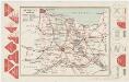
Utrecht, uit: [Provinciale fietskaart ...]
Annotatie: Boven en onder het kaartbeeld verkeersborden voor wielrijders; Provincienaam op voorkant geflankeerd door provinciewapen en wapen van de provinciehoofdstad, waaronder een stadsbeeld met fietser in klederdracht; Kaart van Overijssel ontbreekt Deventer : Burgers E.N.R
Ultraiectum
1 : 425000 [Abraham Goos engraver] [Amsterdam] : [Johannes Janssonius]
Episcop. Ultraiectinus [Karte], in: Novus atlas absolutissimus, Bd. 3, S. 200.
1 Karte aus Atlas Janssonius Offizin
Ultraiectum Dominium. [Karte], in: Novus Atlas, das ist, Weltbeschreibung, Bd. 1, S. 408.
1 Karte aus Atlas Blaeu, Joan Blaeu, Willem Janszoon
Ultraiectum Dominium. [Karte], in: Theatrum orbis terrarum, sive, Atlas novus, Bd. 1, S. 445.
1 Karte aus Atlas Blaeu, Joan Blaeu, Willem Janszoon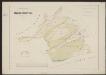
Episcop. Ultraiectinus [Karte], in: Gerardi Mercatoris et I. Hondii Newer Atlas, oder, Grosses Weltbuch, Bd. 1, S. 466.
1 Karte aus Atlas Mercator, Gerhard und Hondius, Jodocus Jansson, Jan
Ultraiectum Dominium. [Karte], in: Le théâtre du monde, ou, Nouvel atlas contenant les chartes et descriptions de tous les païs de la terre, Bd. 1, S. 441.
1 Karte aus Atlas Blaeu, Willem Janszoon und Blaeu, Joan Blaeu, Willem Janszoon
Nieuwe kaart van Utrecht behoorende tot het Vaderlandsch woordenboek van Jacobus Kok
1 : 170000 J.C. de Roeder, del. C. van Baarsel, sculp. [Amsterdam] : [by Johannes Allart]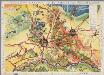
[Recto], uit: Neerland's centrum in kleur en woord : Utrecht uw vacantie-oord! / eigen opzet en uitg. van den Prov. Utr. Bond voor Vreemdelingenverkeer
1 : 80000 Provinciale Utrechtsche Bond voor Vreemdelingenverkeer [Utrecht : Provinciale Utrechtsche Bond voor Vreemdelingenverkeer]
Carte von Utrecht / entworfen von F.L. Güssefeld
1 : 125000 titelvariant: Carte geographique de la Province d'Utrecht; Annotatie: Titel boven de kaart: Carte geographique de la Province d'Utrecht; Annotatie geografische gegevens: West boven Güssefeld, F. L. Nürnberg : bey den Hom. Erben
Tabula nova provinciae Ultrajectinae
1 : 120000 quam jussu nob. hujus dominii ordinum emensus est Bernardus du Roy geometra, et in lucem edidit Nicol: Visscher L. van Anse schulp. [Amsterdam] : Nicol. Visscher
Nieuwe kaart van Utrecht behoorende tot het Vaderlandsch woordenboek van Jacobus Kok
1 : 170000 J.C. de Roeder, del. C. van Baarsel, sculp. [Amsterdam] : [by Johannes Allart]
Tabula nova provinciae Ultrajectinae
1 : 120000 quam jussu nob. hujus dominii ordinum emensus est Bernardus du Roy geometra, et in lucem edidit Nicol: Visscher L. van Anse schulp. [Amsterdam] : nunc apud Petrum Schenk Junior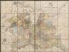
Kaart van de provincie Utrecht op de schaal van 1 à 50.000
1 : 50000 uitgegeven onder goedkeuring van H.H. Gedeputeerde Staten van dat gewest. [Utrecht] : [J. van Druten]
Carte von Utrecht
1 : 130000 Utrecht (Nizozemsko) Güssefeld, Franz L. bey den Hom. Erben
Ultraiectini Dominii Tabula
1 : 120000 Mollova mapová sbírka Wit, Frederik de Covens, Johannes I
Ultraiectini Dominii tabula
1 : 120000 Mollova mapová sbírka Danckerts, Justus Danckerts, Cornelis
La Seigneurie d'Vtrecht
1 : 170000 Mollova mapová sbírka Sanson, Guillaume Jaillot, Alexis Hubert
Ultrajectum
1 : 540000 [Jodocus Hondius jr. engraver] [Amsterdam] : [Jodocus Hondius jr.]
Episcop. Vltraiectinvs.
1 : 140000 Mollova mapová sbírka Berckenrode, Balthasar Florisz. van
Statistieke kaart van de provincie Utrecht
1 : 120000 door L. van de Kasteele op steen gegrav. door A. Bayly & D. Heyse te 's Hage. Utrecht : W.F. Dannenfelser