Maps of Matamoros

Fort Brown
1 : 62500
Southmost
1 : 24000
Southmost
1 : 24000
Southmost
1 : 31680
Southmost
1 : 31680
Southmost
1 : 31680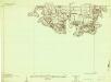
Southmost
1 : 24000
East Brownsville
1 : 24000
East Brownsville
1 : 24000
East Brownsville
1 : 24000
East Brownsville
1 : 24000
East Brownsville
1 : 24000
East Brownsville
1 : 24000
Palmito Hill
1 : 24000
Palmito Hill
1 : 24000
Palmito Hill
1 : 24000
East Brownsville
1 : 31680
East Brownsville
1 : 31680
East Brownsville
1 : 31680
Palmito Hill
1 : 31680
Palmito Hill
1 : 31680
East Brownsville
1 : 24000
Palmito Hill
1 : 24000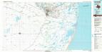
Brownsville
1 : 100000
Brownsville
1 : 250000
Brownsville
1 : 250000
Brownsville
1 : 250000
Brownsville
1 : 250000
Tamaulipas.
1 : 3800000 Garcia Cubas, Antonio, 1832-1912

