Maps of Pittsylvania County

Whitmell
1 : 24000
Whitmell
1 : 24000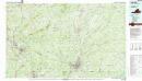
Danville
1 : 100000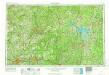
Greensboro
1 : 250000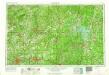
Greensboro
1 : 250000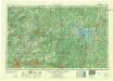
Greensboro
1 : 250000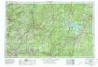
Greensboro
1 : 250000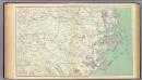
Gen. map III.
1 : 633600 United States. War Department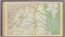
Gen. map II.
1 : 633600 United States. War Department
War telegram marking map
1 : 490000 L. Prang & Co Lith. of J. Bien
A new and accurate map of North Carolina in North America
1 : 1147000
Prang's Naval Expedition Maps: North Carolina coast line
Prang's Naval Expedition Maps: North Carolina coast line L. Prang & Co.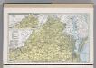
Virginia.
1 : 1271000 Hammond, C.S.
Shell Highway Map of Delaware - Maryland, Virginia, W. Virginia. (eastern portion).
1 : 950400 Shell Oil Company
Shell Highway Map of Delaware - Maryland, Virginia, W. Virginia. (western portion).
1 : 950400 Shell Oil Company
Virginia.
1 : 1700000 Cram, George Franklin; Davis, Ellis Arthur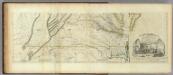
Map of the most Inhabited part of Virginia containing ... Maryland. (Southern Section)
1 : 650000 Jefferys, Thomas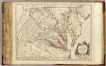
Virginie, Maryland.
1 : 870000 Robert de Vaugondy, Gilles, 1688-1766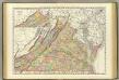
Virginia.
1 : 865000 Rand McNally and Company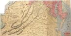
Lloyd's Military Campaign Charts: Virginia
Lloyd's Military Campaign Charts, showing the principal places of interest, compiled from official data by Gen. E.L. Viele and C. Haskins. Published under the auspices of the American Geographical and Statistical Society. Virginia.
(Virginia, N. Carolina) Railroad Map of the United States.
1 : 506880 Rand McNally and Company
North Carolina.
1 : 2070000 Lucas, Fielding Jr.
Coal fields W. Va.
1 : 1900000 Mitchell, Samuel Augustus
Political W. Va.
1 : 1900000 White, M. Wood
County map W. Va.
1 : 1900000 Mitchell, Samuel Augustus
A new and accurate map of the province of Virginia in North America.
from Virginia
The tourist's pocket map of the state of Virginia: exhibiting its internal improvements, roads, distances, &c. / by J.H. Young; engraved by E. Yeager & F. Dankworth.
from Virginia J. H. Young; E. Yeager; F. Dankworth,
The tourist's pocket map of the state of Virginia: exhibiting its internal improvements, roads, distances, &c. / by J.H. Young; engraved by E. Yeager & F. Dankworth.
from Virginia J. H. Young; E. Yeager; F. Dankworth,
The travellers pocket map of Virginia: with its canals, rail-roads & distances from place to place along the stage roads / by H.S. Tanner; engraved by W. Brose, Philadelphia, 1830.
from Virginia Henry S. Tanner; W. Brose,

