Maps of Region Heilbronn-Franken

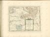
Des Herzogthums Würtemberg nordöstliche Aemter mit den freyen Reichsstädten Heilbronn, Wimpfen und Eslingen
1 Karte : Kupferdruck ; 23 x 26 cm Reilly F. J. J. von Reilly
Suevia Universa :
1 : 170000 Mollova mapová sbírka Michal, Jacques de Seutter, Matthäus Seutter, Matthäus
Pars Sueviae Borealior
1 : 250000 Mollova mapová sbírka Delisle, Guillaume Wolff, Jeremias

Per Inclyti Circuli Suevici Supremorum Ordinum :
1 : 160000 Mollova mapová sbírka Pfeffel, Johann Andreas Homann, Johann Baptista - dědici
Generalkarte von Württemberg: Blatt II
1 : 1500000 Terrainzeichnung: Bach, Topograf und Hauptmann Lithografie: Rebmann und Sommer Herausgeber: K. statistisch-topografisches Büro
Suevia universa IX. tabulis delineata, 2
1 Blatt : s.n.
S.R.Imp. Circuli Franconici Geographica Delineatio Francken-Land mit Seinen Gräntzen
Mollova mapová sbírka Endter, Wolfgang Moritz Endter, Wolfgang Moritz
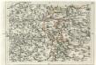
Die freye Reichsstadt Schwæbisch Hall mit ihrem Gebiethe
1 Karte : Kupferdruck ; 21 x 27 cm Reilly F. J. J. von Reilly
Charte von dem Fürstenthum Hohenlohe, und der Grafschafft Limpurg
1 : 150000 Hohenlohe (Německo) Hammer, C.F.
162. Rothenburg a.d. Thauber, uit: Topographische Uebersichtskarte des Deutschen Reiches / herausgegeben v. d. Kartogr. Abt. d. Königl. Preuß. Landesaufnahme
1 : 200000 titelvariant: Topogr. Übersichtskarte des Deutschen Reiches; Annotatie: Titel boven bladen ook: Topogr. Übersichtskarte des Deutschen Reiches; Annotatie geografische gegevens: Op elk blad twee maatstokken: 10 Kilometer = 5,5 cm; 1 geogr. Meile = 3,6 cm; Legenda onder op elk blad Königlich Preußische Landesaufnahme. Kartographische Abtheilung [S.l : Königlich Preußische Landesaufnahme, Kartographische Abtheilung]
Comitatvs Wertheimici Finitimarvmqve Regionvm Nova et Exacta descriptio
1 : 110000 Mollova mapová sbírka Valk, Gerhard Schenk, Peter I
Comitatvs Wertheimici Finitimarvmqve Regionvm Nova et Exacta descriptio
1 : 110000 Mollova mapová sbírka Janssonius, Johannes Janssonius, Johannes I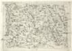
Geographica Provinciarum Sveviae Descriptio :
Mollova mapová sbírka Hurter, Johann Christoph Küsel, Melchior Bodenehr, Johann Georg
Stuttgart 128, uit: Special-Karte von Mittel-Europa / nach amtlichen Quellen bearbeitet von W. Liebenow
1 : 300000 titelvariant: W. Liebenow's Mittel-Europa; Annotatie: Titel boven de bladen: W. Liebenow's Mittel-Europa Johannes Wilhelm Liebenow 1822-1897 Frankfurt a. M. : Ludwig Ravenstein
Tabula geographica sistens territorivm liberæ sacri romani imperii civitatis Svevo=Hallensis
1 Karte : Kupferdruck ; 45 x 54 cm Cnopf Homännische Erben
Geographica Provinciarum Sveviae Descriptio =
Mollova mapová sbírka Hurter, Johann Christoph Bodenehr, Gabriel
Serenissimis Principibvs ac Dominis ab Hohenloh. Dynastis in Langenburg
1 : 170000 Mollova mapová sbírka Chapuset, Johann Karl Homann, Johann Baptista - dědici
Serenissimis Principibvs ac Dominis ab Hohenloh. Dynastis in Langenburg
1 : 170000 Mollova mapová sbírka Chapuset, Johann Karl Homann, Johann Baptista - dědici
Serenissimis principibvs ac dominis ab Hohenloh, dynastis in Langenburg nec non celsissimis comitibvs ac dominis ab Hohenloh. et Gleichen, dynastis in Langenb. et Cranchfeld etc
1 : 170000 Bádensko (Německo) Chapuset, Johann Karl excudentib. Homannianis Heredibus
Serenissimis principibvs ac dominis ab Hohenloh, dynastis in Langenburg nec non celsissimis comitibvs ac dominis ab Hohenloh. et Gleichen, dynastis in Langenb. et Cranchfeld etc
1 : 170000 Bádensko (Německo) Chapuset, Johann Karl excudentib. Homannianis Heredibus
Serenissimis principibvs ac dominis ab Hohenloh, dynastis in Langenburg nec non celsissimis comitibvs ac dominis ab Hohenloh. et Gleichen, dynastis in Langenb. et Cranchfeld etc
1 : 170000 Bádensko (Německo) Chapuset, Johann Karl excudentib. Homannianis Heredibus
Serenissimis principibvs ac dominis ab Hohenloh, dynastis in Langenburg nec non celsissimis comitibvs ac dominis ab Hohenloh. et Gleichen, dynastis in Langenb. et Cranchfeld etc
1 : 170000 Bádensko (Německo) Chapuset, Johann Karl excudentib. Homannianis Heredibus
Die gefürstete Probstey Ellwangen
1 Karte : Kupferdruck ; 18 x 23 cm Reilly F. J. J. von Reilly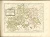
Geographica Provinciarum Sveviae Descriptio =
Mollova mapová sbírka Hurter, Johann Christoph Bodenehr, Gabriel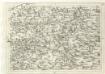
Geographica Provinciarum Sveviae Descriptio =
Mollova mapová sbírka Hurter, Johann Christoph Bodenehr, Johann Georg
171. Göppingen, uit: Topographische Uebersichtskarte des Deutschen Reiches / herausgegeben v. d. Kartogr. Abt. d. Königl. Preuß. Landesaufnahme
1 : 200000 titelvariant: Topogr. Übersichtskarte des Deutschen Reiches; Annotatie: Titel boven bladen ook: Topogr. Übersichtskarte des Deutschen Reiches; Annotatie geografische gegevens: Op elk blad twee maatstokken: 10 Kilometer = 5,5 cm; 1 geogr. Meile = 3,6 cm; Legenda onder op elk blad Königlich Preußische Landesaufnahme. Kartographische Abtheilung [S.l : Königlich Preußische Landesaufnahme, Kartographische Abtheilung]


