Maps of Libín

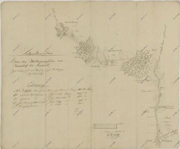
Situační plán erární silnice od dvora Kuna do Ledenic 1
Přehledná mapa polesí Ledenice 1

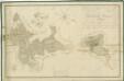
Generální mapa panství Třeboň a inkorporovaných statků Bzí, Lomnice, Borovany, Třeboň, Hamr a Val 1
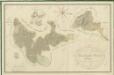
Přehledná mapa polesí Ledenice 1
Přehledná mapa polesí Ledenice 1

Generální mapa panství Třeboň a inkorporovaných statků Bzí, Lomnice, Borovany, Třeboň, Hamr a Val 1

Porostní obrysová mapa polesí Domanín 1
1 : 15000
Porostní mapa polesí Ledenice 1
Geometrický plán Spolského rybníka, chalup na jeho hrázi a přilehlých pozemků 1

Porostní mapa polesí Domanín 1
1 : 15000
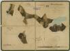
Stiepanowitz - c7778-1-008 - Kaiserpflichtexemplar der Landkarten des stabilen Katasters
1 : 2880
Stiepanowitz - c7778-1-007 - Kaiserpflichtexemplar der Landkarten des stabilen Katasters
1 : 2880
Stiepanowitz - c7778-1-002 - Kaiserpflichtexemplar der Landkarten des stabilen Katasters
1 : 2880
Stiepanowitz - c7778-1-005 - Kaiserpflichtexemplar der Landkarten des stabilen Katasters
1 : 2880
Stiepanowitz - c7778-1-004 - Kaiserpflichtexemplar der Landkarten des stabilen Katasters
1 : 2880
Stiepanowitz - c7778-1-003 - Kaiserpflichtexemplar der Landkarten des stabilen Katasters
1 : 2880
Stiepanowitz - c7778-1-006 - Kaiserpflichtexemplar der Landkarten des stabilen Katasters
1 : 2880
Stiepanowitz - c7778-1-001 - Kaiserpflichtexemplar der Landkarten des stabilen Katasters
1 : 2880
Porostní mapa polesí Domanín 1
1 : 15000
Štěpánovice o. České Budějovice 1
1 : 2880
Porostní mapa polesí Domanín 1
1 : 10000
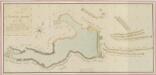
Záměrná mapa rybníků a lesů u Branné
Porostní mapa polesí Domanín 1
1 : 15000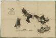
Porostní mapa polesí Zámecké 1

Domanin - c1424-1-006 - Kaiserpflichtexemplar der Landkarten des stabilen Katasters
1 : 2880
Domanin - c1424-1-007 - Kaiserpflichtexemplar der Landkarten des stabilen Katasters
1 : 2880
Domanin - c1424-1-002 - Kaiserpflichtexemplar der Landkarten des stabilen Katasters
1 : 2880
Domanin - c1424-1-001 - Kaiserpflichtexemplar der Landkarten des stabilen Katasters
1 : 2880
Domanin - c1424-1-004 - Kaiserpflichtexemplar der Landkarten des stabilen Katasters
1 : 2880
Domanin - c1424-1-003 - Kaiserpflichtexemplar der Landkarten des stabilen Katasters
1 : 2880