Maps of Ledenice

Ledenice o. České Budějovice 1
1 : 2880
Mapa rozdělení pozemků dvora Mysletín po 1. pozemkové reformě, s vyznačením meliorací 1
1 : 5760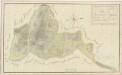
Geometrický plán dvora Mysletín se všemi přilehlými pozemky 1

Zborow - c9182-1-007 - Kaiserpflichtexemplar der Landkarten des stabilen Katasters
1 : 2880
Zborow - c9182-1-003 - Kaiserpflichtexemplar der Landkarten des stabilen Katasters
1 : 2880
Zborow - c9182-1-005 - Kaiserpflichtexemplar der Landkarten des stabilen Katasters
1 : 2880
Zborow - c9182-1-002 - Kaiserpflichtexemplar der Landkarten des stabilen Katasters
1 : 2880
Zborow - c9182-1-001 - Kaiserpflichtexemplar der Landkarten des stabilen Katasters
1 : 2880
Zborow - c9182-1-006 - Kaiserpflichtexemplar der Landkarten des stabilen Katasters
1 : 2880
Zborow - c9182-1-004 - Kaiserpflichtexemplar der Landkarten des stabilen Katasters
1 : 2880
Situační plán silnice z Ledenic do Záluží 1

Zborov o. České Budějovice 1
1 : 2880
Ledenice o. České Budějovice 1
1 : 2880
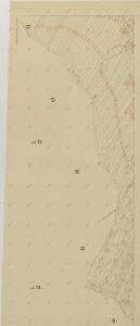
Ledenitz - c3849-1-001 - Kaiserpflichtexemplar der Landkarten des stabilen Katasters
1 : 2880
Ledenitz - c3849-1-006 - Kaiserpflichtexemplar der Landkarten des stabilen Katasters
1 : 2880
Ledenitz - c3849-1-002 - Kaiserpflichtexemplar der Landkarten des stabilen Katasters
1 : 2880
Ledenitz - c3849-1-008 - Kaiserpflichtexemplar der Landkarten des stabilen Katasters
1 : 2880
Ledenitz - c3849-1-007 - Kaiserpflichtexemplar der Landkarten des stabilen Katasters
1 : 2880
Ledenitz - c3849-1-003 - Kaiserpflichtexemplar der Landkarten des stabilen Katasters
1 : 2880
Ledenitz - c3849-1-005 - Kaiserpflichtexemplar der Landkarten des stabilen Katasters
1 : 2880
Ledenitz - c3849-1-004 - Kaiserpflichtexemplar der Landkarten des stabilen Katasters
1 : 2880
Ledenice o. České Budějovice 1
1 : 2880
Zborov o. České Budějovice 1
1 : 2880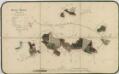
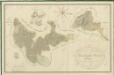
Porostní mapa polesí Zborov 1
Přehledná mapa polesí Ledenice 1
Přehledná mapa polesí Ledenice 1
Porostní mapa polesí Zborov 1
1 : 15000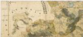
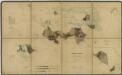
Administrativní mapa třeboňského panství se statky Bzí,Lomnice, Borovany,Hamr a Val 1
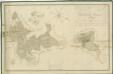
Přehledná mapa polesí Ledenice 1