Maps of okres Domažlice
Katastrální mapa obce Mýtnice spolu s obcemi Herštejnské Chalupy a Křížová Huť WC-XIV-24 dh, cdf
1 : 2880
Mapa pohraničních lesů statku Grafenried, sousedících s koutským panstvím
1 : 4685
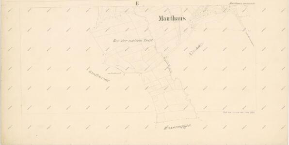
Mauthaus (Meyto) - c4927-1-002 - Kaiserpflichtexemplar der Landkarten des stabilen Katasters
1 : 2880
Mauthaus (Meyto) - c4927-1-001 - Kaiserpflichtexemplar der Landkarten des stabilen Katasters
1 : 2880
Mauthaus (Meyto) - c4927-1-005 - Kaiserpflichtexemplar der Landkarten des stabilen Katasters
1 : 2880
Mauthaus (Meyto) - c4927-1-003 - Kaiserpflichtexemplar der Landkarten des stabilen Katasters
1 : 2880
Mauthaus (Meyto) - c4927-1-004 - Kaiserpflichtexemplar der Landkarten des stabilen Katasters
1 : 2880
Porostní mapa revíru Novosedlské Hutě
1 : 11026
Neubäu - c5300-1-004 - Kaiserpflichtexemplar der Landkarten des stabilen Katasters
1 : 2880
Neubäu - c5300-1-002 - Kaiserpflichtexemplar der Landkarten des stabilen Katasters
1 : 2880
Neubäu - c5300-1-001 - Kaiserpflichtexemplar der Landkarten des stabilen Katasters
1 : 2880
Neubäu - c5300-1-003 - Kaiserpflichtexemplar der Landkarten des stabilen Katasters
1 : 2880
Porostní mapa revíru Novosedlské Hutě
1 : 5760
Hospodářské mapa revíru Novosedlské Hutě
1 : 5806
Hospodářská mapa revíru Novosedelské Hutě
1 : 3224
Mapa panských pozemků v katastru obce Postřekov
1 : 5760
Gradkartenblatt
1 : 25000 Klenčí pod Čerchovem-oblast (Česko) Bulla, Eduard

III. vojenské mapování 4249/2
1 : 25000
III. vojenské mapování 4249/2
1 : 25000
III. vojenské mapování 4249/2
1 : 25000
[Kartenblatt]
1 : 25000 Klenčí pod Čerchovem (Česko : oblast) Reichsamt für Landesaufnahme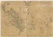
Přehledová mapa panství Trhanov se Staněticemi a Zahořany
1 : 21072
Přehledná mapa kultur velkostatku Kout-Trhanov
1 : 51605


Klentsch
1 : 75000 Klenčí pod Čerchovem (Česko : oblast) K. u. k. Militärgeographisches Institut
Kleneč p. Čerchovem
1 : 75000 Klenčí pod Čerchovem-oblast (Česko) Vojenský zeměpisný ústav
Domažlice a okolí
1 : 75000 Domažlice (Česko : oblast) Vojenský zeměpisný ústav