Maps of Třebenice
Katastrální mapa obce Teplá
1 : 2880
Suttom - c7573-1-001 - Kaiserpflichtexemplar der Landkarten des stabilen Katasters
1 : 2880
Suttom - c7573-1-002 - Kaiserpflichtexemplar der Landkarten des stabilen Katasters
1 : 2880
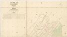
Teplai - c7859-1-001 - Kaiserpflichtexemplar der Landkarten des stabilen Katasters
1 : 2880
Teplai - c7859-1-002 - Kaiserpflichtexemplar der Landkarten des stabilen Katasters
1 : 2880
Katastrální mapa obce Vlastislav WC-II-9 ci
1 : 2880
La bataille de Lowositz entre Sa Majesté le Roi de Prusse et le maréchal Broun le 1. octobre 1756
1 : 500 Lovosice-oblast (Česko) Thierbu Coentgen, Heinrich Hugo
Unvollendete Topographische Carte von der Position zwischen Aussig und Bilin, und den gegenden gegen abend des Mittelgebürges bis an die Eger bey Laun
České středohoří (Česko : oblast)
Ebauché du combat qui s'est donné le 1. d'octobre. 1756. entre les troupes imp. et les Prussiens pres de Lobozitz en Boheme
Lovosice-oblast (Česko) Kotzii, Car. de
Plan der Gegend bey Lowositz in Böheim
Lovosice-oblast (Česko)
Topographischer Plan zwischen Trebnitz, Millischau und den Kletschen Berg
1 : 15000 Bílka (Bořislav, Česko) Marssovicky

III. vojenské mapování 3852/1
1 : 25000
Gradkartenblatt
1 : 25000 Louny-oblast (Česko) Bellschan, Anton
Bezirk Lobositz
1 : 72000 Lovosice-oblast (Česko) Josef Czerny

III. vojenské mapování 3752/3
1 : 25000
[České středohoří - západní část]
Most-oblast (Česko)
Lager der Kaÿserl. Königl. Ungarischen Armée beÿ Budin in Böhmen vor der Schlacht beÿ Lowositz Anno 1756
Mollova mapová sbírka Fridrich, Jacob Andreas Friedrich, Jacob Andreas
Raudnitz und Jungferteinitz
1 : 75000 Roudnice nad Labem (Česko : oblast) Ahl K. u. k. militär-geographisches Institut
Raudnitz und Jungferteinitz
1 : 75000 Roudnice nad Labem (Česko : oblast) Ahl K. u. k. Militärgeographisches Institut
Raudnitz und Jungferteinitz
1 : 75000 Roudnice nad Labem (Česko : oblast) K. u. k. Militärgeographisches Institut
Touristen-Karte des Aussiger Mittel- und Erzgebirgs-Vereines
1 : 75000 Krušné hory (Česko a Německo) Kroitzsch, Carl Mittel- und Erzgebirgesverein
Mapa okres. hejtmanství Roudnického
1 : 100000 Budyně nad Ohří-oblast (Česko) R. Kaška
Roudnice n. Labem
1 : 75000 Roudnice nad Labem (Česko : oblast) Vojenský zeměpisný ústav
Karte der Bezirkshauptmannschaft zugleich Strafgerichtsbezirk Leitmeritz
1 : 222500 Litoměřice-oblast (Česko) von dem Lehrpersonale der Leitmeritzer k.k. Hauptschule
Litoměřice a okolí
1 : 75000 Litoměřice (Česko : oblast) Vojenský zeměpisný ústav
Soubor přehledných map pro plánování a statistiku: 3852 – Roudnice n. Labem

Okresní hejtmanství Roudnické
Roudnice nad Labem-oblast (Česko)


