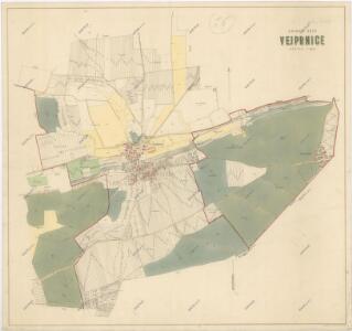
Maps of Vejprnice

Porostní mapa revíru Vejprnice
1 : 8640
Weiprnitz (Wegprnic) - c8346-1-004 - Kaiserpflichtexemplar der Landkarten des stabilen Katasters
1 : 2880
Weiprnitz (Wegprnic) - c8346-1-005 - Kaiserpflichtexemplar der Landkarten des stabilen Katasters
1 : 2880
Weiprnitz (Wegprnic) - c8346-1-003 - Kaiserpflichtexemplar der Landkarten des stabilen Katasters
1 : 2880
Weiprnitz (Wegprnic) - c8346-1-002 - Kaiserpflichtexemplar der Landkarten des stabilen Katasters
1 : 2880
Weiprnitz (Wegprnic) - c8346-1-001 - Kaiserpflichtexemplar der Landkarten des stabilen Katasters
1 : 2880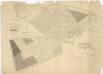
Porostní mapa revíru Vejprnice
1 : 2880
Katastrální mapa obce Vejprnice WC-IX-20 be
1 : 2880
Katastrální mapa obce Vejprnice WC-VIII-20 de 21 df
1 : 2880
Katastrální mapa obce Vejprnice WC-IX-20 ai bi
1 : 2880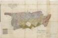
Porostní mapa revíru Vejprnice
1 : 2880
Katastrální mapa obce Tlučná WC-IX-21 bf cg bg
1 : 2880
Katastrální mapa obce Křimice
1 : 2880
Katastrální mapa obce Tlučná WC-IX-21 be
1 : 2880
Katastrální mapa obce Tlučná WC-IX-21 bf cg bg
1 : 2880
Katastrální mapa obce Křimice
1 : 2880
Wochow - c8726-1-003 - Kaiserpflichtexemplar der Landkarten des stabilen Katasters
1 : 2880
Wochow - c8726-1-002 - Kaiserpflichtexemplar der Landkarten des stabilen Katasters
1 : 2880
Wochow - c8726-1-004 - Kaiserpflichtexemplar der Landkarten des stabilen Katasters
1 : 2880
Wochow - c8726-1-001 - Kaiserpflichtexemplar der Landkarten des stabilen Katasters
1 : 2880
Tlutzna (Tlucna) - c7926-1-003 - Kaiserpflichtexemplar der Landkarten des stabilen Katasters
1 : 2880
Tlutzna (Tlucna) - c7926-1-002 - Kaiserpflichtexemplar der Landkarten des stabilen Katasters
1 : 2880
Tlutzna (Tlucna) - c7926-1-001 - Kaiserpflichtexemplar der Landkarten des stabilen Katasters
1 : 2880
Tlutzna (Tlucna) - c7926-1-004 - Kaiserpflichtexemplar der Landkarten des stabilen Katasters
1 : 2880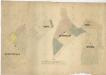
Porostní mapa lesů v katastru obce Tlučná
1 : 2880
Katastrální mapa obce Křimice
1 : 2880
Katastrální mapa obce Vochov
1 : 2880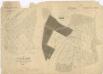
Porostní mapa lesů v katastru obce Tlučná
1 : 2880
Záměrná mapa pozemků a rybníků dvora Pořejov
1 : 5760