Maps of Samtgemeinde Barnstorf

259. Diepholz.
1 : 100000 Reichsamt fur Landesaufnahme
Composite: 259. Diepholz.
1 : 100000 Reichsamt fur Landesaufnahme
Germany 1:25,000, Lembruch
Germany 1:25,000 , Series GSGS 4414. Great Britain. War Office. [London] : War Office
Germany 1:25,000, Wagenfeld
Germany 1:25,000 , Series GSGS 4414. Great Britain. War Office. [London] : War Office
Germany 1:25,000, Strohen
Germany 1:25,000 , Series GSGS 4414. Great Britain. War Office. [London] : War Office
Germany 1:25,000, Diepholz
Germany 1:25,000 , Series GSGS 4414. Great Britain. War Office. [London] : War Office
Meßtischblatt 1809 : Ströhen, 1938
1 : 250000 Ströhen. - Hrsg. 1899, einz. Nachtr. 1938. - 1:25000. - [Berlin]: Reichsamt für Landesaufnahme, 1938. - 1 Kt.
Meßtischblatt 1808, neue Nr. 3417 : Wagenfeld, 1938
1 : 250000 Wagenfeld. - Hrsg 1899, einz. Nachtr. 1938. - 1:25000. - [Berlin]: Reichsamt für Landesaufnahme, 1938. - 1 Kt.
Meßtischblatt 1807, neue Nr. 3416 : Lembruch, 1938
1 : 250000 Lembruch. - Hrsg. 1899, einz. Nachtr. 1938. - 1:25000. - [Berlin]: Reichsamt für Landesaufnahme, 1938. - 1 Kt.
Meßtischblatt 1737 : Sulingen, 1899
1 : 250000 Sulingen. - Aufn. 1897, hrsg. 1899. - 1:25000. - [Berlin]: Reichsamt für Landesaufnahme, 1899. - 1 Kt.
Meßtischblatt 1736 : Barver, 1899
1 : 250000 Barver. - Aufn. 1897, hrsg. 1899. - 1:25000. - [Berlin]: Reichsamt für Landesaufnahme, 1899. - 1 Kt.
Meßtischblatt 1735 : Diepholz, 1899
1 : 250000 Diepholz. - Aufn. 1897, hrsg. 1899. - 1:25000. - [Berlin]: Reichsamt für Landesaufnahme, 1899. - 1 Kt.
Meßtischblatt 1665 : Schmalförden, 1936
1 : 250000 Schmalförden. - Hrsg. 1899, einz. Nachtr. 1924, gedr. [19]36. - 1:25000. - [Berlin]: Reichsamt für Landesaufnahme, 1936. - 1 Kt.
Meßtischblatt 1664 : Barnstorf, 1934
1 : 250000 Barnstorf. - Hrsg. 1899, einz. Nachtr. 1925, gedr. [19]34. - 1:25000. - [Berlin]: Reichsamt für Landesaufnahme, 1934. - 1 Kt.
Meßtischblatt 1664 : Barnstorf, 1899
1 : 250000 Barnstorf. - Aufn. 1897. - 1:25000. - [Berlin]: Reichsamt für Landesaufnahme, 1899. - 1 Kt.
Meßtischblatt 1663 : Goldenstedt, 1900
1 : 250000 Goldenstedt. - Aufn. 1898, hrsg. 1900. - 1:25000. - [Berlin]: Reichsamt für Landesaufnahme, 1900. - 1 Kt.
72. Nienburg, uit: Topographische Uebersichtskarte des Deutschen Reiches / herausgegeben v. d. Kartogr. Abt. d. Königl. Preuß. Landesaufnahme
1 : 200000 titelvariant: Topogr. Übersichtskarte des Deutschen Reiches; Annotatie: Titel boven bladen ook: Topogr. Übersichtskarte des Deutschen Reiches; Annotatie geografische gegevens: Op elk blad twee maatstokken: 10 Kilometer = 5,5 cm; 1 geogr. Meile = 3,6 cm; Legenda onder op elk blad Königlich Preußische Landesaufnahme. Kartographische Abtheilung [S.l : Königlich Preußische Landesaufnahme, Kartographische Abtheilung]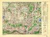
Germany/Central Europe 1:100,000, Minden
Germany / Central Europe 1:100,000, Series GSGS 4416. Great Britain. War Office. [London] : Ordnance Survey
Composite: 234. Wildeshausen.
1 : 100000 Reichsamt fur Landesaufnahme
260. Nienburg.
1 : 100000 Reichsamt fur Landesaufnahme
234. Wildeshausen.
1 : 100000 Reichsamt fur Landesaufnahme
Composite: 260. Nienburg.
1 : 100000 Reichsamt fur Landesaufnahme
Meßtischblatt 1810 : Nendorf, 1899
1 : 250000 Nendorf. - Aufn. 1897. - 1:25000. - [Berlin]: Reichsamt für Landesaufnahme, 1899. - 1 Kt.
Meßtischblatt 1738 : Siedenburg, 1899
1 : 250000 Siedenburg. - Aufn. 1897. - 1:25000. - [Berlin]: Reichsamt für Landesaufnahme, 1899. - 1 Kt.
Meßtischblatt 1666 : Schwaförden, 1935
1 : 250000 Schwaförden. - Hrsg. 1899, einz. Nachtr. 1925, gedr. [19]35. - 1:25000. - [Berlin]: Reichsamt für Landesaufnahme, 1935. - 1 Kt.
Messtischblatt 1593 : Wildeshausen, 1936 Wildeshausen
1 : 250000 Wildeshausen. - Hrsg. 1900, einz. Nachtr. 1925. - 1:25000. - [Berlin]: Reichsamt für Landesaufnahme, 1936. - 1 Kt.
Messtischblatt 1594 : Twistringen, 1919 Twistringen
1 : 250000 Twistringen. - Aufn. 1898, Nachtr. 1919. - 1:25000. - [Berlin]: Reichsamt für Landesaufnahme, 1919. - 1 Kt.
Messtischblatt 1595 : Bassum, 1936 Bassum
1 : 250000 Bassum. - Hrsg. 1899, Nachtr. 1925. - 1:25000. - [Berlin]: Reichsamt für Landesaufnahme, 1936. - 1 Kt.
Le Theatre de Bellone :
Mollova mapová sbírka Schenk, Pieter Braakman, Adriaan


