Maps of Malay Archipelago

East Indies.
1 : 11000000 Colton, G.W.
East Indies.
1 : 12000000 Colton, G.W.
East Indies.
1 : 12000000 Colton, G.W.
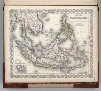
East Indies.
1 : 11000000 Colton, G.W.
Archipel Asiatique.
1 : 10000000 Vivien St Martin, L.
East Indies.
1 : 11000000 Colton, G.W.
East Indies.
1 : 12672000 Colton, G.W.
Hinterindien und Malaien-Archipel
1 : 18000000 Malajsie Meyer, Joseph Bibliographisches Institut
Malaisie.
1 : 1200000 Levasseur, E.
Die Ostindischen Inseln
Stieler's Hand-Atlas Stieler, Adolf bei Justus Perthes
Die Ostindischen Inseln
[S.l. : s.n.]
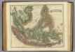
East India Islands.
1 : 10000000 Hall, S. (Sidney)
Die Ostindischen Inseln
Hand-Atlas über alle Theile der Erde nach dem neuesten Zustande und über das Weltgebäude Stieler, Adolf bei Justus Perthes
Malaisie.
1 : 18500000 Malte-Brun, Conrad, 1775-1826
Malay Archipelago.
1 : 11000000 Society for the Diffusion of Useful Knowledge (Great Britain)
Asiatic Archipelago.
1 : 10771200 Letts, Son & Co.
East India Islands.
1 : 16500000 Darton, William
East India Isles.
1 : 7200000 Pinkerton, John, 1758-1826
Ostindischen Inseln.
1 : 11000000 Berghaus, Heinrich; Flemming, Carl; Sohr, Karl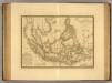
Grand Archipel d'Asie.
1 : 10200000 Picquet, C.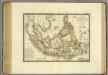
Grand Archipel d'Asie.
1 : 10200000 Brue, Adrien Hubert, 1786-1832
Die Ostindischen Inseln
Hand-Atlas über alle Theile der Erde und über das Weltgebäude Stieler, Adolf Justus Perthes
Ostindischen Inseln.
1 : 14700000 Radefeld, Carl Christian Franz, 1788-1874

E. India Islands.
1 : 9000000 Lizars, Daniel
Niederländisch-Indien
1 : 13000000 Druck und Verlag von Carl Flemming. Glogau : Carl Flemming
Niederländisch-Indien / Druck und Verlag von Carl Flemming
Glogau : Carl Flemming
Atlas für Handel und Industrie: Für Kaufleute, Fabrikante u. Gewerbetreibende, Handlungs- u. Gewerbe-Schulen