Maps of Turkey

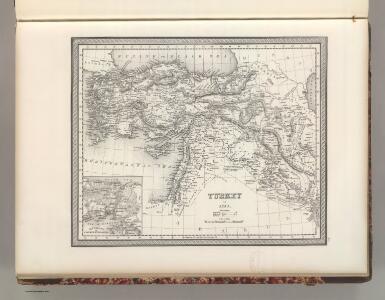
Turkey in Asia.
1 : 6000000 Tanner, Henry S.
Turkey In Asia.
1 : 7603200 Tallis, J. & F.
Klein-Asien
[Allgemeiner Atlas über alle Theile der Erde in 29 Blättern] Ziegler, Jakob Melchior Top. Anstalt v. J. Wurster u. Comp.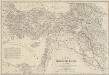
Karte des Türkischen Reichs in Asien
1 : 2500000 nach den besten und neuesten Hülfsmitteln vorzüglich nach der Aufnahme-Karte von Klein-Asien und Kurdistan von v. Vincke, Fischer, v. Moltke und Kiepert, der Aufnahme des Euphrat und Tigris von Chesney und Lynch, der Monteith'shen Karte von Kurdistan, sowie den neusten Reiseberichten von Hamilton, Ainsworth, Brant, Koch, Schönborn u.a. entworfen und gezeichnet von H. Kiepert Stich und Druck von H. Delius Berlin : Schropp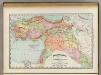
Turkey in Asia.
1 : 7603200 Rand McNally and Company
Turkey In Asia.
1 : 5900000 Mitchell, Samuel Augustus
Turkey In Asia.
1 : 6000000 Tanner, Henry S.
Turkey In Asia.
1 : 6000000 Tanner, Henry S.
Asiatische Türkey
Geographischer Atlas über alle Theile der Erde Ziegler, Jakob Melchior Verlag von Dietrich Reimer
Turkey in Asia.
1 : 5800000 Mitchell, Samuel Augustus
Turkey in Asia.
1 : 5800000 Mitchell, Samuel Augustus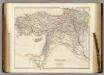
Turkey in Asia.
1 : 3484800 Arrowsmith, John
Asiatische Türkey
Geographischer Atlas über alle Theile der Erde Ziegler, Jakob Melchior Verlag von Joh. Wurster um Comp.
Karte von Klein Asien
1 : 5700000 Malá Asie Radefeld, C. Biedermann, E. aus der Geograph. Graviranstalt des Bibliograph. Instituts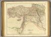
Turkey in Asia.
1 : 3440000 Arrowsmith, John
Klein Asien
Hypsometrischer Atlas Ziegler, Jakob Melchior Topogr. Anstalt v. J. Wurster u. Comp.
Die asiatische Türkey
Schul-Atlas in 36 Karten Völter, Daniel Verlag der J.M. Dannheimer'schen Buchhandlung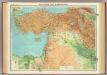
Asia Minor, Syria & Mesopotamia.
1 : 4000000 John Bartholomew and Son
Klein Asien.
1 : 5670000 Radefeld, Carl Christian Franz, 1788-1874
Karte des Osmanischen Reiches in Asien
1 : 6000000 von Dr. Schmidt Carlsruhe : Velten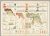
Turkey, Israel, Cyprus, Lebanon, Syria, Iraq, Jordan. Pergamon World Atlas.
Polish Army Topography Service
Das osmanische Asien
1 : 3800000 Blízký východ Weiland, Karl Ferdinand Geograph. Institut
Das Osmanische Asien oder die Asiatische Türkey
1 : 3640000 entworfen und gezeichnet von C.F. Weiland Weimar : Verlag des Geograph. Instituts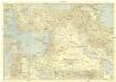
Bible Lands and the cradle of western civilization
1 : 3000000 Jeruzalém National Geographic Society
Das osmanische Asien oder die asiatische Türkey
osmanská říše Weiland, Karl Ferdinand Horsburgh, James im Verlage des Geograph. Instituts
Karte von Klein Asien
Grosser Hand-Atlas über alle Theile der Erde in 170 Karten Meyer, J. Verlag des Bibliographischen Instituts
Turquie, Syrie, Liban, Caucase.
1 : 4750000 Garnier, F. A., 1803-1863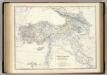
Turkey in Asia, Transcaucasia.
1 : 4007520 Johnston, Alexander Keith, 1804-1871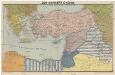
Der vordere Orient
1 : 2750000 Blízký východ List & von Bressensdorf